Performance plan
1. The name of the country and the composition of the territory.
2. Economic-geographical and political-geographical position. The impact of EGP on the development of the country. Changing the position of the country in time.
3. Features of the population. demographic policy.
4. Natural resources and their use. Assessment of natural resource potential for the development of industry and agriculture.
5. general characteristics economy. Reasons affecting the pace of economic development.
6. Geography of the main industrial complexes and industries.
7. Specialization of agricultural production.
8. Development of the transport complex.
9. Foreign economic relations. Export. Import. Participation in integration economic unions.
10. List of used literature.
1. Name of the country and composition of the territory
Algeria. The capital is Algiers. Population - 29.5 million people (1997). The population density is 12 people per 1 sq. km. km. Urban population - 56%, rural - 44%. Area - 2381.74 thousand square meters. km. The highest point is Mount Tahat (2908 m), the lowest is Lake Melgir (-40 m). Main languages: Arabic (state), French. The state religion is Islam. Administrative-territorial division: 48 wilayas (provinces). Monetary unit: dinar = 100 centimes. Public holiday - Independence Day (July 5, since 1962).
V 
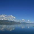
 North Africa, in the western part of the Mediterranean basin, where important world routes pass between the Atlantic and the Middle East, Europe and African countries, there is the largest country in Africa after Sudan - Algeria. In Arabic, it sounds like al-Jezair (islands). This name owes its origin to small islands near the capital. Its area is 2382 thousand square meters. km. In the west, Algeria borders on Morocco, Western Sahara and Mauritania, in the south - on Mali and Niger, in the east - on Libya and Tunisia. The coast of the Mediterranean Sea (1300 km.) serves as its northern border. Algiers has four main physical regions. In the north, stretching along the coast and going south from 80-190 km, there is Tell, consisting of narrow valleys ending in part of the Atlas mountain system. The main river of the country, Chelif, originates in the Atlas Mountains and flows into the Mediterranean Sea. There are practically no rivers south of the Tel. Further south lies a second region, the High Plateau, whose several depressions form shallow lakes during the rainy season. When dried, they turn into salty areas called Schott or Chott. The third region is the Saharan part of the Atlas Mountains. The fourth, occupying more than 90% of the country's territory, is the Algerian Sahara: a stone desert.
From the 16th century, the country was under the rule of the Ottoman Empire, and in the middle of the 19th century it was occupied by France. The Seven Years' War against French rule ended with the declaration of Algerian independence in 1962.
The capital of the state - the city of Algiers - the largest port, economic and cultural center. It was founded in the X century. By the end of the 20th century, more than 3 million people lived in it. This is a beautiful white city, located like an amphitheater on the slope of low mountains on the western coast of the Bay of Algiers, stretching along the coast for 16 km. The city is immersed in the greenery of gardens, parks and  boulevards. Its quarters are built up with high-rise buildings and villas. The Catholic Cathedral of Notre Dame d, Afrique (Cathedral of Our Lady of Africa) rises above the city, the domes of which are far visible from the Mediterranean Sea. Surrounded by modern quarters, the old Kasbah district continues to exist - a complete architectural ensemble of the 16th century. In this ancient part of the city, all examples of religious and secular buildings from the time of the domination of Algeria by the Ottoman Empire from the end of the 16th to the beginning of the 18th century are concentrated - mosques, madrasas, citadels and city dwellings. Algiers has the country's oldest university, a national library, museums of fine arts, ancient and medieval art, ancient history and ethnography, and a large botanical garden.
The second largest city is Oran (1 million inhabitants). This is a modern port in the north-west of the country, a major industrial and cultural center.
Constantine - the "eastern capital" of Algeria, the third largest city (750 thousand inhabitants), is located in the mountains, on both sides of a deep gorge.
2. Economic-geographical and political-geographical position. The impact of EGP on the development of the country. Changing the position of the country in time.
On the territory of Algeria, 4 economic regions can be distinguished: North-West (covers approximately the Wilaya Mostaganem, Oran, Saida, Tiaret and Tlemcen); Central North (Algiers, Medea, Tizi Ouzou and El Asnam); Northeast (Annaba, Constantine, Ores, Setif), as well as the territory of the Algerian Sahara. The northwest, with fertile lands, became the main area for commercial agriculture (soft wheat and especially wine grapes). The Northeast, with large deposits of iron ore, phosphorites, and other minerals, received mining specialization in combination with backward forms of agricultural production. production. The Central North began to form as an area of the most diverse Agriculture(grain farming, subtropical horticulture, early vegetable growing in combination with pasture cattle breeding) with the main center of the processing industry in Algiers. After the discovery of the largest oil and gas resources in the Algerian Sahara, separate mining centers, nodes and mineral raw materials regions began to take shape on its territory.
The structure of the Algerian economy took shape under the long influence of French monopoly capital during the colonial period. Local, so-called. traditional production, represented mainly by semi-subsistence and small-scale agriculture and handicrafts, in which 4/5 of the entire economically active population was employed, in the last years of French domination produced less than 1/4 of the gross national product. The European capitalist sector occupied a dominant position in such sectors of the economy as energy, mining, transport, and in a number of branches of commercial agriculture and manufacturing. In agriculture, there were 22,000 European households that owned 27% of all cultivated land, which provided about 2/3 of the total agricultural production. products, the rest accounted for 631 thousand Algerian farms. In 1954-58. agriculture accounted for 75% of the economically active population and 21% of gross output, while industry accounted for 7% and 18%, respectively.
After gaining state independence, the government of the ANDR began to overcome the consequences of the 7-year war (1954-62) and transform the colonial economy into a national one. In 1962-65. the expropriation of foreign landed property and the nationalization of many industrial and commercial enterprises (the so-called “ownerless property”), as well as the main modes of transport, were nationalized. In 1966, the enterprises of the mining industry (excluding oil and gas extraction) were nationalized, in 1967-68. - a number of foreign companies in the manufacturing and distribution sectors. On this basis, self-governing farms and state enterprises were created, which together form the leading socialized sector (in 1968, its share in value accounted for 60% of all agricultural and 80% of industrial products, except for oil and gas, as well as 100% of domestic cargo transportation ). Foreign capital, mainly French, retains positions mainly in the oil and gas industry and some manufacturing industries. In 1963-66. the financial and banking system was reorganized (a new monetary unit - dinar = 100 old francs). In 1968, all the country's banks (with the exception of one) passed into the hands of the state. A new customs tariff has been introduced, state control over foreign trade has been established, and a national investment code has been approved. A program was adopted for the industrialization and modernization of agriculture, the development of backward areas, and the first national 7-year plan was developed, covering 2 periods: 1967-69 and 1970-73.
In the 1980s, the country's socio-economic situation deteriorated, and the pace of development slowed down. The gap between food production and the needs of the population has widened; as a result, grain imports increased. In addition, Africa suffered an unprecedented drought, the country found itself in the grip of debt to Western countries.
In the 1990s, the socio-economic situation improved somewhat.
In 1996, Algeria's GDP was estimated at $115.9 billion, or $4,000 per capita. Between 1987 and 1997 the annual increase in GDP was 0.5%.
In 2003, Algeria's gross domestic product (GDP) was estimated at $173.8 billion, or $5,400 per capita. The share of agricultural production is 11.7%, the mining industry is approximately 40%, the share of the service sector is 40% and the manufacturing industry is approximately 10%. In 2002, the increase in GDP was 3.3%. According to 2003 data, the population on the verge of poverty was 23%.
3. Features of the population. demographic policy.
In the era of the French conquest, the population of Algeria was about 3 million people. In 1966, it already reached 11.823 million people, and in 1997 - 29.476 million people. In 1996, the birth rate was 28.5 per 1,000 people and the death rate was 5.9 per 1,000 people. Infant mortality (children under one year old) is 48.7 per 1000 newborns. In the mid-1990s, about 68% of the population was under the age of 29.
The population of the country is represented by different ethnic groups. The most numerous are the Arabs (80%). They settled on the territory of Algeria during the period of Islamic conquests of the 7th-8th centuries and nomadic migrations of the 11th-12th centuries. Traditionally, they live in large families, or clans, uniting several generations under one roof, where each occupies a strictly defined place. Men work, shop for the house, visit cafes and other public places. Women are responsible for the care of the home and the upbringing of children. In families, sons are especially valued. If a man says that he has three children, this means that he has three sons, although there may also be daughters. The restrained behavior of a woman - the keeper of traditions - is dictated by Korn. The traditional dress of Algerian women is a white haiq, with which she wraps herself from head to toe, covering everything except her eyes. But by the end of the 20th century, these customs were preserved only in rural areas. In cities, they weaken, the process of disintegration of a large family is accelerating, which cannot exist in city apartments and therefore gives way to small families. Khaik is worn only by elderly townswomen or visiting peasant women. Basically, city dwellers dress in European clothes.
Berbers are second in number. This indigenous population in the 7th century was pushed back by the Arabs from the coast to the hard-to-reach mountains of Kabylia in the north-east of the country. For many centuries, the Berbers resisted the Arabs, the Turks, and then the French. This allowed them to preserve their language, original culture, customs and mores. The older generation of the Algerian intelligentsia are mostly from Kabylia.
Mozabites (about 25 thousand people) are a special group - residents of the Mzab region in the south of the country, who settled in the barren Sahara in the 6th century. The identity of this people of Berber origin is explained by life in the desert, where religion, traditions and asceticism were necessary conditions for survival. In Mzaba there is a chain of cities - oases, the main one among which is Proud. They were specially built small so that even the inhabitants of the outskirts could hear the voice of the muezzin calling Muslims to prayer. Mozabites cultivate date palms. In addition, they are engaged in trade in different parts of the country. Some men live for a long time from their native places, but before they die, they either return to their homeland, or their remains are brought there. Mozabites marry only the girls of their people, but they do not have polygamy. Women, according to ancient traditions, never leave their oasis. Mozabite women live behind the blank walls of houses, clothes hide them from head to toe, leaving only one eye open.
After the conquest of Algeria by France in the 19th century, the European part of the population increased, and by 1960 about 1 million Europeans already lived here. Most had French roots, the ancestors of the rest moved to Algeria from Spain, Italy and Malta. After Algeria's independence in 1962, most Europeans left their country.
The state religion of the country is Islam. There are about 150 thousand Christians in the camp, mostly Catholics and approximately 1 thousand adherents of Judaism.
The official language is Arabic, but is still widely spoken French. Some Berber tribes, speaking Tamahaq and Tamazirt, acquired their own written language. Several books have already been published in the Tamazirt dialect in Algeria.
About ¾ of the population is concentrated in the foothills of the Tell Atlas, approximately 1.5 million people live in the highlands and less than 1 million in the Sahara Desert. The highest density is observed near the capital and in the Kabylia region. The average population density is about 13 people per 1 km2.
Society and culture Book >> Sociology
Whole countries. Why Algeria, one of the most modernized ... from the new global economy. Economy North Africa thanks to geographical, demographic and ... significant reconstruction, fully and documented described in Machimura's book. Government...
Economic and geographical characteristics of Algeria
1. Introduction 3
2. Natural conditions 5
3. Population geography 8
4. Geography of industry 9
5. Geography of agriculture 11
6. Geography of transport 14
7. Foreign economic relations 15
8. Conclusion 16
9. References 17
1. Introduction
Algeria (by the name of the city of Algiers, from the Arabic al-Jezair - islands), (Arabic - Al-Jumhuriya al-Jezairiya Democracy ash-Shaabiya) -
- a state in North Africa, located in the western part of the Mediterranean basin., where important world routes pass between the Atlantic and the Middle East, Europe and African countries. It borders: in the west with Morocco and Western Sahara, in the southwest with Mauritania and Mali, in the southeast with Niger, in the east with Libya and Tunisia. From the north, the territory is washed by the Mediterranean Sea. Area 2381700 sq. km. Population 29.3 million people (1998). Capital - mountains. Algiers (3 million inhabitants). The major cities are Oran (700 thousand people), Constantine (600), Annaba (400). Arabs make up 80%, Berbers - 19% (Kabils, Chauya, Tuareg), the rest - 1%.
Most of the population of Algeria are Sunni Muslims (Malikites and Hanafis). A number of followers of the Ibadi sect live in the Mzab valley, Ouargla and Algiers. The state religion of the country is Islam. The country has approx. 150 thousand Christians, mostly Catholics, and approximately 1 thousand adherents of Judaism. The official language is Arabic, but French is still widely spoken. Some Berber tribes, speaking Tamahaq and Tamazirt, acquired their own written language. Several books have already been published in the Tamazirt dialect in Algeria. About 3/4 of the population is concentrated in the foothills of the Tell Atlas, approximately 1.5 million people live in the highlands and less than one million live in the Sahara desert. The highest density is observed near the capital and in the Kabylia region. The length of railways is 4.2 thousand square meters. km., the length of roads is 102 thousand km. Geographical position |
Algeria occupies the central part of the Atlas mountain region and 1/4 of the Sahara desert.
The territory of the country is 2381.7 thousand square meters. km.
The climate of Northern Algeria is subtropical. The average temperature in January is 5 - 12C, in July 25C. Precipitation 400 - 1200 mm per year. The central and southern parts of the country are occupied by the Sahara desert, where average daily temperature fluctuations reach 30 C. The climate of the Sahara is tropical, desert (less than 50 mm of precipitation per year).
Cork oak forests (in the mountains), semi-desert and desert vegetation.
Form of government -
Republic
Administrative division - 48 wilayas (provinces)
Head of State - President
Legislature - Unicameral National People's Assembly
The country belongs to the developing, to the key subgroup.
2.Nature
Algeria occupies the central part of the Atlas Mountains and the Sahara Desert. Washed by the Mediterranean Sea. The coastal part lies in the northern subtropical zone, the rest of the territory lies in the tropical zone of the Northern Hemisphere.
The shores are mostly high, rocky, with narrow beaches. On the entire coast there are no bays deeply protruding into the land; the number of large bays is insignificant (Oranskaya, Algerskaya, Bejaia, Annaba).
Relief. Northern Algeria is represented by folded ridges, massifs and intermountain plains of the Atlas Mountains system. Within Algeria are the largest ranges of the Atlas - Tel Atlas and the Saharan Atlas, massifs - Varsenis (Sidi Amar, 1985 m), B. Kabylia and M. Kabylia (altitude up to 1200 m), Hodna, Ores (Shelia, 2328 m ). The mountains are cut by deep gorges of rivers, divided into separate dome-shaped smaller massifs. The large intermountain plains and plateaus (the so-called High Plateaus) in the central parts are occupied by large salt lakes—sebkhas.
The Algerian Sahara occupies the central part of the world's largest desert region of the Sahara. Its relief is dominated by plateaus about 500 m high. In the northeast, there is a large lowland filled with sand and a basin of the salt lake Shott-Melgir (26 m below sea level). To the south-east extensive volcanic the Ahaggar highlands with the Atakor massif (Takhat, 3,003 m, the highest peak of Algeria), surrounded by a system of stepped plateaus (Tademait, Tassilin-Adjer, Muydir, and others). Within Algeria there are large sandy deserts with high dune ridges (the Great Western Erg, the Great Eastern Erg, the ergs of Igidi, Shesh, and others) and stony deserts (the Tanez-ruft in the south).
Geological structure and minerals. The territory of Algeria within the Atlas Mountains belongs to the Mediterranean geosynclinal folded belt, and in the Sahara region to the ancient African platform. There are large deposits of oil and natural gas (Hassi-Messaoud and others), which constitute the main wealth of Algeria. The Atlas contains deposits of iron (Maghrib), copper, lead and zinc ores, phosphorites, mercury, antimony, barite, diatomaceous earth, coal, etc.
Climate. Northern Algeria has a subtropical Mediterranean climate with warm, rainy winters and hot, dry summers. Wed January temperature on the coast is 12°C, on the intermountain plains 5°C, in July 25°C. The absolute maximum temperature is above 40°C everywhere. Severe droughts are frequent. Most of the precipitation falls in November - January (400 - 800 mm in Tel Atlas, up to 1200 mm or more per year in the Kabyle massifs). In winter, in the mountain regions, snow stays on the peaks for up to 10-20 days or more. In the transitional zone to the Algerian Sahara, the climate is more arid, semi-desert (average temperature in July is above 30 ° C, precipitation is 200-400 mm per year). In the Sahara, the climate is desert, extremely dry (less than 50 mm of precipitation per year, in some years there is no rain at all). Daily fluctuations in temperature reach up to 30°C (in summer daytime 40°C and above, at night 20°C, in winter around 20°C during the day, at night it drops to 0°C and below). Dry winds often cause sandstorms.
Inland waters. All the rivers of Algeria are of the Oued type. The Oueds of Northern Algeria are close to Mediterranean-type rivers with a predominance of rain feeding. Only in the coastal zone is the flow of oueds directed to the Mediterranean Sea. In the rest of Algeria, there are closed basins of internal runoff. Water discharges in the Mediterranean oueds range from 0-2 cubic meters. in sec in summer time, up to 1000 cubic meters per second or more during floods after rains. Short but severe floods are frequent. The largest oued is Shelif (700 km), the remaining oueds rarely exceed 100 km in length (El-Hamman, Isser, Summam, El-Kebir, etc.). Dams, reservoirs and hydroelectric power plants have been built on the oueds of northern Algeria. The waters of the Ueds are used for irrigation (more than 100 thousand hectares). Most of the salt lakes (sebkh) lie in intermountain basins (Schott-el-Shergi, Shott-el-Khodna, Zahrez-Shergi, Zahrez-Garbi, etc.) or depressions (Schott-Melgir). The Sahara has large reserves of groundwater, especially in the northern part, where the largest oases are located (Tidikelt, Tuggurt, El Golea).
Soils. In northern Algeria, the zonal soil type is brown (carbonate and leached in Tel Atlas, gray-brown in semi-desert regions). The altitudinal zonality is manifested in the variants of brown and brown forest soils. In the foothills, solonchak massifs are widespread around them. The Sahara is dominated by gravel soils of subtropical deserts, waving and semi-fixed sands.
Vegetation. On the coast, vegetation is of the Mediterranean type with dry hard-leaved forests and shrubs. Altitude zonation is well expressed in the mountains: up to 800-1000 m - a belt of evergreen dry-loving thickets of shrubs and stunted trees (maquis), mostly cultivated (olive tree, pistachio, etc.), higher - forests of cork and evergreen (holm) oak and deciduous species, from 1200 to 1500 m - the belt of Aleppo pine, from 1500 to 2000 m - junipers and thuja, above 2000 m there are cedar forests. To the south of Tel Atlas, the vegetation acquires a semi-desert character with a predominance of grasses and sagebrush. The vegetation cover is highly degraded. Only isolated areas of forests have survived. In the Sahara - saltwort, ephemeral plants on the sands after short spring rains, cereals (Sahara gorse, ephedra, drin), shrubs - species of acacia, jujube.
Animal world. Large mammals (lions, leopards, gazelles, etc.) and birds (ostriches, cormorants) are heavily exterminated. Of the mammals in northern Algeria, the Barbary macaque (mago), hare, and rabbit have survived; in the north of the Algerian Sahara - hyena, genet, jackal, fennec fox; gazelles and antelopes are rare. Many small rodents (jerboas, etc.), bats, birds of prey. There are a lot of reptiles (lizards, monitor lizards, more than 20 species of snakes, turtles) and insects (locusts are especially harmful), as well as phalanxes, scorpions, ticks.
3. Population geography
2 type of reproduction - population explosion. The birth rate is 35-40 per 1000 people in 1 year. Mortality 5-10 per 1000 people in 1 year. The natural increase is more than 30. The composition of the population is the predominance of the male population. Average life expectancy: men - 67, women - 69.
The main population of the country is Algerians, who make up more than 98% of the total population. They consist of Arabs and very close to them in language and culture of the Berbers.
Most of the indigenous population speaks an Algerian dialect Arabic(81.5%). Dialects of the Berber language spoken. 17.9%, survived mainly among the Berber population of the mountainous regions of the country and some oases of the Algerian Sahara (Kabil, Shauya, Tuareg). Among the population of large cities, French is also common (it is spoken by 0.4%). By religion, Arabs and Berbers are Sunni Muslims.
Over 4% of the population lives abroad, mainly in France and Belgium. After 1962, as a result of the mass exodus of the French from Algeria, their number decreased from 1 million people. (1960) to 68.4 thousand (1966).
The population is distributed throughout the territory. extremely uneven. More than 95% of the total population of the country lives in Northern Algeria, and most of it is concentrated in a narrow coastal strip. The most densely populated Kabylia, where the density reaches more than 300 people. per 1 sq. km, with an average density in the country of 12.3 people. per 1 sq. km. In the Algerian Sahara, the density is less than 1 person. per 1 sq. km. Rural residents, who make up the majority of the country's population, lead a sedentary, semi-sedentary or nomadic lifestyle. In the western and central part of Northern Algeria, a settled population predominates, mainly engaged in field cultivation. Semi-nomadic and pastoral nomads inhabit the so-called High Plateaus, the Saharan Atlas and the Sahara. The settled population of the desert is the inhabitants of oases and mining centers. Demographic growth 2.6%,
4.Geography of industry
Industry. The mining and energy industries account for over 1/3 of the country's gross industrial output. Leading among these industries is the oil and gas industry. In the northern and eastern regions of the Sahara there are the main Algerian oil and natural gas fields of world importance discovered after World War II (oil reserves are estimated at about 1 billion tons, gas - 3,000 billion cubic meters). The annual oil production is about 60 million tons. Oil is delivered through pipelines to the Mediterranean ports, from where it is exported mainly to France (70% of all oil). Part of the oil goes to refineries in Algiers and El-Harrash, about half of the oil products are exported.
The extraction of natural gas has also become important - 3288 million cubic meters. m in 1968; 43 billion cubic meters m - in 1997. 3 fields are being exploited - Hassi-Rmel (provides approx. 9/10 of all gas production), In-Amenas and Hassi-Mesaud (associated with oil). The gas pipeline transports methane to the coast, where most of it is liquefied at the Arzew plant and exported mainly to England and France. Expanding use natural gases inside the country; the cities of Algiers, Oran, Mostaganem and others were gasified.
The development of ore minerals is concentrated in northern Algeria. Among them, the first place is occupied by the extraction of iron ore, which is mainly exported. The main mines are Wenza (over 50% of all production), Bu-Kadra. The extraction of lead-zinc ores is of great importance. Their development is carried out in the Oued Zunder and Oued Abed deposits, as well as in small quantities in Sidi Kamber and Varsenis. Mining of phosphorites in connection with the development of the El-Quif deposit has decreased. A new large deposit, Jebel-Onk, has been explored and put into operation. Insignificant mining of coal is underway (in the city of Kenadza, in the northwest of the Algerian Sahara), copper ore (in Ain Barbar near the city of Annaba, 4.6 thousand tons per year), as well as iron pyrite, barite, antimony, diatomaceous earth. The largest deposits of iron ore in the Maghreb (Gara-Jibilet, near Tindouf) and a large deposit of mercury (in northern Algeria) have been explored. Electricity production is 1.2-1.3 billion kWh, including about 780 million kWh at thermal power plants (the most important thermal power plants are in the cities of Algiers, Annaba, Oran, Bechar).
The main branches of the manufacturing industry are: food and flavor (about 1/2 of all products), metalworking, textile and clothing, oil refining, chemical, leather and footwear, cement (small and partly medium-sized enterprises predominate). Distilleries and canning factories, tobacco factories, grain processing and olive oil production are located in almost all cities of Northern Algeria. The textile industry, including the handicraft production of carpets, is located in the cities. Algiers, Oran, Annaba, Tlemcen. The metal-working industry is represented by small mechanical and repair shops, car-building and pipe-rolling plants, etc. Its main center is the city of Algiers (assembly plants for cars and trucks); in the city of El Harrash - tractor assembly plants. A metallurgical plant was built in Annaba with the assistance of the USSR and other countries (in 1968, the first stage of the plant with a capacity of 400,000 tons of steel per year was commissioned). The chemical industry is developing: plants for the production of superphosphate, sulfuric acid, copper sulphate, cellulose, etc.—in the years. Algiers, Oran and Annaba. Built (1969) large plant nitrogen fertilizers and ammonia in Arzev. Cement plants (with a total capacity of about 1 million tons annually) are located in the cities. Algiers and Oran. Algeria received a variety of economic, scientific and technical assistance from the USSR, which provided large loans and supplied the latest equipment for enterprises under construction; organized and operates the Institute of Oil and Gas in the city of Boumerdes (near the capital), handed over together with the technical school as a gift to the people of Algeria.
5. Geography of agriculture
Agriculture is an industry that employs the bulk of the population of Algeria. Agricultural land, including forest land, is occupied. 44.2 million hectares, or about 1/5 of the entire territory, of which 7-10 million hectares (depending on climatic conditions) are cultivated land (almost all in Northern Algeria). At the first stage of the agrarian reform (1962-64), the lands of the European colonists were expropriated and collective farms headed by self-government committees were created on them. The self-governing sector in 1966 consisted of 2,200 households with a total area of 2,400,000 hectares, including 30% of farms, each having a size of over 1,000–2,000 hectares. They are located on the most fertile lands, and half of them are in the plains of the Northwest (wilaya Oran, Mostaganem, Tiaret). The share of x-in this sector accounts for 24% of all arable land, 65% of land with fruit plantations, 60% of all crop production, 5% of livestock. The old peasant sector covers 650,000 farms, of which 600,000 farms each have less than 10 hectares of land, including 350,000 farms with less than 2 ha.
In 1988, an agrarian reform was carried out. The state farms were dissolved. On their basis, 22,000 small cooperatives were formed. Part of the land was transferred to the peasants.
Agriculture provides about 3/4 of the entire agricultural sector. Algerian products. The main place (over 4/5) in the sown area is occupied by grain crops. Rain-fed agriculture dominates in Algeria; irrigated lands do not exceed 250,000-300,000 ha. Hard wheat is cultivated mainly in the inner regions of Tel, soft wheat - in the northwest. The yield of cereals in small farms does not exceed on average (except for rice) 3-8 c/ha. Algeria is forced to systematically import grain (2300 - 3000 thousand centners per year). The farms of the socialized sector produce about one-third of the total harvest of wheat, barley, and oats, and about two-thirds of corn, sorghum, and rice.
Of particular importance are viticulture and winemaking, which gave in the 50s. about 1/3 of all gross output and 1/2 of Algerian exports (by value). The main vineyards are in the northwest. Algiers (in the region of the city of Oran, more than 1/2 of their entire area).
Most of the wine is exported to France. After 1962, France markedly reduced its purchases of wine from Algeria, which sharply affected the situation of viticulture in the country. Exported wine is 1.7 million hl.
The production of citrus fruits also plays a significant role, especially oranges (on the Mitidzha plain, in the Shelifa valley), most of which are exported to European countries.
The olive tree has long been cultivated, especially in Kabylia (about 2/5 of the total olive harvest); olive oil (an average of about 20 thousand tons per year) is consumed mainly within the country. In the oases of the Sahara, the date palm is cultivated. On the coast, near large cities, the cultivation of early vegetables (about 6 million centners per year), tomatoes, artichokes, carrots, and also potatoes sold in European markets is developed. The socialized sector accounts for approximately 92% of the total citrus crop, 34% of olives, 8% of dates and 45% of vegetables. Of the industrial crops, tobacco is cultivated, mainly in Mitidzha and Kabylia, which is mostly exported (about 10 thousand tons per year).
Animal husbandry is extensive in nature, it provides almost 1/4 of the total agricultural production. production, but in the interior, on the elevated plains and plateaus, especially in the Sahara, often serves as the main and even the only source of subsistence for semi-nomads and nomads. The population of the mountainous and coastal regions of northern Algeria is characterized by distant pasture or mountain pasture cattle breeding in combination with agriculture. The number of cattle is 1.5 million heads, sheep - 15 million heads.
Forestry and fisheries. Forests and bushes (total area 3 million hectares) have been preserved mainly in the mountains of Tel Atlas. Cork oak massifs are of the main economic importance (harvesting of 300-600 thousand centners of cork raw materials per year - 3rd place in the world). The main part of raw materials is processed at state-owned enterprises and exported. In the semi-desert districts (vilaya Tiaret, Saida, Medea), the collection and primary processing of alpha grass (total area approx. 4 million ha) is important. Alpha raw materials (90-100 thousand tons annually - 1st place in the world) are mainly used for production the best varieties paper, pulp, wickerwork.
Fishing (mainly sardine, herring, anchovy) is poorly developed (average catch is about 20 thousand tons per year). Measures are being taken to increase the marine fishery and fishing ports are being reconstructed (Beni Saf, Oran, Tenes, Shershel, etc.).
Livestock (thousand heads)
Sheep, goats, cattle, camels are bred.
Structure of land in use (thousand ha)
6. Geography of transport
An important role is played by railways, the total length of which is 4.2 thousand km, including with the norms. gauge 2.6 thousand km; Main railway the highway between the city of Oujda (Morocco) and the city of Gardimau (West. Tunisia) through the years. Oran, Algiers and Constantine are connected by the most important economic centers of the North. Algeria. From ch. highways depart lines to the north, to seaports, and to the south, to mining developments and oases of the north. Sahara. The total freight turnover is 960-980 million t-km.
The length of the road network is 50.2 thousand km. The main highway runs along the coast, from which highways branch off in the north and south directions. After 1962, the roads Adrar-Bechar (720 km), Bechar-Tindouf (900 km), In-Amenas-Ghadames were built.
Pipeline transport has been developed (the total length of oil pipelines is about 3,000 km, and gas pipelines are more than 1,000 km). There are large oil pipelines: In-Amenas-Sekhira (Tunisia), Hassi-Mesaoud-Bejaia, Hassi-Mesaoud-Arzev, Beni-Mansur-Algiers and gas pipelines Hassi-Rmel-Arzew, Mesdar-Skikda (700 km) and gas pipeline Hassi-Rmel - Skikda.
Maritime transport provides almost all foreign trade transportation. In terms of cargo turnover, the following ports are distinguished (thousand tons): Bejaia - 15.3, Arzew - 9.1, Algiers - 4.4, Annaba - 19.2, Oran - 1.8.
Air transport is developing rapidly. There are 65 airfields in the country, of which 31 are civil. Airports of international importance are located near the cities. Algiers (Dar el Beida), Annaba and Oran (La Senia).
7. Foreign economic relations
The volume of foreign trade of the countries is $5-25 billion.
Export - 100% (fuel).
Import: Machinery and equipment, food, agricultural raw materials, chemical products, etc.
Until 1962, the total volume of foreign trade turnover amounted to more than half of Algeria's gross national product. After the establishment of political independence, Algeria follows the path of overcoming one-sided dependence on foreign markets and capital, strengthening the state monopoly in foreign relations. In 1967, the state controlled 90% of exports and 75% of imports. Until 1962, France, England, Germany, Italy, Morocco and Tunisia accounted for 90% of the total Algerian foreign trade turnover, including 80% to France. In the 60s. this share is declining as a result of strengthening trade ties with socialist and developing countries. In 1965, the share of France in Algerian imports was 70%, and in exports 76%. The main export commodities to the countries listed above are: oil (approx. 2/3 of the total value of Algerian exports), wine (15%), fruits and vegetables (12%), iron ore (3%), tobacco, paper. Algeria imports industrial equipment, food products (especially grain, milk, meat), as well as light industry products (synthetic fabrics, textile products) and metals (the import of the latter has been put under strict control since 1967).
Agreements on economic cooperation, including financial assistance, Algeria concluded with the USSR, China, Yugoslavia, Bulgaria. Czechoslovakia, UAR, Kuwait. There are agreements with France, England, the USA, the International Bank for Reconstruction and Development and the European Development Fund.
Currently, foreign trade with the EU countries accounts for more than 60%, the US - 17%. External trade turnover is 22.6 billion dollars (1997). Export: oil and oil products - 51.7 million tons (1997); natural gas - 43 billion cubic meters m; wine, citruses, cork, building materials.
In November 1996, the Maghreb-Spain gas pipeline was put into operation. In 1997, 4 billion cubic meters of gas was supplied to Spain. m, to Portugal - 400 million cubic meters. m.
The financial position of Algeria is determined by oil and gas revenues (up to 98% of foreign exchange earnings and about 66% of the state budget revenues. Algeria's gold and foreign exchange reserves are more than 9 billion dollars.
In recent years, for objective reasons, the financial situation of Algeria has deteriorated, and the external debt has increased significantly (34 billion in 1997). As a result of negotiations with the International Monetary Fund, the Paris and London Clubs, an agreement was reached to re-segregate most of the debt.
The growing financial and economic difficulties led to an increase in inflation, prices, a deterioration in the life of the population (over 2.5 million unemployed, mostly young people. More than 1 million Algerians work in Western Europe. The property stratification of society is deepening.
Algeria is a country with an ancient history of wars of conquest and colonization, both by African and Eurasian states. The main influence was exerted by the Arabs, who planted their culture, language, religion (Islam). Berbers - the descendants of the historically indigenous population - the Libyans, constitute an absolute minority.
The formation of Algeria as a state was facilitated by its favorable geographical position - important world routes pass here between the Atlantic and the Middle East, Europe and African countries.
ANDR is a parliamentary presidential republic with very broad presidential powers.
Algeria is a fairly developed state economically and culturally. The standard of living of the population is relatively high, supported by subsidies from the state, mainly due to the export of oil, gas, etc. Free education and medical care. Much attention is paid to education.
ANDR is a state characterized by political instability, in the containment of which the army plays the main role. The main factor of political instability is the struggle for power, both between political movements and within them. The main troublemakers of political life are the FIS and Hamas. They constitute the main opposition to the state course (the construction of socialism, the establishment of a presidential regime, a one-party system, etc.). One of the main factors used by the opposition is unemployment, economic difficulties, etc. Instead of a constitution, they put forward Sharia law - the Koran. The main methods of struggle for extremist Islamic organizations are international and domestic terrorism.
The economic base of Algeria is natural resources (oil, gas, ores, etc.) and nationalized foreign possessions, firms, companies, banks, property, etc.
In the Algerian economy, in recent years there has been a transition from planned to market; allowed to buy land from the state fund, unprofitable cooperatives; much of the trade passed into private hands.
There are still problems in public health: the fight against infectious and environmental diseases, as well as in veterinary medicine - the fight against animal diseases, including those dangerous to humans.
LITERATURE:
Asia and Africa today. Journal No. 9, pp. 19-21. M., 1996.
Africa. General review. North Africa. In the book: Countries and Peoples. Popular science geographic and ethnographic publication in 20 volumes. M., "Thought". 1982. S. 251-291.
Great Soviet Encyclopedia. In 30 volumes. Edition 3rd. Volume 1. M., “Soviet Encyclopedia”, 1969. S. 422-434.
countries of the world today. Volume 3. Africa. Algeria. M., 1999.
Countries of the world. Directory. Ed. I.S. Ivanova. M., "Republic". 1999. S. 13-15.
Echo of the planet. Magazine No. 3 M., 1997.
Echo of the planet. Magazine No. 4 M., 1998. S. 11.
Lesson objectives:
- Improve the ability to work with atlas maps, textbook text, make tables.
- To ensure the development of abilities for evaluative actions, to express judgments.
- Develop the ability to work in a team; develop mutual assistance.
Equipment : physical map of the world, political map of Africa, illustrations, tables, educational pictures, textbook, notebook, workbook, atlas, universal encyclopedia for youth (countries and peoples), geographical atlas of the world, multimedia technologies (technical equipment).
Forms of work : group with elements of a role-playing game.
Lesson type : for didactic purposes - the study of new material; on teaching methods - role-playing game.
Lesson plan:
1. Organization of the lesson.
2. Actualization of students' knowledge. Statement of educational tasks. Exploring a new topic.
3. The work of students in groups. Results of work in tables. Student responses.
4. The result of the lesson. Evaluation of student responses. Achievement of the goal.
5. The practical part of the lesson.
Completing the task in the workbooks on page 43.
6. Homework.
The course and content of the lesson.
1. Stage - organizational.
Greetings. Ready for the lesson. Mark absentees in the journal.
2. Stage - updating the knowledge of students.
Teacher. We continue to study the mainland Africa. Africa is the ancestral home of man. The most ancient remains of human ancestors and tools of his labor were found in rocks that are 27 million years old. Guys, let's update our knowledge.
Question #1 What are the geographic coordinates of a point earth's surface?
Answer: Latitude and longitude are geographic coordinates of a point on the earth's surface.
Question number 2 Define the concept of "geographical location".
Answer: The geographical position is the position of any point or object on the earth's surface in relation to other points or territories.
Question number 3 In what climatic zones is mainland Africa?
Answer: Africa is located in the equatorial, subequatorial, tropical and subtropical climatic zones.
Question number 4 Name the largest countries in terms of area.
Answer: Russia, China, Brazil, USA, Canada.
Teacher: According to natural conditions, the composition of the population, Africa can be divided into four parts: North, West and Central, East and South.
Lesson topic: “Countries of North Africa. Algeria".
The purpose of the lesson : characterize the country according to the plan, show the economic activity of the population. (students write the date, the topic of the lesson in their notebooks).
3. Stage - a group form of work.
Teacher: Guys, today we work in groups. To compile the characteristics of the country, a standard plan is used (textbook - p. 313).
The template is displayed on the screen. (Annex 1)
The questions of the plan are reflected in the tables presented to each member of the group. Groups have three questions, including evaluation sheets (Appendix 2), the organizer is determined, who distributes questions, listens, evaluates answers.
You work with atlas maps, which provide 80% of the information, with the text of the §31 textbook and additional literature. The results of the work are entered in the table.
The fourth group will prepare additional information about Algeria.
Groups begin to work, the time allotted for the tasks is 10 minutes.
Upon completion of the work, the groups give a description of the country according to the plan.
(In the course of characterization, each of the groups enters the results of the other group into the table).
Description of the country according to the plan.
1. What maps should be used when describing a country?
The physical map of Africa, the climatic map of Africa, the map of the natural zones of Africa, the political map of Africa.
2. In what part of the mainland is the country located? What is the name of its capital?
Algiers is located in northwestern Africa. This is one of the major developing states of the mainland, freed from colonial dependence.
The capital of the country is Algeria, geographic coordinates are 37 degrees north latitude. and 3 degrees east
3. Features of the relief (general nature of the surface, the main forms of relief and the distribution of heights). Minerals.
Due to the large extent from north to south, in Algeria, Northern Algeria and the Algerian Sahara are distinguished.
The Atlas Mountains amaze with their beauty. The ridges, rising up, end with sharp peaks with sheer cliffs.
Two main mountain ranges stretch along the coast - the Tell Atlas and the Saharan Atlas.
The highest peak - Shelia(2328 m) in the Ores mountains. Most of the southern part of the country is an elevated plain, while highlands rise in the east Ahaggar. Most of the surface of the Algerian Sahara is rocky; and only on separate sections there are sands. The bowels of Algeria contain large reserves of fuel minerals – oil and gas, ore - iron and polymetallic, chemical - phosphorites.
Cast iron and steel are smelted from iron ores, non-ferrous metals are smelted from polymetallic ores, mineral fertilizers are smelted from phosphorites.
4. Climatic conditions in different parts of the country(climatic zones, average temperatures in July and January, annual precipitation). Differences by territory and by seasons.
Climatic zones - subtropical, tropical. The climate of the coast is subtropical, Mediterranean.
The subtropical climate is characterized by dry, hot summers and warm, wet winters.
Northern part of Algeria: average temperature: January +8 degrees C, July +32 degrees C, average annual precipitation in millimeters -100-1000.
Southern part of Algeria: average temperature: January +16 degrees C, July +32 degrees C, the average annual rainfall is less than 100 mm. The reasons are the geographical latitude, the influence of the oceans and seas, the relief features, the prevailing air masses.
5. Large rivers and lakes.
There is almost no surface water here and only one river flows - Shelf.
In the Algerian Sahara, large reserves of groundwater are concentrated. Sometimes they come to the surface in the form of springs.
6. Natural areas and their main features.
Northern Algeria occupies a zone of hard-leaved evergreen forests and shrubs, which includes the northern part of the Atlas Mountains and the adjacent coastal plain.
In this zone there is a lot of heat and sufficient moisture. Therefore, the natural conditions of this part of Northern Algeria are most favorable for human life and agriculture.
The once diverse fauna of the country is now greatly impoverished; lions, leopards, ostriches, cormorants and some other animals and birds have been rapaciously exterminated. Monkeys, hares, jackals, hyenas have been preserved in Algeria. There are many migratory birds on the lakes. Numerous reptiles: snakes, lizards, monitor lizards.
7. The peoples inhabiting the country. Their main activities.
Indigenous The population of the country is Algerians, consisting of Arabs and Berbers. The nomadic population of the Algerian Sahara is represented by tribes Tuareg. They inhabit the harshest parts of the desert and the Ahaggar Highlands. Rectangular dwellings are being built in rural areas. They have flat roofs and flat courtyards. Walls without windows face the street.
Algerians are mainly engaged in animal husbandry - they breed sheep, goats and camels. Farming is possible only in the oases, where the Algerians grow date palms, and under their crown - fruit trees and crops.
Pottery is represented by the manufacture of carpets, woolen and silk fabrics, as well as the processing of alpha grass, from which mats, baskets and ropes are woven.
The fourth group gives additional information about Algeria.
4. Stage of the lesson - summing up.
Final questions:
- How do you think, what is the significance of access to the Mediterranean Sea for Algeria?
- What are the features of the nature of Algeria?
- Which places in Algeria would you like to travel to and why?
Algeria is an agricultural and industrial country. One of the largest countries in North Africa. It ranks first in natural gas reserves, mercury and tungsten ores and third in oil reserves.
All types of land transport, as well as air and sea, operate in the country. Algeria is the main exporter of oil and natural gas to Europe, which contributes to the country's entry into the world economic level.
(The use of multimedia technologies, fragments of the natural features of the country are shown on the screen).
Evaluation of student responses.
5. Stage of the lesson - the practical part of the lesson.
Students completing assignments in workbooks on page 43.
1. In contour maps, sign the name of the country Algeria, its capital.
2. Sign the names of the countries with which Algeria borders.
(Grading in the diaries).
6. Homework: § 31, questions after § 31.
THANKS FOR THE LESSON, FOR COOPERATION.
1. When describing a country, it is necessary to use political, physical, climatic maps, a map of natural zones and peoples. To describe the economic activity of the population - a comprehensive map.
2. Algeria is located in northern Africa. Capital of Algiers. Algeria borders Morocco to the west, Mauritania and Mali to the southwest, Niger to the southeast, and Libya and Tunisia to the east.
3. The territory of the country occupies the central part of the Atlas mountain system and the Sahara desert. Northern Algeria is represented by folded ridges, massifs and intermountain plains of the Atlas Mountains system. Within Algeria are the largest ranges of the Atlas - Tel Atlas and the Saharan Atlas, massifs - Varsenis (Sidi Amar, height 1985 m), Big Kabylia and Small Kabylia (height up to 1200 m), Hodna, Ores (Shelia, height 2328 m
4. In Northern Algeria, the climate is subtropical, Mediterranean with warm, rainy winters and hot, dry summers. The average January temperature is 12°C on the coast, 5°C on the intermountain plains, and 25°C in July. The absolute maximum temperature is above 40°C everywhere. Most of the precipitation falls in November - January (400-800 mm in Tel Atlas, up to 1200 mm or more per year in the Kabyle massifs). In the transition zone to the Algerian Sahara, the climate is more arid, semi-desert (the average July temperature is above 30 ° C, precipitation is 200-400 mm per year). In the Sahara, the climate is desert, extremely dry (less than 50 mm of precipitation per year, in some years there is no rain at all). Daily temperature fluctuations reach up to 30 ° C (in summer the temperature during the day is 40 ° C and above, at night 20 ° C, in winter it is about 20 ° C during the day, at night it drops to 0 ° and below). Dry winds often cause sandstorms.
5. The longest river is Shelif (700 km), the rest rarely exceed 100 km in length (El-Hamman, Isser, Summam, El-Kebir). Most of the rivers are dominated by rain feeding. Dams, reservoirs and hydroelectric power stations have been built on the rivers. The waters of the oueds are used for irrigation.
Most of the salt lakes (sebkhs) lie in intermountain basins. These are lakes - Shott-ash-Shergi, Shott-el-Khod-na, Zahrez-Shergi, Zahrez-Gharbi.
6. Natural areas. On the coast of the Mediterranean Sea - hard-leaved forests and shrubs, areas of altitudinal zonation and deserts.
7. The peoples of Algeria are Arabs and Berbers. In some oases of the Algerian Sahara live Kabils, Shavia, Tuareg. The population is distributed throughout the territory of Algeria extremely unevenly. More than 95% of the total population of the country lives in Northern Algeria, and most of it is concentrated in a narrow coastal strip.
In the western and central part of Northern Algeria, a settled population predominates, mainly engaged in field cultivation. Semi-nomadic and pastoral nomads inhabit the High Plateau, the Saharan Atlas and the Sahara. The settled population of the desert is the inhabitants of oases and mining centers.
The population is engaged in mining, fishing, growing citrus fruits./
Algiers is located in northern Africa. One of the largest countries on the continent. The total area of the country is 2,381,740 km2. The length of the coastline is 998 km.
One of the largest and most developed countries in Africa, located in the north of the mainland. The territory of the country occupies the central part of the Atlas mountain system and the north of the Sahara desert. The relief of northern Algeria is represented by two main ranges - the Coast (or Tel Atlas) and the Saharan Atlas and intermountain plains. The highest point is Mount Tahat (3003 m) in the Ahaggar highlands. The territory of the Sahara is occupied by rocky deserts - hamads and sandy - ergs. The river network is poorly developed (the main river is the Shelif), most of the rivers dry up regularly. It borders with Morocco in the west, with Tunisia and Libya - in the east, with Niger, Mali, Mauritania - in the south. From the north it is washed by the waters of the Mediterranean Sea. Algeria belongs to the countries of the Maghreb ("Arab West"). The total area of Algeria is 2381.7 thousand square meters. km.
Nature of Algeria
The Tell Atlas mountain range, which runs in the north along the coast, is cut through by a few bays and plains. The lowlands around the cities of Algiers and Oran are densely populated. Small bays are used for fishing, export of iron ore and oil. Tell Atlas rises above sea level by more than 1830 m and includes the Tlemcen massifs, the Greater and Lesser Kabylia and Mejerda.
At medium altitudes, there are Mediterranean-type shrubs and cork oak forests. At higher elevations, cedar and pine forests once grew, but as a result of clearings, fires and cattle grazing, many mountainous regions have turned into a scrub-covered wasteland. The climate is Mediterranean, with hot, dry summers and warm, rainy winters. In winter, snow covers only the highest peaks. The dispersion of average annual precipitation is from 760 mm on the coast to 1270 mm on the slopes of Tell Atlas facing the sea and less than 640 mm on its inner slopes.
The southern part of Tell Atlas is a high plateau with an average height of 1070 m. This area is characterized by semi-arid climatic conditions with an annual rainfall of 250–510 mm. In more humid areas, cereals and alpha (esparto) grass are cultivated, the fibers of which are used to make ropes, fabrics and high-quality paper. Salt lakes (called schott) and salt marshes are found at lower elevations with dry climates. Farther south, the Sahara Atlas rises to a height of 150 m above the plateau and then drops to the Sahara by more than 300 m. The most elevated part of the Sahara Atlas is the Ksur, Amur and Ouled Nail mountain systems. The annual rainfall on the northern slopes is approx. 510 mm, in the south - 200 mm. Due to the abundant grass cover, the Saharan Atlas serves as a convenient grazing area.
Statistical indicators of Algeria
(as of 2012)
The rest of the country is occupied by the Sahara desert. The average height mark in the Sahara is approx. 460 m. In the region of the Ahaggar (Hoggar) massif, near the southern border of Algeria, there is the highest peak of the country, Mount Tahat - 2908 m. Most of the Sahara is occupied by gravel and pebble deserts (hamads and regs), and approximately 1/4 part is sandy deserts (ergs) . During the day it is hot, sometimes the temperature reaches 35 °, but the nights are cool. Precipitation is extremely rare. In oases, under conditions of constant irrigation, the date palm grows. In Algeria, only a few rivers have a constant flow, the rest are fed by precipitation. Wells dug in dry riverbeds (wadis) serve as sources of water supply, in many places groundwater is used, which comes to the surface through artesian wells and foggars - horizontal tunnels dug at a slight slope.
Geological structure of Algeria
In the territory of Algeria, regions different in geological structure and metallogeny are distinguished - Sahara (part of the ancient African platform) and Atlas (sector of the Mediterranean geosynclinal belt), separated by the South Atlas Fault. In the south of the Sahara region, the Ahaggar (Hoggar) shield stands out, in the southwest - El-Eglab (Regibat). They are composed of Archean crystalline rocks, metamorphosed volcanic clastic and carbonate deposits of the Lower Proterozoic and Riphean-Vendian; geosynclinal-orogenic volcanic-sedimentary deposits, Taurirt granites (650-500 Ma) are also widely developed in Ahaggar. The platform cover is formed by marine terrigenous-carbonate deposits of the Riphean-Vendian (especially in the Regibati massif), lagoonal-continental and marine deposits of the Paleozoic (thickness 1.2-3.8 km), sandstones and evaporites of the Triassic, clays and sandstones of the Jurassic - Neogene.
In the cover of the Sahara Plate, syneclises (Tindouf, Western and Eastern Sahara) are distinguished, separated by uplifts, and the Ugarta zone, which is an aulacogen, the folding of which manifested itself at the end of the Carboniferous. The deposits of ores of uranium, tin, tungsten, rare metals and gold in Ahaggar are associated with volcanic rocks and granites of the Riphean-Vendian. In the Tindouf syneclise, among the Paleozoic clayey-sandy deposits of the platform cover, the largest deposits of iron ore are localized, in the south of Ahaggar - promising deposits of uranium. The anticlines in the sediments of the cover on the northern dip of the Ahaggar host unique deposits of oil (Hassi-Mesaud) and gas (Hassi-Rmel).
In the folded Atlas region, evaporites, gypsum-saline clays, and red clastic rocks of the Triassic are developed, overlain by marine terrigenous-carbonate deposits and carbonate-terrigenous flysch (Jurassic, Cretaceous, Paleogene). In the north, the Neogene is represented by marine volcanic-sedimentary, clay-carbonate, in the south - by continental deposits.
In the Tel Atlas, folded rocks of the Mesozoic-Cenozoic (up to and including the Middle Miocene) form a series of tectonic covers (charyazhs) displaced from north to south. In the coastal zone, andesites and granitoids of the Neogene are slightly developed, in the massifs of Greater and Lesser Kabylia - Precambrian metamorphic rocks and Paleozoic shales that protrude to the surface. To the south of Tel-Atlas, there is a platform block of the High Plateaus (Oran meseta), where the folded Hercynian basement is covered by a thin, weakly deformed Mesozoic-Cenozoic cover. In handfuls, Paleozoic terrigenous and volcanic-shale rocks are exposed, crumpled and intruded by Hercynian granitoids. To the south of the High Plateaus is the moderately folded zone of the Saharan Atlas, formed on the site of the Mesozoic trough. On the whole, near-latitudinal folds and faults of eastern and northeastern (or "Atlas") strike prevail in the Atlas region, as well as submeridional "Red Sea" faults superimposed in the northern part of Algeria on the Tel-Atlas shariags. Longitudinal and transverse faults determine the location of volcanites, evaporite diapirs, and the most important ore-bearing zones with deposits of ferrous and non-ferrous metals in the Atlas region. In northern Algeria, deposits of ores of iron, zinc, lead, copper, antimony, mercury and various kinds non-metallic raw materials.
The territory of Algeria is characterized by high seismicity, which is associated with movement along faults and ridges in various zones of Northern Algeria. The most seismic is Tel Atlas (6-7 points), within its limits are coastal zones (Tenes-Shershel, Oran-Mostaganem and Shelf).
Minerals of Algeria
In Algeria, deposits of oil, natural gas, coal, ores of uranium, iron, manganese, copper, lead, zinc, mercury, antimony, gold, tin, tungsten, as well as phosphorites, barite, etc., have been discovered and explored.
In terms of oil reserves, Algeria ranks third in Africa. On the territory of Algeria, 183 oil and gas fields are known, confined to the Algerian-Libyan oil and gas basin; most of the deposits are located in the northeast of the Sahara region. The largest oil field - Hassi-Mesaud is localized in the sandstones of the Cambrian-Ordovician. The Zarzaitin, Hassi-Tuil, Hassi-el-Agreb, Tin-Fue, Gourd-el-Bagel and other fields have significant reserves. Algeria ranks first in Africa in terms of gas reserves. The largest gas field Hassi-Rmel lies in the sandstones of the Triassic; Significant gas reserves have been explored at the Gurd-Hyc, Nezla, Oued-Numer and other fields.
The reserves of coal are insignificant, its deposits (Kenadza, Abadla, Mezarif) are concentrated in the deposits of the Upper Carboniferous in the Bechar basin. Coals are fat, caking, medium ash (8-20%), contain 20-35% volatile impurities and 2-3.5% sulfur.
In terms of uranium ore reserves, Algeria ranks 4th in Africa. The hydrothermal-vein deposits of uranium ores Timgauin, Tinef and Abankor have been explored in Ahaggar (proved reserves are 12 thousand tons, the content of U3O8 is 20%); in the south of the shield, uranium manifestations are known in Paleozoic sandstones (Tahaggart).
In terms of iron ore reserves, Algeria is in 2nd place in Africa. In northern Algeria, metasomatic iron ore deposits have been explored in reef limestones of the Apt (Jebel-Uenza, Bou-Khadra), the total reserves of which are over 100 million tons, the Fe content is 40-56%. The Tindouf syneclise revealed the largest Devonian sedimentary deposits of oolitic iron ores in Algeria - Gara-Jebilet (total reserves 2 billion tons, Fe content 50-57%) and Mesheri-Abdelaziz (2 billion tons, 50-55%). The reserves of manganese ores are insignificant, they are confined to the volcanogenic-hydrothermal deposit of Oued-Gettara (total reserves 1.5 million tons, Fe content 40-50%) in the Bechar region.
In terms of lead and zinc ores, Algeria ranks second in Africa. In northern Algeria, stratiform, vein (telethermal) and lenticular vein (hydrothermal) deposits of polymetallic ores are developed. Stratiform deposits of lead and zinc ores are located in carbonate deposits of the Jurassic (El-Abed, Deglen), Cretaceous (Kerzet-Yusef, Meslulla, Jebel-Ishmul), veins in sandy-argillaceous rocks of the Cretaceous (Gerruma, Sakamody) are associated with diapirs of Triassic evaporites. Volcanogenic and plutonogenic-hydrothermal copper-polymetallic deposits in Cretaceous-Neogene rocks are associated with Miocene volcanic rocks (Bu-Sufa, Oued-el-Kebir) and granitoids (Bu-Duka, Ashaish, Ain-Barbar, Kef-um-Tebul). Ore occurrences of cuprous sandstones are known in the Cretaceous and Triassic deposits (Ain Sefra, in the west of the Saharan Atlas), Cambrian (Ben-Tajik in Ugart) and Vendian (Khank south of Regibat).
Algeria ranks first in Africa in terms of mercury reserves (about 4% of global reserves). Deposits of mercury ores were found in the Azzaba area among terrigenous-clastic rocks of the Cretaceous - Paleogene and in Precambrian shales (Genish deposits - total reserves in terms of metal 4.5 thousand tons, Hg content 1.16%; Mpa-Cma, respectively, 7.7 thousand tons, 3.9%; Ismail - worked out). In terms of antimony ore reserves, Algeria ranks second in Africa; they are concentrated in northern Algeria at the Hammam-Nbails telethermal deposit. In terms of reserves of tungsten ores, Algeria ranks first in Africa. In Ahaggar, quartz-cassiterite-wolframite greisen-vein bodies of Nahda (Launi), Tin-Amzi, El-Kapycca, Bashir, Tiftazunin, etc., associated with Taurirt granites, have been explored. In northern Algeria, the Belelietta skarn-scheelite deposit is known.
The most significant hydrothermal vein gold deposits - Tiririn, Tirek, Amesmessa, Tin-Felki, etc. - have been explored in the Precambrian crystalline rocks of Ahaggar; exploration and prospecting for gold continues.
The Bou-Duau deposit has been discovered in northern Algeria.
In terms of phosphorite reserves, Algeria is in 5th place in Africa. In northern Algeria, deposits of granular phosphorites are associated with clay-carbonate deposits of the Upper Cretaceous - Paleogene. The largest deposits are Dzhebelyonk, El-Kuif, Mzaita (see Arabian-African phosphorite-bearing province).
In terms of barite reserves, Algeria ranks second in Africa. In northern Algeria, the vein fields of Mizab (total reserves of 2.15 million tons, BaSO4 content of 90%), Affensu, Bu-Mani, Varsenis and Sidi-Kamber were discovered, in the Bechar region - vein fields of Bu-Kais, Abadla, etc. From other minerals in Algeria, a large deposit of celestine Beni-Mansour (Northern Algeria), the total reserves of which are 6.1 million tons; known deposits of pyrites (reserves are small), common salt, etc.
History of development of mineral resources. The oldest evidence of the use of stone for the manufacture of tools was found in Ternifin and dates back to the Lower Paleolithic (about 700 thousand years ago). From the Neolithic era, the extraction of clays for the manufacture of ceramic dishes began (5-4th millennium BC), from the 2nd millennium BC. - stone for the construction of large burial structures - dolmens. Information about the developed mining and metallurgical production in the Middle Ages is given in the works of Arab scientists and travelers al-Yakubi (9th century), al-Bakri (11th century), al-Qazvini (13th century), etc. The main mining centers were concentrated in the north - iron ore mines "Nemours" and "Beni-Saf" near the city of Arzev (Western Algeria), as well as near the cities. Setif, Annaba, Bejaia; copper mines in the Jebel Ketama mountains. In the department of Constantine (near Majana, Eastern Algeria), there are also mentions of the development of deposits of silver, lead ores, building stone (not later than the 16th century). Mercury ore was mined near the city of Arzev. In the 10th century, salt mines were located on the hill of Jebel el-Melh ("Mountain of Salt").
After the colonization of Algeria (1830), an intensive search for minerals began in the country. Industrial exploitation of iron ore deposits (Ain Mokra, Beni Saf, Jebel Wenza, Mokti el Hadid) has been carried out since the 50-60s. The 19th century, at the same time, intensive development of deposits of lead, zinc and copper ores (Muzaya, Oued-Merja, Tizi-Ntaga), phosphorites (since 1893) was carried out. In 1907, the main coal deposit of Algeria, Kenadza, was discovered, the maximum production from which was carried out during the years of World War II (1939-45).
Mining. General characteristics. The leading branch of the mining industry is oil and gas (more than 90% of the value of all products of the mining industry); provides most of the foreign exchange earnings. In 1981, oil and gas accounted for 96% of the value of the country's exports, which amounted to 62 billion Algerian dinars. In the mining industry, the public sector plays a leading role. In the oil and gas industry, the state company "Société Nationale pour la Recherche, la Production, le Transport, la Transformation et la Commercialization des Hydrocarbures" ("SONATRACH") holds a monopoly position. Oil and gas reserves and production, all main oil and gas pipelines, gas liquefaction and oil refining plants have been taken under the control of the company.
The total number of personnel employed in the oil and gas industry is about 36 thousand people (1980). The Algerian government promotes the development of the oil and gas industry by merging with foreign capital (up to 49%) while maintaining 51% of the shares in SONATRACH. The company conducts production and exploration for oil and gas in the Sahara jointly with the French firms "Total", "Compagnie Française de Pétrole", "Compagnie de Recherches et d`Activités Pétrolières", US companies ("Getty Oil Co."), Spain ("Hispanoil"), Germany ("Deminex"), Poland ("Copex") and Brazil ("Petrobras"). After the nationalization of mines and quarries (1966) in the mining industry of Algeria, the state company "SONAREM" completely controls the exploration, extraction, consumption and export of all solid minerals (the total number of employees is about 14 thousand people, 1980). The company includes 30 mines and quarries, conducts exploration in northern Algeria and the Sahara. Algeria is one of the leading producers of mercury. The extraction of iron ores and non-ferrous metals is insignificant.
Climate of Algeria
The climate of Algeria is subtropical Mediterranean in the north and tropical desert in the Sahara. Winter on the coast is warm and rainy (12 ° C in January), in the mountains - cool (2-3 weeks of snow), in the Sahara it depends on the time of day (below 0 ° C at night, 20 ° C in the daytime). Summers in Algeria are hot and dry. Annual rainfall ranges from 0-50 mm in the Sahara to 400-1200 mm in the Atlas Mountains.
Water resources of Algeria
All the rivers of Algeria are temporary streams (oueds) filled during the rainy season. The rivers of the far north of the country flow into the Mediterranean Sea, the rest are lost in the sands of the Sahara. They are used for irrigation and water supply, for which reservoirs and hydroelectric power stations are built on them. The largest river is Sheliff (700 km). The basins of lakes (sebkhas) are also filled during the rainy period, and in summer they dry up and are covered with a salt crust up to 60 cm thick. In the Sahara, in areas of large reserves of groundwater, the largest oases are located.
Flora and fauna of Algeria
Algeria has a poor flora. In some places in the mountains there are forests of cork oak, semi-desert and desert vegetation. Oak, olive, pine and thuja grow in the north of the country. The Sahara desert contains practically no vegetation, there are very few oases. The most characteristic species of animals for the country are jackals, hyenas, antelopes, gazelles, hares are also found.
Population of Algeria
During the era of the French conquest, the population of Algeria was approx. 3 million people. In 1966 it already reached 11.823 million people, and in 1997 - 29.476 million people. In 1996, the birth rate was 28.5 per 1,000 people and the death rate was 5.9 per 1,000 people. Infant mortality (children under one year old) is 48.7 per 1000 newborns. In the mid-1990s, ca. 68% of the population was under the age of 29.
Algiers was originally inhabited by peoples who spoke Berber languages. These peoples as early as 2000 BC. moved here from the Middle East. Most of the modern population uses the colloquial version of the Arabic language in everyday life. The Arabs settled in the territory of Algeria during the Islamic conquests of the 7th-8th centuries. and nomadic migrations of the 11th–12th centuries. The mixing of two waves of immigrants with the autochthonous population led to the emergence of the so-called Arab-Berber ethnic group, in the cultural development of which the Arab element plays a dominant role.
As the main ethnic subgroup of Algerian society, the Berbers play an important role in the life of the country. During the period of the Roman and Arab conquests of North Africa, many Berbers moved from the coast to the highlands. Berbers make up approximately 1/5 of the country's population. The largest concentration of the Berber population is found in the highlands of Djurdjura to the east of the capital, known as Kabylia. Local residents, Kabyles, settled in many cities of the country, but carefully preserve ancient traditions. Other significant groups of the Berber population are represented by the Shawiya tribal unions, originating from the mountainous region around Batna, the Mzabita, who settled in the territory of the oases of the Northern Sahara, and the Tuareg nomads living in the far south in the Ahaggar region.
After the conquest of Algeria by France in the 19th century. the number of the European part of the population increased, and by 1960 approx. 1 million Europeans. Most had French roots, the ancestors of the rest moved to Algeria from Spain, Italy and Malta. After Algeria's independence was proclaimed in 1962, most Europeans left the country.
Most of the population of Algeria are Sunni Muslims (Malikites and Hanafis). A number of followers of the Ibadi sect live in the Mzab valley, Ouargla and Algiers. The state religion of the country is Islam. The country has approx. 150 thousand Christians, mostly Catholics, and approximately 1 thousand adherents of Judaism. The official language is Arabic, but French is still widely spoken. Some Berber tribes, speaking Tamahaq and Tamazirt, acquired their own written language. Several books have already been published in the Tamazirt dialect in Algeria.
About 3/4 of the population is concentrated in the foothills of the Tell Atlas, approximately 1.5 million people live in the highlands and less than one million in the Sahara Desert. The highest density is observed near the capital and in the Kabylia region.