1.1. Origins
Siberia was the cradle for many Siberian clans, surnames, and families. Probably, every Siberian clan reflects the history of the Earth itself, the history of its settlement. Here the original Russians, who came to Siberia at different times and in different ways, mixed with the local population - the Buryats, Tungus and border Mongolian tribes. And Western ferment was added to this cauldron - Poles, Lithuanians, Latvians, who were exiled to Siberia after each uprising against the Russian Tsar.
Each Siberian family has its own origins, its own history, its own legends. Our family has mixed Russian, Mongolian and Polish blood. Among the Russian ancestors were a Transbaikal Cossack and a Vyatka peasant. Completely different languages, religions, cultures, customs, and habits mixed together. Therefore, before talking about the family, I want to talk about its origins.
Perhaps something will seem completely unnecessary to one reader, but another, on the contrary, will be interested. I’m not writing the history of nations—I’m writing the history of a family. But our past lives in each of us. We are children of our Earth and its history.
Therefore, we have to start with the arrangement of the place where the phenomenon arose, in this case the Titlyanov family.
Our ancestral place - the village of Aksha on the Onon River - belongs, according to the administrative-territorial division of today's Russia, to the Trans-Baikal Territory, in the old way - to Transbaikalia.
1. 2. Nature of Transbaikalia
Transbaikalia is a large country that extends almost 1000 km from north to south and more than 1000 km from west to east from the shores of Lake Baikal to the confluence of the Shilka and Argun rivers, right up to the border with China and Mongolia.
In Transbaikalia, mountain ranges and intermountain basins alternate, elongated in a northeast direction. The climate of Transbaikalia is sharply continental: winters are long and harsh, summers are moderately warm, and there is relatively little precipitation (250-300 mm per year). The bottoms of the basins are most deprived of sediments. The most precipitation falls in the second half of summer. Winter is almost snowless. At the bottoms of the basins, the snow cover is 10–15 cm high, but on high ridges there is a lot of snow (the snow cover height here can reach 150 cm).
In Transbaikalia there is part of the main watershed between the basins of the Arctic and Pacific oceans; the largest rivers are Vitim, Olekma, Selenga, Shilka, Argun. The rivers are fed by rain and the period of summer rains accounts for 50−80% of the annual flow. Catastrophic floods are also common here.
The harsh country of Transbaikalia, but beautiful. Its main part is located in the taiga zone, which in the south gives way to forest-steppe and steppe. Forest-steppes are confined to middle mountains up to an altitude of 1000−1200 m. Here larch-birch and aspen forests alternate with tansy-forb and mixed-grass steppes. In the southeast of Transbaikalia lie the Daurian steppes. Only there I saw the indescribable beauty of the steppe: blue from blooming irises, red-yellow red-and-white steppes and bright yellow tansy steppes. But mostly the Daurian steppes are grassy: feather grass, chamomile, and on the slopes there are grasses and shrubs.
The steppes are good at any time of the year. The open sky, the widest expanse without barriers, the intoxicating stray steppe winds, like a dope, and the sometimes fluffy, sometimes hard carpet of grass underfoot.
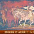
My great-great-grandmother, a Mongolian, raced across these steppes, her daughter (my father’s grandmother) grazed herds here, and the dashing cavalry of Ataman Semenov and the Red partisans rushed across these steppes during the civil war. And in some squadron of partisans, a young guy was galloping with a weapon in his hands - Antonin Titlyanov. I saw these steppes when I went on an expedition for the first time. Accident? Coincidence? A pattern? I believe in chance; in my opinion, it is a link of inevitability.
1.3. Indigenous population of Transbaikalia
The indigenous population of Transbaikalia are the Buryats, Evenks (Tungus), as well as the Mongols who roamed here. The Buryats of Transbaikalia considered themselves Mongols. The Selingin Buryats claimed that they were descendants of Genghis Khan or his brother of the purest blood. The Agin Buryats called themselves descendants of Prince Bartu. Most researchers believe that the Buryats are the oldest aborigines of Transbaikalia and only a small part of them come from Mongolia.
Transbaikal Buryats were cattle breeders. They made constant migrations: in the summer to open places where the winds blow, carrying midges and gadflies, in the fall - to meadows and islands in river valleys mown in the summer, in the winter - to places protected from the wind, where livestock feed on rags, in the spring - to the slopes, where The snow melts first.
The belief of the Transbaikal Buryats is Lamaism, one of the sects of Buddhism. As Poddubny wrote, none of the Buryats, except lamas, know prayers, services and rituals. The participation of the people in prayer consists of a solemn mood, many bows, offerings to the gods and lamas, and, finally, muttering words and phrases they do not understand from Buddhist prayer books.
Buryats live in uluses of 10-20 yurts or winter huts, belonging to individuals of the same clan. Each Buryat has one or two yurts, several wooden flocks (a place for livestock), two or three small courtyards and sometimes a log barn for storing grain and supplies.
The Buryats have monogamy. The situation of women and men is not the same. Women enjoy freedom and independence, but they are at work all day, they are responsible for all the worries and housework. The man, like a true nomad, is extremely restless. He is drawn to another ulus - to see friends, find out news, and often he goes without any purpose to another ulus or even to the city.
The Tungus (aka Evenks) in Transbaikalia live in the taiga, they are excellent hunters and experts on the taiga. The Tungus are distinguished by their honesty, cheerfulness, wit and good nature. Every event in the life of the Tungus is marked by dancing. The Evenks are considered Orthodox, but in reality they are still pagans, shamanists. With the adoption of Christianity, polygamy did not disappear, but only the rich have two or three wives. The main occupation of the Transbaikal Evenks is hunting and fishing [Poddubny, 1914].
1.4. Russian population of Transbaikalia
The first Russian settlers of Transbaikalia were Cossack explorers. In the Middle Ages, the Russians, like many other large and powerful nations, could not sit still.
In terms of capturing vast spaces, the Russian movement is comparable to the conquests of Alexander the Great, Genghis Khan, and Batu; in terms of the style of movement, it is sharply different. Ancient leaders walked at the head of huge armies. The Russians advanced across Siberia in small detachments - tens of people, rarely hundreds.
The Russian movement went in different directions, but in the end - to the east. At the end of the reign of Mikhail Fedorovich (1645), several expeditions were already heading to the shores of the Pacific Ocean. One generation (1613−1648) traveled the distance from the river. Ob to the Pacific Ocean, annexing the Tungus, Yakuts, Buryats, Daurs, Koryaks and others to the Russian crown [Asian Russia, 1914].
Much and interesting things have been written about the conquest of Siberia by Ermak. We will not retell the historical stories, but only recall that the campaign lasted from 1581 to 1585, Ermak himself died at the hands of Kuchum, the remnants of his squad left Siberia, to which the previous owners returned. However, the work started by Ermak did not die. New detachments under the command of governors Sukin and Myasnoy completed the work begun by Ermak, annexing the lands along the Ture, Tobol and Irtysh rivers to Russia.
The troubled time of devastation that followed the death of Tsar Fyodor Ioannovich delayed the movement of Russians into Siberia. However, after the end of the Time of Troubles, the advance of Muscovite Rus' into Siberia resumed.
We will not dwell on the navigation of the Pomors in the northern seas, thanks to which a direct water route was established from Arkhangelsk to the Yenisei Bay. We will not talk about the routes, partly on foot, partly by water, from the Ob to the Yenisei and further to the Lena. We are interested in the forest-steppe area in Transbaikalia, the development of which is associated with the movement of the Russians to the Amur.
In 1643−1645. Poyarkov with 130 Cossacks went from the Lena along the Aldan, dragged across the Stanovoy Range and entered the Amur River by the Zeya River. Poyarkov’s stories that “the land along the Amur is crowded and rich in grain and sable, and there is a lot of every animal, and a lot of grain will be born, and the rivers are full of fish” prompted the old experimenter Yorka Khabarov to recruit a squad of 70 people and, with the permission of the Yakut governor, move to the Amur. Khabarov sailed along the Amur, returned and the next year (1650) repeated his campaign at the head of a detachment of 400 people with three cannons. There were 170 hunters in the detachment. The Daurs, who lived along the banks of the Amur and paid tribute to the Bogodoy (i.e., Chinese) king, resisted. The Russians occupied Albazin and established the Achansky town and town at the mouth of the river. Zei. However, Manchu troops approached Achansk, which were defeated by the Russians that time. Thus began the wars between Russia and China over the possession of the Amur [Asian Russia, 1914].
Simultaneously with the campaigns on the Amur, the Russians established themselves in Lake Baikal and Transbaikalia. Under the leadership of centurion Beketov, the Cossacks were sent “to... long-distance service to Irgen Lake and the great Shilka River.” The campaign began in 1652 from Yeniseisk and the goal was “to set up two forts in the strongest and most comfortable places, and to bring peaceful people from the lands under the sovereign royal hand.” It took several years to complete this plan. Most of the way they walked against the flow of the rivers, heavy boats with weapons and various supplies were pulled with a towline. Having overcome all sorts of obstacles, Beketov’s detachment reached Lake Irgen, where the Irgen fort was set up.
Leaving some of the people in the prison, Beketov and the main detachment crossed the Yablonovy Ridge along the Irgensky portage, i.e. along the dry route from the lake. Irgen to r. Ingoda. From Ingoda he sent Beket Cossacks led by Urasov to search on the river. Nerche is the place for another prison. Urasov and rebuilt the Nelyudsky (Nerchinsky) fort.
In winter, the Cossacks collected a rich tribute and, under the protection of 30 people, sent nineteen “forty” sables to Yeniseisk. (Forty is a bunch of forty pieces of sables.) Near the newly built forts, the Cossacks plowed and sowed the land, laying the foundation for agriculture beyond Baikal.
1.5. Ostrogi
The system of forts served as outposts for the acquisition of new lands and economic development of the region, as well as fortresses during attacks by “foreigners.” A prison is a fortification. Internal buildings (huts, barns, churches) were fenced with a wall of sharpened logs with defensive towers and shooting holes. Often forts were surrounded by a moat. When choosing a place for a fort, the Cossacks cared not only about the possibilities of patrol and defense, but also about whether the surrounding area was suitable for arable farming and cattle breeding. Winter huts and forts in Transbaikalia were built on river bends, capes, islands and peninsulas.
In the second half of the 17th century, the Transbaikal border system included about 15 forts, built from 1646 (Verkhne-Angarsk fort) to 1700 (Sretensky fort). Nerchinsky, Selenginsky and Udinsky forts eventually turned into cities. At the end of the 17th century, when the military threat from China weakened and the local population rather obediently became Russian subjects, most of the forts practically disappeared, others were turned into prisons.
1.6. Establishment of the border with China
With the forces that the Russians had in Siberia in the 17th century, they reached the limits of possible expansion of their possessions. There were neither people nor weapons to fight seriously with the Chinese Empire. And yet, the war with China, now calming down, now flaring up, went on for about forty years, mainly near Albazin on the Amur and the mouth of the Zeya. In 1684, a Chinese army of six thousand, armed with a hundred cannons, approached Albazin. Against the powerful Chinese group, the Russians could field only about two thousand defenders, 20 cannons and 500 arquebuses. Although Albazin suffered, the Chinese troops were repulsed.
Peace negotiations took place near Nerchinsk. The Russian embassy was headed by the Tsar's envoy F.A. Golovin. The Chinese delegation arrived near Nerchinsk at the head of a 12,000-strong army. At first, the Manchus laid claim to the entire Amur - from the headwaters to the mouth and to all the lands lying east of Baikal. Then they nevertheless moderated their claims and signed the Nerchinsk Treaty on the border between Russia and China in 1689 [Asian Russia, 1914].
The border line turned out to be extremely uncertain. The main geographical landmarks were unclear, and there were no accurate maps of the division areas. Due to such confusion, the Chinese considered part of the territory to be Chinese, and the Russians to consider it Russian. At the turn of the 17th and 18th centuries, the official border existed only along the Arguni River. To the west of the Argun there were no forts or guards, and only the yasak Tungus, who roamed in these places, were the guardians of Russian lands.
Meanwhile, trade with China required order and understanding of where the border between states lay. The situation was aggravated by China's claims to the entire southern part of Western and Eastern Siberia, that is, to establish a border along the Krasnoyarsk-Argun line. For negotiations on clarifying the border, Russia sent an embassy to Beijing in 1726, headed by Count Savva Vladislavich Raguzinsky.
The count did not arrive alone, he was accompanied and guarded by a Yakut infantry regiment, one company of dragoons and 200 people of the Yekaterinburg security guard. At the request of the count, negotiations were moved to the border of Russia and Mongolia in the area of the river. Buri (20 km from Kyakhta). Here, on August 20, 1727, the Burin Treaty was concluded, which became an integral part of the Kyakhta Treaty.
The border was drawn from the upper reaches of the Argun to Kyakhta and further to the Shamin-Dabata pass in Altai according to the principle “let there be a northern side to the Russian Empire.” And let there be a midday side for the Middle Empire.” The resolution of all kinds of conflicts on the border was entrusted to the border administration of both sides. The order of trade between Russia and China was established. Kyakhta and the Mongolian settlement of Tsurukhaitu were declared permanent duty-free trade points.
Two border commissions, consisting of both sides, were engaged in marking the border, setting up border signs, establishing guards, and moving settlements and nomads. About 150 servicemen took part in the demarcation, some of them “drew” the border from Kyakhta to the Altai Mountains, others from Kyakhta to Argun. They installed 87 beacons (conical earthen or stone embankments). Attached to the agreement were letters of exchange describing the demarcation line and a list of lighthouses.
The two thousand verst border was guarded by twenty-five guards. The distances between the guards ranged from 100 to 200 versts. Each guard consisted of 5-10 yurts (families) of Tungus or Buryats, who were tasked with monitoring border beacons and the crossing of people and livestock. In 1772, 800 Russian Selenga, Nerchinsk and Irkutsk Cossacks, along with their wives and children, were settled on the border. This settlement completed the formation of the border guard on the Chinese border. The border was divided into eight distances, within which 70 posts or guards, 8 fortresses and 63 redoubts were established, where Russian Cossacks were settled [Smirnov, 2008].
Our ancestral place (Onon river, Aksha village) according to the Burin Treaty moved from Mongolia to Russia. The territory annexed to Russia was steppe and the border was lost in the steppe, along which independent Mongol tribes roamed, looking unfriendly at the Russian newcomers.
1.7. The class “must” of Siberians
After the first trickles, the flows of Russians to Siberia became more and more full-flowing. The pioneers were attracted not only by ambition, but also by self-interest. The initiative for the campaign did not usually belong to government people, but to individual, often adventurous, individuals. It happened, of course, that the governors themselves sent servicemen on reconnaissance. But more often, an “experimentalist” would appear to the governor, or even to the head of the prison, and ask permission to look for new lands and “unknown” peoples. Having the consent of the “sovereign authorities,” the experimenter recruited his squad. He was pestered by industrial hunters, often foreigners. The governors, in order to maintain government interests, sent their people with a detachment. The squad is ready and on the road!
Some of the “experimenters” were truly authoritative personalities; their name alone was the key to success. The detachments often included industrialists, and there were also clerks - representatives of the Moscow merchant class. In today's terms, big capital invested in the future (silver, gold and, above all, furs) and did not lose.
Already in the 17th century, Russians were divided into several groups: service people (military), peasants, industrialists, townspeople (residents of cities who had the right to engage in trade and craft) and the so-called “walkers”, who did not have a permanent assignment to the sovereign service, village or Posad.
Service people. In Transbaikalia, service people and their families usually inhabited forts. The garrisons of the forts were small in number: dozens, at most 2-3 hundred people. Initially, the service included archers and Cossacks. Gradually, there were fewer and fewer archers; their place was taken by servicemen who ended up in Transbaikalia under the State Transfer. The range of responsibilities of servicemen was wide: military campaigns, construction of forts, collection of yasak, search for silver ores and arable farming.
However, the first place has always been the annexation of new lands to the Russian crown and the protection of borders. Those who served received benefits for their service - money, bread, salt, and some of the servicemen were allocated arable land.
Peasantry. The initial centers of arable farming were forts, around which a few peasants settled. Then more and more peasants began to come to Transbaikalia. Will beckoned them. In their homeland they were serfs, in Siberia they were free people. Basically, they became “arable” peasants who worked the “sovereign tithe arable land” for the right to have their own land. In Transbaikalia, for a tithe of the sovereign's arable land, a peasant could plow for himself 4-7, or even 10 dessiatinas (a tithe is equal to 1.09 hectares). Seeds for the “tithe arable land” were issued from the treasury, but the harvest from that arable land went entirely to the “sovereign granaries.” In the 17th century, peasant farming was almost entirely subsistence. They themselves made plows, harrows, carts, sleighs, bows; they sewed shoes, spun wool, and wove cloth. In the villages there were mills, forges, and tanneries, which took payment in kind from the peasants.
Posad people. The posad population (estate) is younger than the peasant population. Only towards the end of the 17th century the townspeople began to settle in Nerchinsk, Selenginsk, Udinsk, i.e. large settlements. The townspeople were engaged in crafts, trade, and partly in arable farming. The townspeople had to work off their duties in kind - build roads, bridges, barns, mills, repair fortifications in the forts, in general, do everything that the governor ordered.
In Transbaikalia, the townspeople developed blacksmithing, tanning, carpentry, carpentry, and flour milling; manufacturing of boats and rafts. They made soap and salt, smoked wine, painted canvas, and mined mica for windows. The townspeople grew into merchants who traded not only throughout Siberia, but also with Russia and China.
With each decade, the population of Siberia and Transbaikalia increased. In 1897, the population of the Transbaikal region was 672,072 people, of which 442,744 were Russians. (66%), in 1911 (over 14 years) the population increased to 868,790 people, among whom 68% were Russians. [Turchaninov, 1914].
1.8. Formation of an ethnic “alloy”
The Buryats and Evenks, after long resistance, accepted Russian power and became yasak people - tributaries of the Russian treasury. Yasak is mainly fur. At first, yasak was not rationed; they took what the yasak people themselves gave. At the end of the 17th century, yasak became rationed; it was levied on the entire male population (from 18 to 50 years old). Depending on local conditions (steppe or forest), from 1 to 6 sables were surrendered per year.
Merchants and industrialists used usury operations, unusual for the aborigines, to involve tribute-payers into unpayable debts. Locals lost their hunting grounds for debt. The Abrigens resisted the unrighteous tribute in different ways. There were also petitions to the Siberian Prikaz and migrations to hard-to-reach places. Considering the “shakyness of foreigners” and the small military forces in Transbaikalia, the Russian state tried to resolve tribute matters peacefully. Let us give just one example - an extract from the royal order to A. Pashkov for the voivodeship in the Daurian land.
“And to the service people... firmly order that they, when they pay yasak, do not inflict unnecessary insults and taxes on anyone by any means, and collect the sovereign’s yasak from them with kindness and greetings, and not with cruelty and injustice; but they would not inflict any cruelty on them, and they would take the sovereign’s tribute from them as much as possible, once a year, but do not take two or three tribute for one year.” [Anthology on the history of the Chita region, 1972, p. 33−34].
Just look at it! “Do not inflict unnecessary insults and taxes on anyone by any means!”
The government looked at yasaks as subjects on an equal basis with Russians. They were judged according to the same laws; they did not interfere with beliefs, customs, or the internal structure of society. The Russian authorities included the Buryat and Evenki communities in the state system, recognizing the communities as the lowest level of government and did not interfere in their internal affairs.
Two reasons contributed to peace in the emerging Transbaikal society. The first is the lack of interest among the Russians in displacing local tribes from their ancestral territories, since these territories were not suitable for arable farming.
The second reason is local women who entered Russian houses. Russian land seekers were in constant struggle with harsh nature and hostile Aboriginal tribes. You could only rely on yourself. This is where iron characters were forged - fearlessness, determination, resourcefulness, bold enterprise.
These men knew how to do everything: to repel the enemy, to kill an animal, to build a house, to plow the land, and to collect grain from it. But a home is not a home without a family. And there were almost no Russian women in Siberia. The government took its own measures: it sent women from Russia, ordered peasants to marry off their daughters to exiles, and even paid money for this to both fathers and daughters (dowry), and husband. But, in the end, a decree in 1825 ordered local authorities to buy girls from foreigners. So independent Buryats, good-natured Tunguskas, and wayward Mongolians entered Russian houses as housewives. Marriages of Russians with foreigners took place in large numbers even before 1825. From mixed marriages with Buryats and Mongols in Transbaikalia, offspring appeared dark-skinned, black-haired, black-eyed, sometimes with regular facial features, sometimes with high cheekbones and narrow eyes. Probably, these dark-skinned children running around the courtyards and galloping on horses, sometimes with snub-nosed and light-eyed, sometimes with high cheekbones and narrow-eyed, were the main glue that strengthened the emerging special Transbaikal population, connecting Russians with foreigners by blood ties, and was the basis of peaceful relations and mutual economic interests. The men are Russian, and the women are either Mongolians, or Buryats, or Tunguskas.
1.9. Family legends
In addition to historical chronicles, family legends are an invaluable source of genealogies. Where do they come from? Grandmothers tell them to their grandchildren, and much less often, mothers and fathers tell their daughters and sons. These legends are sometimes confirmed in old diaries, letters, old photographs, preserved antiques, and sometimes in family jewelry and personalized weapons. Nothing material (except for one photograph from a hundred years ago) that would confirm family legends has been preserved in our family. Only the stories of my grandmother, Alexandra Konstantinovna, and my father, Antonin Andreevich, remain in my memory. My grandmother and I lived in Kamchatka, where my parents went to work in 1935. The place of work was a small experimental station 12 km from the village of Milkovo (now Elizarovo). When we arrived, the house in which we were supposed to live was not completed - there was not even a floor. My parents completed the construction themselves - my father laid the floors, my mother plastered the walls. It was already cold and dugouts were built for us. There was a stove in the dugout, on which the grandmother cooked food, it was warm and cozy. My parents spent the night in another dugout, then in a new house, where it was very cold, and my grandmother and I lived all winter in the dugout and slept on a large trestle bed.
After dinner, when my parents left, I sat on a bench near the stove or climbed onto the trestle bed and asked my grandmother: “Tell me about the old things.” I was 5-6 years old when I heard family legends. What could be preserved in my memory? Much has been preserved, but how much has been conjectured, invented by a little girl with a vivid imagination! Of course, later, already at school, when we lived with my grandmother again, I asked again and clarified; the grandmother answered, told me something new, and then said: “Yes, I forgot a lot, maybe it wasn’t like that, or maybe my father told me fairy tales mixed with the truth. My Cossack grandmother also told me that things often didn’t work out as well for her as for my father. The truth, Argentochka, is different, everyone has their own.” I have remembered this grandmother’s maxim for the rest of my life and from long life experience I know “Yes, everyone has their own truth.”
Many years later, when I was already about thirty, my father and I went to the taiga and there at night over tea by the fire he told me his version of the distant past. My father preferred to read historical literature, was interested in the history of the Cossacks, and referred to certain dates. Much agreed, but much diverged from the grandmother’s stories. From these conversations, a family history formed in my head and I even wrote down some of it then. Since the story combined the stories of my grandmother (and they, in turn, were born from the stories of her father and her grandmother) and the stories of my father (which he heard from his grandmother), then everything stated below is a legend, a family legend of the Titlyanovs.
The population of the Trans-Baikal Territory, according to the preliminary results of the 2010 All-Russian Population Census, as of October 14, 2010 is 1106.6 thousand people, 0.8% of the Russian population. The population density as of October 14, 2010 was 2.6 people per 1 sq. km, in Russia - 8.4 people.
The main settlement zone covers the central, southern and south-eastern parts of the Trans-Baikal Territory. The most densely populated area (9-13 people/km2) is the area along the railway and the valleys of the Ingoda, Shilka and Onon rivers. The population density is somewhat lower in the Onon-Borzinsky and Aginsky steppes. In the southwest of the region the population is located along the valleys of the Khilok and Chikoy rivers; in the northern regions the population density is low. The Trans-Baikal Territory is inhabited by representatives of more than 120 nationalities, incl. Russians, Buryats, Tatars, Ukrainians, Belarusians, etc. Aginsky Buryat Okrug is populated mainly by Buryats (54.9%, average population density - 4.2 people/km2) and Russians (about 40%). In the north, in the Vitim and Olekma basin, live the Evenks and Yakuts. There are 10 cities and 44 urban-type settlements in the Trans-Baikal Territory. The largest city is the regional center of Chita (316.6 thousand people). Other cities have a significantly smaller population: Krasnokamensk (55.9 thousand people), Borzya (31.5 thousand people), Petrovsk-Zabaikalsky (21.2 thousand people), Baley (14.8 thousand people). All cities and many urban-type settlements are administrative centers of districts.
National composition
Nations with a population of more than 1,000 people as of 2010 are listed (with a total population of 1,107,107 people).
Russians - 977,400 (89.9%)
Buryats - 73,941 (6.8%)
Ukrainians - 6,743 (0.6%)
Tatars - 5,857 (0.5%)
Belarusians - 1,544 (0.2%)
Evenks - 1,387 (0.1%)
The population of the Trans-Baikal Region, according to the National Census from 2010, is 1106.6 thousand people (14th of October, 2010), 0.8% form the total of population of the Russian Federation. The density of population on the 14th of October, 2010 was 2.6 persons per 1 sq. km, total Russia - 8.4 persons.
Nationalities
The nationalities with population more than 1000 people according to 2010 data (total population1.107.107 people) are listed below:
|
977 400 |
|
Contact our headquarters for assistance to investors and authors of investment projects
Choose a communication method convenient for you and we will definitely contact you!
Trans-Baikal Territory is a region of Eastern Siberia, which is famous not only for its unique natural phenomena, but also for its hospitable population. A huge number of tourists come here every year to see the Chara Sands with their own eyes and improve their health in one of the many resorts. The healing mineral waters of Transbaikalia will help you cope with any disease.
How did the region appear?
Trans-Baikal Territory can be called a relatively young region. The first people appeared here no more than 35 thousand years ago. The first settlements were discovered near the current capital.
The formation of the Trans-Baikal Territory began with the unification of the Buryat Autonomous Okrug in 2007. The heads of local government sent an official letter to the President of the Russian Federation. The official date of creation of the region is March 11, 2007. On this day a referendum was held. The people had to express their opinion on the unification of several administrative units into the Trans-Baikal Territory. The capital of the region was chosen a little later.
Today Transbaikalia is a fairly large region inhabited by people of various nationalities. According to the latest population census, the total population of the Trans-Baikal Territory is 1,087,479 people. The most populated is the central part of the region. But in the northern part the population is quite weak.
Chita
Several regions are united into the Trans-Baikal Territory. They have the same capital. The city of Chita with a population of more than 300 thousand people was chosen as the center of the region. The settlement got its name from the river that flows nearby. Chita is still the real pride of Transbaikalia today.
The capital has a sharply continental climate with a characteristic temperature regime. In winter, the average temperature here is about 25 degrees Celsius below zero. Summers are warm and humid. Temperatures rarely rise above 20 degrees Celsius. The warmest period in Chita lasts only 77 days.
The capital is located in the Irkutsk time zone. The offset relative to Moscow time is 5 hours.
The government of the Trans-Baikal Territory is located in Chita. And local government is represented by the City District Duma, as well as the local city administration. The head of the administration is the mayor, who is elected by the population.

Chita is not just the center of Transbaikalia, but a real cultural capital. There are a huge number of museums and theaters here. A visitor can get great pleasure walking along the streets. The ancient architecture of the city is impressive. And in spring and summer, Chita hosts many festivals that attract tourists not only from Russia, but also from other neighboring countries.
Government of the Trans-Baikal Territory
The highest official of the region is the Governor, who is elected for a term of 5 years. Only the Legislative Assembly, consisting of 50 deputies, can appoint the head. Elections of members of the representative body also occur every five years. The executive body is the Government of the Trans-Baikal Territory, headed by the governor.
The first Governor of Transbaikalia was elected only on February 5, 2008. He became Ravil Geniatulin. A little later, elections of deputies to the representative body of power took place. Some members of the Legislative Assembly were elected from party lists. Some deputies were able to get into the government through single-mandate constituencies.
The laws of the Trans-Baikal Territory appear thanks to a representative body of power. If the majority of deputies vote for a particular project, it is submitted to the governor for signature. The law comes into force only when it is approved by the highest official in the region.
Districts of the Trans-Baikal Territory
The Trans-Baikal Territory includes 31 districts. These include 10 cities, 41 and 750 rural settlements. This administrative-territorial division explains the main employment of the population. Most residents of Transbaikalia live in villages. Thanks to good black soil and clean air, farmers have a good income.

The largest settlement in the region is Chita. The second place is occupied by the city of Krasnokamensk. About 50 thousand people live here. The population in most cities and towns does not exceed 20 thousand people.
Development of the region
Like the rest of Russia, the Trans-Baikal Territory has good economic indicators. A huge amount of black soil makes it possible to develop agriculture well. Most of the products consumed by the local population are produced in Transbaikalia.
Thanks to a significant number of rivers and lakes, the region has enormous hydropower potential. But, unfortunately, very little work has been done in this area to date. Much emphasis is placed on other areas of the economy. The excellent development of the Trans-Baikal Territory is due to large reserves of valuable precious metals, copper, tin, molybdenum, and polymetallic ores. The main base of the Russian nuclear industry is also located in the Trans-Baikal Territory.

The development of the region is also characterized by a good educational base. Zabaikalsk (Zabaykalsky Krai) is famous for its three higher educational institutions. More than 7,000 students can study here at the same time. This is the pride of not only the region, but the entire Russian Federation. After all, university graduates receive a truly high-quality education thanks to a good teaching staff. Much attention is paid to the sports development of youth.
Healthcare in the region
Today there are more than 120 medical institutions in Transbaikalia. Patients are assisted by qualified doctors with higher medical education. In this regard, the Transbaikal region can be called quite developed. The capital of the region is famous for its educational institutions that successfully treat cancer.
In rural areas, people are provided with assistance at first aid stations. Here they deliver babies and make appointments for the treatment of simple diseases. In difficult cases, the patient is sent to the regional center or the capital.
Religion
In terms of religion, the Transbaikal region can be called quite diverse. Today, traditional beliefs of ancient peoples still exist here - shamanism, totemism and fetishism. Some practice Islam and Judaism.

With the advent of the Russian-speaking population on the territory of modern Transbaikalia in the 17th century, Orthodoxy came here. The first Church of the Resurrection was built in 1670. It has survived to this day.
Nature in Transbaikalia
The region's topography consists of both mountains and plains. In the northern part of the Trans-Baikal Territory there are many mountains, but in the south the steppe predominates. Forests predominate in mountainous areas. The Department of the Trans-Baikal Territory reports that in 2006 the total forest area was more than 34 thousand hectares. This is 67% of the total area of the entire region. Thanks to the forests, the air in Transbaikalia is clean and fresh. Many resort areas are located in pine forests.
Transbaikalia is also famous for its water resources. The largest rivers include the Shilka, Onon, Khilok, and Argun. But the largest groups of lakes include Torey and Kuando-Chara.
The good ones contribute to the high level of the economy of the Trans-Baikal Territory. The region contains concentrated reserves of silver and copper in large quantities. More than 2% of all-Russian reserves of hard coal are also concentrated in Transbaikalia.
Tourism in the Trans-Baikal Territory
The entire region is divided into several tourist areas. The South-West is considered the most popular among visitors. It attracts a lot of attention from tourists. Entire hikes with overnight stays in the open air are organized here. In the summer, tourists travel by kayaking, and in winter - by skiing. The mountainous terrain also attracts many people. But only experienced tourists can afford to climb the hill.

The South-East attracts much less sports tourists. Despite this, there are many natural and cultural attractions here. Just look at the national culture - the Aginsky datsan, the Tsugolsky datsan. In Alkhanay National Park, every tourist can relax his soul and body. There are many monuments here that will tell you about the history and culture of Transbaikalia.
The Transbaikal region is famous for its beautiful architecture. The capital shows the contrast between ancient times and modern times. Next to the ancient buildings there are modern buildings and cottages.
The north of Transbaikalia attracts tourists with its mountainous terrain. Climbing to the highest point of Transbaikalia - Peak Bam - is organized. The ridge is characterized by difficult passes and turbulent rivers. Therefore, it is not recommended to go here on your own.
Attractions

They are extremely popular in the region. Every year, many tourists come to the Sokhondninsky and Daursky nature reserves. There are such attractions as the Charsky Sands tract, Lamsky town, and the Polosatik rock.
Buddhist centers are of great interest to tourists. Their age exceeds 200 years. It is here that the most ancient architectural monuments of the Buryat people have been preserved. It will be interesting for tourists to look at the building of the Tsokchen-dugan cathedral temple, as well as numerous incense burners. Tourists have vivid impressions after attending a service in the temple.
|
population of the Trans-Baikal Territory on, population of the Trans-Baikal Territory of Russia
The total population of the region is 1,087,452 people. (2015). Population density - 2.52 people/km2 (2015). Urban population - 67.37% (2015).
- 1 Population
- 2 Demographics
- 3 Urban and rural population
- 4 Settlements
- 5 Age composition
- 6 National composition
- 7 See also
- 8 Literature
Population
| Population | |||||||
|---|---|---|---|---|---|---|---|
| 1959 | 1970 | 1979 | 1989 | 1990 | 1991 | 1992 | 1993 |
| 1 036 387 | ↗1 144 918 | ↗1 233 435 | ↗1 377 975 | ↘1 320 562 | ↘1 317 948 | ↘1 307 810 | ↘1 283 764 |
| 1994 | 1995 | 1996 | 1997 | 1998 | 1999 | 2000 | 2001 |
| ↘1 269 690 | ↘1 256 389 | ↘1 247 668 | ↘1 234 397 | ↘1 219 795 | ↘1 207 030 | ↘1 192 819 | ↘1 178 824 |
| 2002 | 2003 | 2004 | 2005 | 2006 | 2007 | 2008 | 2009 |
| ↘1 155 346 | ↘1 152 596 | ↘1 143 876 | ↘1 135 721 | ↘1 128 238 | ↘1 122 104 | ↘1 118 931 | ↘1 117 030 |
| 2010 | 2011 | 2012 | 2013 | 2014 | 2015 | ||
| ↘1 107 107 | ↘1 106 155 | ↘1 099 396 | ↘1 095 169 | ↘1 090 344 | ↘1 087 452 | ||
Demography
| Fertility (number of births per 1000 population) | ||||||||
|---|---|---|---|---|---|---|---|---|
| 1970 | 1975 | 1980 | 1985 | 1990 | 1995 | 1996 | 1997 | 1998 |
| 18,0 | ↗21,2 | ↗21,3 | ↘20,5 | ↘16,7 | ↘12,2 | ↘11,3 | ↘11,0 | ↗11,7 |
| 1999 | 2000 | 2001 | 2002 | 2003 | 2004 | 2005 | 2006 | 2007 |
| ↘10,9 | ↗11,1 | ↗11,7 | ↗12,3 | ↗13,5 | ↗13,8 | ↘13,5 | ↗13,9 | ↗14,9 |
| 2008 | 2009 | 2010 | 2011 | 2012 | 2013 | 2014 | ||
| ↗15,9 | ↗15,9 | ↗15,9 | ↘15,4 | ↗16,1 | ↘15,9 | ↗16,0 | ||
| Mortality rate (number of deaths per 1000 population) | ||||||||
|---|---|---|---|---|---|---|---|---|
| 1970 | 1975 | 1980 | 1985 | 1990 | 1995 | 1996 | 1997 | 1998 |
| 7,4 | ↗8,4 | ↗9,5 | ↘9,2 | ↘8,7 | ↗12,8 | ↘12,4 | ↘12,0 | ↘11,6 |
| 1999 | 2000 | 2001 | 2002 | 2003 | 2004 | 2005 | 2006 | 2007 |
| ↗13,6 | ↗13,7 | ↗14,4 | ↗15,2 | ↗16,8 | ↗17,1 | ↗17,2 | ↘15,5 | ↘14,4 |
| 2008 | 2009 | 2010 | 2011 | 2012 | 2013 | 2014 | ||
| ↘14,3 | ↘13,7 | ↗13,8 | ↘13,2 | ↘13,0 | ↘12,5 | ↘12,4 | ||
| Natural population growth (per 1000 population, sign (-) means natural population decline) | ||||||||
|---|---|---|---|---|---|---|---|---|
| 1970 | 1975 | 1980 | 1985 | 1990 | 1995 | 1996 | 1997 | 1998 |
| 10,6 | ↗12,8 | ↘11,8 | ↘11,3 | ↘8,0 | ↘-0,6 | ↘-1,1 | ↗-1,0 | ↗0,1 |
| 1999 | 2000 | 2001 | 2002 | 2003 | 2004 | 2005 | 2006 | 2007 |
| ↘-2,7 | ↗-2,6 | ↘-2,7 | ↘-2,9 | ↘-3,3 | ↗-3,3 | ↘-3,7 | ↗-1,6 | ↗0,5 |
| 2008 | 2009 | 2010 | 2011 | 2012 | 2013 | 2014 | ||
| ↗1,6 | ↗2,2 | ↘2,1 | ↗2,2 | ↗3,1 | ↗3,4 | ↗3,6 | ||
| at birth (number of years) | ||||||||
|---|---|---|---|---|---|---|---|---|
| 1990 | 1991 | 1992 | 1993 | 1994 | 1995 | 1996 | 1997 | 1998 |
| 66,8 | ↗67,0 | ↘65,5 | ↘61,5 | ↘59,7 | ↗61,5 | ↗62,3 | ↗63,3 | ↗64,2 |
| 1999 | 2000 | 2001 | 2002 | 2003 | 2004 | 2005 | 2006 | 2007 |
| ↘61,7 | ↘61,5 | ↘60,3 | ↘59,8 | ↘59,7 | ↘59,3 | ↗59,3 | ↗61,4 | ↗63,0 |
| 2008 | 2009 | 2010 | 2011 | 2012 | 2013 | |||
| ↗63,8 | ↗64,7 | ↗64,8 | ↗65,8 | ↗66,2 | ↗67,1 | |||
Urban and rural population
| Years | Whole population | Including rural | % urban population |
|---|---|---|---|
| 1939+ | 963,2 | 565,1 | 41 |
| 1970+ | 1144,9 | 487,1 | 57 |
| 1990 | 1320,6 | 477,3 | 64 |
| 1995 | 1256,4 | 457,7 | 63,1 |
| 2000 | 1192,8 | 434,2 | 63,6 |
| 2002+ | 1155,3 | 416,8 | 63,9 |
| 2005 | 1135,7 | 415,1 | 63,5 |
| 2006 | 1128,2 | 413,5 | 63,3 |
| 2007 | 1122,1 | 410,2 | 63,5 |
Plus (+) denotes census years.
Settlements
Settlements with a population of more than 5 thousand people
|
Age composition
National composition
National composition of the region's population according to the 2002 and 2010 censuses
| 2002 year |
% from Total |
% from indicating- shih national ness |
2010 year |
% from Total |
% from indicating- shih national ness |
|
|---|---|---|---|---|---|---|
| Whole population | 1155346 | 100,00% | 1107107 | 100,00% | ||
| Russians | 1037502 | 89,80% | 90,01% | 977400 | 88,28% | 89,91% |
| Buryats | 70457 | 6,10% | 6,11% | 73941 | 6,68% | 6,80% |
| Ukrainians | 11843 | 1,03% | 1,03% | 6743 | 0,61% | 0,62% |
| Tatars | 8159 | 0,71% | 0,71% | 5857 | 0,53% | 0,54% |
| Armenians | 3594 | 0,31% | 0,31% | 3943 | 0,36% | 0,36% |
| Azerbaijanis | 2129 | 0,18% | 0,18% | 2045 | 0,18% | 0,19% |
| Kyrgyz | 532 | 0,05% | 0,05% | 1634 | 0,15% | 0,15% |
| Belarusians | 2973 | 0,26% | 0,26% | 1544 | 0,14% | 0,14% |
| Uzbeks | 655 | 0,06% | 0,06% | 1515 | 0,14% | 0,14% |
| Evenks | 1492 | 0,13% | 0,13% | 1387 | 0,13% | 0,13% |
| Bashkirs | 1228 | 0,11% | 0,11% | 968 | 0,09% | 0,09% |
| Tajiks | 375 | 0,03% | 0,03% | 964 | 0,09% | 0,09% |
| Chuvash | 1271 | 0,11% | 0,11% | 792 | 0,07% | 0,07% |
| Germans | 1294 | 0,11% | 0,11% | 750 | 0,07% | 0,07% |
| Chinese | 295 | 0,03% | 0,03% | 632 | 0,06% | 0,06% |
| Moldovans | 827 | 0,07% | 0,07% | 613 | 0,06% | 0,06% |
| Kazakhs | 535 | 0,05% | 0,05% | 570 | 0,05% | 0,05% |
| Dargins | 589 | 0,05% | 0,05% | 527 | 0,05% | 0,05% |
| Mordva | 749 | 0,06% | 0,06% | 429 | 0,04% | 0,04% |
| Mari | 496 | 0,04% | 0,04% | 349 | 0,03% | 0,03% |
| Udmurts | 498 | 0,04% | 0,04% | 336 | 0,03% | 0,03% |
| Georgians | 366 | 0,03% | 0,03% | 304 | 0,03% | 0,03% |
| Koreans | 365 | 0,03% | 0,03% | 256 | 0,02% | 0,02% |
| Gypsies | 313 | 0,03% | 0,03% | 243 | 0,02% | 0,02% |
| Avars | 249 | 0,02% | 0,02% | 214 | 0,02% | 0,02% |
| Tuvans | 274 | 0,02% | 0,02% | 214 | 0,02% | 0,02% |
| Lezgins | 296 | 0,03% | 0,03% | 206 | 0,02% | 0,02% |
| Jews | 334 | 0,03% | 0,03% | 199 | 0,02% | 0,02% |
| Poles | 307 | 0,03% | 0,03% | 182 | 0,02% | 0,02% |
| Chechens | 226 | 0,02% | 0,02% | 177 | 0,02% | 0,02% |
| Yakuts | 206 | 0,02% | 0,02% | 163 | 0,01% | 0,01% |
| Altaians | 129 | 0,01% | 0,01% | 160 | 0,01% | 0,01% |
| Ossetians | 196 | 0,02% | 0,02% | 159 | 0,01% | 0,01% |
| Vietnamese | 13 | 0,00% | 0,00% | 153 | 0,01% | 0,01% |
| Lithuanians | 190 | 0,02% | 0,02% | 130 | 0,01% | 0,01% |
| Ingush | 131 | 0,01% | 0,01% | 117 | 0,01% | 0,01% |
| Kumyks | 127 | 0,01% | 0,01% | 116 | 0,01% | 0,01% |
| Khakassians | 92 | 0,01% | 0,01% | 106 | 0,01% | 0,01% |
| Mongols | 58 | 0,01% | 0,01% | 84 | 0,01% | 0,01% |
| Gagauz | 65 | 0,01% | 0,01% | 60 | 0,01% | 0,01% |
| Bulgarians | 101 | 0,01% | 0,01% | 55 | 0,00% | 0,01% |
| other | 1122 | 0,10% | 0,10% | 889 | 0,08% | 0,08% |
| total indicated | 1152653 | 99,77% | 100,00% | 1087126 | 98,20% | 100,00% |
| not specified | 2693 | 0,23% | 19981 | 1,80% |
see also
- Transbaikal region
- Population
Literature
- Kulakov V. S. “Geography of the Trans-Baikal Territory” Textbook. - Chita: Express Publishing House, 2009. ISBN 9785956601266
- “Chita region - 70 years” Chita, 2007.
- 1 2 Resident population estimates as of January 1, 2015 and 2014 average (published March 17, 2015). Retrieved March 18, 2015. Archived from the original on March 18, 2015.
- Estimated resident population as of January 1, 2015 and average for 2014 (published March 17, 2015)
- All-Union Population Census of 1959. Retrieved October 10, 2013. Archived from the original on October 10, 2013.
- All-Union population census of 1970. The actual population of cities, urban-type settlements, districts and regional centers of the USSR according to census data as of January 15, 1970 for republics, territories and regions. Retrieved October 14, 2013. Archived from the original on October 14, 2013.
- All-Union Population Census 1979
- All-Union population census of 1989. Archived from the original on August 23, 2011.
- 1 2 3 4 5 6 7 8 9 10 11 12 13 14 15 16 17 18 19 20 Resident population as of January 1 (persons) 1990-2010
- All-Russian population census 2002. Volume. 1, table 4. Population of Russia, federal districts, constituent entities of the Russian Federation, districts, urban settlements, rural settlements - regional centers and rural settlements with a population of 3 thousand or more. Archived from the original on February 3, 2012.
- Results of the 2010 All-Russian Population Census. 5. Population of Russia, federal districts, constituent entities of the Russian Federation, districts, urban settlements, rural settlements - district centers and rural settlements with a population of 3 thousand people or more. Retrieved November 14, 2013. Archived from the original on November 14, 2013.
- Population of the Russian Federation by municipalities. Table 35. Estimated resident population as of January 1, 2012. Retrieved May 31, 2014. Archived from the original on May 31, 2014.
- Population of the Russian Federation by municipalities as of January 1, 2013. - M.: Federal State Statistics Service Rosstat, 2013. - 528 p. (Table 33. Population of urban districts, municipal districts, urban and rural settlements, urban settlements, rural settlements). Retrieved November 16, 2013. Archived from the original on November 16, 2013.
- Estimated resident population as of January 1, 2014. Retrieved April 13, 2014. Archived from the original on April 13, 2014.
- 1 2 3 4 5 6 7 8 9 10 11 12 13
- 1 2 3 4
- 1 2 3 4
- 1 2 3 4 5 6 7 8 9 10 11 12 13 5.13. Fertility, mortality and natural population growth by regions of the Russian Federation
- 1 2 3 4 4.22. Fertility, mortality and natural population growth by constituent entities of the Russian Federation
- 1 2 3 4 4.6. Fertility, mortality and natural population growth by constituent entities of the Russian Federation
- Fertility, mortality, natural increase, marriage, divorce rates for January-December 2011
- Fertility, mortality, natural increase, marriage, divorce rates for January-December 2012
- Fertility, mortality, natural increase, marriage, divorce rates for January-December 2013
- Fertility, mortality, natural increase, marriage, divorce rates for January-December 2014
- 1 2 3 4 5 6 7 8 9 10 11 12 13 14 15 16 17 18 19 20 21 Life expectancy at birth, years, year, indicator value per year, entire population, both sexes
- 1 2 3 Life expectancy at birth
- 1 2 3 4 5 6 7 8 9 10 11 12 13 14 15 16 17 18 19 20 21 22 23 24 25 26 18.1 Estimation of the permanent population of the Trans-Baikal Territory as of January 1, 2011-2015 (by region, regions equated to regions of the Far North, municipalities)
- 1 2 3 4 Population of the Russian Federation by municipalities as of January 1, 2014. Retrieved August 2, 2014. Archived from the original on August 2, 2014.
- All-Russian population census 2010. Population of the Trans-Baikal Territory by urban districts, municipal districts, urban and rural settlements, urban settlements, rural settlements. Retrieved September 11, 2014. Archived from the original on September 11, 2014.
- Applications // Geography of the Trans-Baikal Territory / V.S. Kulakov. - Chita: Express Publishing House, 2009. - pp. 284-288. - 308 p. - 3000 copies. - ISBN 978-5-9566-0126-6.
- 4. Population by nationality and Russian language proficiency in the constituent entities of the Russian Federation // All-Russian Population Census 2010
| Transbaikal region | |||
|---|---|---|---|
|
Administrative center: Chita Urban districts: Aginskoe | Mountain | Petrovsk-Zabaikalsky | Chita Articles: Geography | Coat of arms | Anthem | History | Population| Administrative division | Flag Altaic Zabaikalsky Kamchatka Krasnodar Krasnoyarsk Perm Primorsky Stavropol Khabarovsk |
|||
| Regions |
Amur Arkhangelsk Astrakhan Belgorod Bryansk Vladimir Volgograd Vologda Voronezh Ivanovo Irkutsk Kaliningrad Kaluga Kemerovo Kirov Kostroma Kurgan Kursk Leningrad Lipetsk Magadan Moscow Murmansk Nizhny Novgorod Novgorod Novosibirsk Omsk Orenburg Orel Penza Pskov Rostov Ryazan Sam Arskaya Saratovskaya Sakhalinskaya Sverdlovskaya Smolenskaya Tambovskaya Tver Tomskaya Tula Tyumenskaya Ulyanovskaya Chelyabinskaya Yaroslavlskaya |
||
| Federal cities |
Moscow St. Petersburg Sevastopol |
||
| Autonomous region |
Jewish |
||
| Autonomous okrugs |
Nenets1 Khanty-Mansiysk - Yugra2 Chukotka Yamalo-Nenets2 |
||
|
1 Located on the territory of the Arkhangelsk region 2 Located on the territory of the Tyumen region |
|||
population of the Trans-Baikal region of Latvia, population of the Trans-Baikal region in, population of the Trans-Baikal region of Russia, population of the Trans-Baikal region