Baikal-Amur Mainline
(BAM) - railroad route to East. Siberia and the Far East, 2nd main railroad. exit CCCP to Tehom approx. Runs along the territory. sowing p-nov of the Irkutsk region. (pre-Baikal area), Buryat. ACCP, Chita region (Trans-Baikal area), Amur region. and Khabarovsk Territory (Far East section). The total length of the route from Taishet to Sov. Harbors 4,300 km, of which the section Ust-Kut (on the Lena) under construction since 1974 - Komsomolsk-on-Amur - 3,100 km; two previously built sections adjoin it: Taishet - Ust-Kut (733 km, commissioned in 1958) and Komsomolsk-on-Amur - Sov. Harbor (434 km, introduced in 1947). Three connect. lines connect BAM with the Trans-Siberian Railway. D.: Bam - Tynda, Izvestkovaya - Urgal and Volochaevka - Komsomolsk-on-Amur. The territory included in the zone of influence of the BAM (about 1.5 million km 2) is distinguished by very difficult natural conditions, geol. structure and topography, the development of permafrost, strong seismicity, that is. swampiness, which determine a large volume of geol. research, engineer-geol. and hydrogeol. surveys related to the laying of the route, the construction of near-station and other towns and cities, and the development of mineral resources.
Relief. The Cis-Baikal area occupies the Prilenskoye (Angara-Lena) plateau with a predominance of soft relief forms - wide flat watersheds, small depressions and plains. Abs. heights vary between 400-1000 m. Tpacca is laid in the main. along the valleys pp. Lena, Tayura, Kirenga, Kunerma. The Trans-Baikal area is entirely located within the Baikal forge. country. B ref. parts of it are the Baikal, Akitkansky, Synnyrsky and Barguzinsky ridges with altitudes up to 2600 m. The Baikal ridge is characterized by alps. - trough valleys, cirques and rocky (), etc.; the ridges have the features of bald plateaus. Vost. part occupies a vast and complexly constructed Stanovoe, where elongated c west - southwest alternate. on B. - C.-B. high ridges and deep basins. The latter divide this highland into two chains: the northern one, which includes the Verkhneangarsky, Delyun-Uransky, North Muysky, Muyakansky and Kodarsky ridges, the southern one - the South Muysky, Kalarsky and Udokansky ridges. Abs. heights reach 2800 m (Skalisty char in the Kalar Range). All ridges are systems of dome-shaped or flat-topped bald mountains, covered with placers of coarse-grained deposits, in the axial parts of the ridges - alps. landforms; there are traces of the ancient, and in the Kodar ridge - and modern. glaciation (circuses, carr, moraine, glacial lakes). B.ch. The route in this section crosses the largest basins - Verkhneangarskaya, Muysko-Kuandinskaya and Verkhnecharskaya, having abs. heights 500-700 m and hilly-flat. All BAM tunnels fall on the Trans-Baikal section, the total length of which is 26 km, incl. Severo-Muisky 15.3 km, Baikal 6.7 km. In the Far East section, medium and low-altitude plains are combined with extensive accumulative-denudation plains. Tpacca runs here along the south. spurs of the Stanovoy Range, crosses the Tukuringra-Dzhagdy, Turana, Bureinsky, Dycce-Alinsky, Badzhalsky, Sikhote-Alin ridges and goes to the coast. Approximately 1/3 of the Far Eastern section of the route runs along the Verkhnezeya and Amur-Zeya-Bureya plains, which have a ridged and heavily swampy terrain. B horn. p-nah she passes preim. along the slopes of mountains and river valleys (left tributaries of the Amur).
Geological structure. The territory adjacent to BAM covers fragments of several. the largest tectonic structures - Siberian platform, Baikal and Stanovoy forge. regions, the Mongolian-Okhotsk and Sikhote-Alin folded systems (see map).
These structures are limited by powerful extended fault zones; numerous cause their mosaic block structure. Duration and complex history of geol. development predetermined the wide distribution of uneven-aged (from Archean to Cenozoic) sedimentary, volcanogenic, intrusive, metasomatic. and metamorphic. complexes of extremely diverse composition, as well as the related p. and. Zap. part (bass pp. Angara, Nezhnyaya Tunguska, upper reaches of the Lena) belongs to the southeast. edge of the Siberian platform. Paleozoic and Mesozoic, gently dipping carbonate-terrigenous Paleozoic and Mesozoic, saturated with diabase sills, are developed here. B Zap. The Baikal region of Paleozoic and underlying Proterozoic deposits increases sharply, as does the degree of their dislocation (Angara-Lena trough). B Baikal mountain. The country is widely distributed metamorphosed and dislocated sedimentary and volcanic strata top. Archean, Proterozoic and lower. Paleozoic, penetrated by intrusions of various composition. There are exits of the most ancient crystalline. foundation (Baikal, Severo-Mui, etc.). Mesozoic sedimentary, volcanogenic and intrusive formations are noted in places. Large basins of the Baikal type are made up of loose Cenozoic deposits ( cm. Baikal). Within the Aldan Shield developed metamorphic. the thickness of the lower Archaean, among which numerous are mapped. suture troughs (troughs) with greenstone sedimentary-volcanic-siliceous formations. In the Kodaro-Udokan p-not, they are overlain by a thick sequence of Lower Proterozoic terrigenous deposits, and in the basins pp. Zhuya, Aldan, Uchur - gently dipping terrigenous and carbonate deposits of the Proterozoic, Vendian, Paleozoic and Mesozoic. Along the south the margins of the shield are extended by depressions with Jurassic and Cretaceous coal-bearing deposits (Chulman, Tokyo, etc.). Intrusive formations include ancient granites, gabbro- and Paleozoic, Mesozoic small alkaline composition, Proterozoic intrusions of alkaline ultrabasic rocks. Stationary horn. the area is characterized by a wide distribution of Archean metamorphic. rocks and granite-gneisses, Mesozoic granitoids. There are troughs with Precambrian greenstone complexes. Uncoordinated Mesozoic volcanics are observed everywhere. structures, small intrusions of various compositions, as well as grabens filled with coal-bearing Jurassic and Cretaceous deposits. In the Mongolian-Okhotsk fold system, metamorphosed and dislocated sedimentary and volcanogenic sequences of the Proterozoic, Paleozoic and Mesozoic, intruded by intrusions of different ages, are developed. Mesozoic volcanics are known in the Zeya basin and its tributaries. buildings and depressions filled with coal-bearing deposits. Within the boundaries of the Bureya massif, ancient granitoids, which cut through the Precambrian crystals, predominate. . In the region, sedimentary-volcanogenic formations of the Mesozoic and Paleozoic are developed, which make up the Sikhote-Alin folded system. Very numerous volcanic. buildings and belts (Primorsky, Yam-Alinsky), in the structure of which Mesozoic and Paleogene-early Quaternary volcanic rocks take part. breeds. Late Mesozoic granitoids predominate among intrusive formations. A series of large rift depressions and extensive troughs is filled with Cenozoic sediments (Tugursky, Khabarovsk, etc.).
Seismicity. Part of the BAM zone is highly seismic. The Cis-Baikal area passing through the Siberian Platform is practically aseismic, but sometimes “transit” ones with strength up to 5 points come here from the side of the Baikal seismic. belts. The most seismic is the Trans-Baikal area. It has been established that earthquake epicenters are grouped into a relatively narrow band along a chain of rift depressions; at the same time, inter-rift horns are characterized by increased seismicity. lintels (Verkhneangarsko-Muiskaya, Muysko-Charskaya). Seismic. The situation in the Far East is very different. Raised to B. from the Udokan Ridge and in the p-not cp. flow p. The Olekma is connected with the system of ruptures of the Stanovoy Fault. K B. from p. Olekma seismicity weakens, but in the p-not of the Tukuringra-Dzhagdy ridge it increases again; it is connected with the Mongol-Okhotsk fault. Further on B. earthquakes occur less often and of lesser strength, however, there are also seismic waves here. sources (Zeysky, Amgunsky, etc.) with earthquakes up to 7 points. T.o., BAM is located in a complex engineering and seismological area. conditions; when designing structures, anti-seismic is provided. reinforcement of structures.
Permafrost. Extreme zap. the site belongs to the non-frozen zone; in the rest of the territory it is distributed either in the form of islands or everywhere. K B. from the Angara to the Baikal Range occupies small areas, occurs in the form of separate. arrays in swampy river valleys and sowing. slopes. In large rift basins of the Baikal mountain. The area is developed only on floodplains and the first terraces of rivers, on deluvial plumes and alluvial fans, which are usually swampy. The thickness of permafrost can apparently reach values from 150 to 500-600 m. Framed by depressions with ridge heights of 2000-2800 m, there are the most severe permafrost conditions. Permafrost strata are characterized by an almost continuous distribution, interrupted by taliks only in the bottoms of deep-cut large valleys and zones of flooded faults. Their thickness reaches, apparently, more than 1 km. On the Aldan shield, the permafrost density and thickness increases with height. The mildest permafrost conditions exist in the altitude range of 800-1000 m, where the watersheds are usually thawed. Such watersheds are developed Ch. arr. within the Mesozoic coal basins. Even the permafrost again receives predominance. continuous distribution, interrupted by taliks only in the valleys of large rivers. The watershed spaces of the highest ridges (Stanovoy, Yankan, Tukuringra), as a rule, are frozen, the thickness of the permafrost reaches 200 m. on slopes and on low (500-1000 m) watersheds, the thickness of permafrost mounds is sharply reduced, and taliks are widely developed; swampy bottoms of the valleys and deluvial plumes at the foot of the slopes are permafrost. B mid-altitude ridges of the Amur region (Soktakhan, Dzhagdy, Aesop, Dycce-Alin, Bureinsky, etc.), the structural patterns of cryolithosis are similar. Permafrost conditions of the intermountain. depressions are more differentiated. In the northernmost of them, Verkhnezeya, permafrost settlements have an almost continuous distribution. Within the Zee-Bureya Plain, they line the bottoms of wide swampy pads, measured ridges, and watersheds composed of fine sediments from the surface.
The groundwater. Depending on the natural conditions, there are great differences in the conditions for the formation of resources and the composition of groundwater. In the platform conditions of the Angara-Lena Plateau, formation and formation-karst waters predominate in terrigenous-carbonate rocks of the Ordovician and lower. Cambrian, to a lesser extent in alluvial and glacial deposits. Large foci of groundwater discharge are sometimes formed in areas of contact between highly permeable carbonate rocks and poorly permeable terrigenous, forming lithological. barriers. B Baikal mountain. country means. groundwater resources are concentrated in alluvial and lacustrine-alluvial deposits, in massifs of carbonate rocks in fault zones (talik waters). In the Aldan Shield and in the Stanovoy Range, they are also connected mainly with continuous taliks in alluvial deposits; there are fissure subpermafrost and fissure-vein waters in the fault zones. In the Zeya and Zee-Bureya depressions, abundant pressure water horizons (often subpermafrost) are associated with Jurassic and Cretaceous sandstones and lacustrine-alluvial deposits. In the Bureinsky ridge and the Sikhote-Alin region, there are significant. accumulations of formation and fissure waters; for practical groundwater of alluvial deposits of river valleys is most suitable for use.
Important for the formation of hydrogeol. conditions per b.h. The territory of the BAM zone has permafrost rocks. In some cases, they exclude huge massifs from active water exchange, in others they serve as a regional aquiclude, dividing water into subpermafrost and suprapermafrost. zones are extremely diverse in terms of chem. composition, which is determined by the chemical composition of the water-bearing rocks. In a very wide range, the degree of water mineralization also varies (from 0.1 to 630 g/l). Quite numerous mineral waters. The East-Siberian hydromineral region of nitrogen and methane chloride and sulfate salt waters and brines, the Baikal region of nitrogen and methane thermal waters, the Nizhneamurskaya region of cold carbonic waters, and the Amur-Primorskaya region of nitrogen and methane thermal waters stand out. Mineral waters can be used here for medical, thermoenergetic, industrial purposes. purposes, as a source of salt production, etc.
Engineering-geological conditions. The most common feature of engineering geol. the structure of the zone is the predominant development of rocks, slightly overlain. a cover of loose Quaternary deposits of eluvial, deluvial, alluvial and glacial genesis. The thickness of this cover is 2-3 m, in rare cases more than 10-15 m. This is an object of geotechnical engineering. development; it fills overdeep valleys, includes certain fields of development of glacial and hydroglacial deposits, large deluvial plumes. A significantly smaller area is occupied by p-ns, where the entire engineering and geol. composed of loose Cenozoic deposits. These are the rift depressions of the Baikal region and the large depressions of the Amur region.
The most important factor in the formation of engineering geol. conditions - modern. geol. processes and phenomena. In the BAM zone, slope processes (deluvial washout, and especially stone rivers) are ubiquitous, which pose a particular danger in land construction. On alpine-type ridges, avalanches and related forms (foci, flumes, plumes) are widespread. The BAM zone is covered by icings of underground and ground water having diff. size and dynamics. Means. some of the icings have developed well-defined icing glades. Such cryogenic phenomena are widespread as polygonal formations (re-veined ice, ground veins, etc.), structural soils(stone rings, spots-medallions, etc.), connected by ch. arr. with valley bottoms, wide watershed spaces, and plains. In general, the conditions for engineering development of the BAM zone are difficult, especially within the Baikal folded region, where high seismicity, the most severe permafrost and high mountains are combined. relief.
Mineral resources. The BAM zone is a relatively little-studied, but promising region in the east of the country: known large deposits and ore occurrences make it possible to count on the possibility of discovering new industries. deposits of various items and. On the Siberian platform, deposits of gas condensate (Markovskoye, Yarakta, etc.) are known, as well as thick layers of kam. and potash salts (Nepsko-Gazhensky), small deposits and manifestations of phosphorites, coals, cuprous sandstones were found. K Z. from Ust-Kut, deposits of railway were identified and explored. ores of the Angaro-Ilimsky and Angaro-Katsky districts. B Baikal mountain. country of paramount importance are deposits of pyrite-polymetallic. ores in the greenstone strata of the Proterozoic (Kholodninskoye), muscovite (Mamsky district), chrysotile asbestos (Molodezhnoye), gold (placers and small ore deposits) and various ornamental stones. Also known fluorite-polymetallic. deposits in carbonate strata (Barvinskoe, Tabornoe, etc.), manifestations of nickel, molybdenum, tungsten, rare elements, and also stone. and brown coal. For the Aldan shield, the most important are , kam. coal, and iron. In addition to ore deposits of gold (Aldan district), numerous are known. placers. Coal mines have been explored in the Chulman depression; significant are the prospects for the Tonkinskaya depression and other Mesozoic depressions that form the South Yakutsk depression. Deposits of cuprous sandstones are known in the west of the Aldan shield (Udokan deposit). In Chapo-Tokkinsky p-not established means. iron reserves (magnetite quartzites in ancient strata), deposits of iron ore metasomatic have not been explored in the South Aldan region. type (Taiga, Desovskoye, Pioneer, etc.). Deposits of phlogopite are being developed (Aldan region), deposits of apatite (Seligdarskoye), copper-cobalt ores with platinoids (Chineyskoye), rare elements, as well as corundum, graphite, charoite (the only deposit in the world) have been discovered , horn. crystal, etc.
B Stanovoy region prom. gold mining matters; ore occurrences of molybdenum, cuprous sandstones, polymetallic. ores, mercury, rare elements, apatite, magnetite ores, ornamental stones, builds. materials. The Mongolian-Okhotsk system and Bureinsky are characterized by numerous. placers and small deposits of ores of gold, iron (Garinsky), coal (), manifestations of tin-polymetallic. ores, molybdenum, manganese, phosphorites. In the Sikhote-Alin system, the leading role belongs to the extraction of tin (Komsomolsky, Badzhalsky and other p-ns), deposits of gold and tungsten ores are also known.
In the Neogene-Quaternary depressions are enclosed kam. and brown coal (Lianskoye deposit). In all parts of the BAM development zone, there are numerous deposits of decomp. builds. materials, the reserves of which provide the construction of the route itself, industrial and residential facilities.
The development of mineral resources along with logging will give impetus to the development of the production forces of the BAM zone. Large stocks of valuable items and. contribute to the formation on their basis of terr.-productions. complexes, such as in Yuzh. Yakutia, where large-scale coal mining is developing, and iron mining is possible in the future. ores, apatite, etc. Literature: Pinneker E. V., Pisarsky B. I., Underground waters of the Baikal-Amur Mainline zone, Novosib., 1977; Nekrasov I. A., Klimovsky I. V., Permafrost of the BAM zone, Novosib., 1978; Sobolev Yu. A., Zone of the Baikal-Amur Mainline; ways of economic development, M., 1979; Krasny L. I., Geology of the region of the Baikal-Amur Mainline, M., 1980; Kuznetsov V.A., Problems of metallogeny of the BAM zone, "", 1980, No 6. L. I. Krasny (geological structure), M. S. Naumov (seismicity, permafrost, groundwater, engineering-geological conditions), A. F. Pryalukhina (relief, geological structure, mineral resources).
Mountain Encyclopedia. - M.: Soviet Encyclopedia. Edited by E. A. Kozlovsky. 1984-1991 .

Text for the lecture "On the ways of the Baikal-Amur Mainline"
slide 2-3
The Baikal-Amur Mainline (BAM) is a railway in Eastern Siberia and the Far East. One of the largest railway lines in the world. The length of the main route Taishet - Sovetskaya Gavan is 4287 km. BAM runs north of the Trans-Siberian Railway, branching off from it in Taishet, crosses the Angara in Bratsk, crosses the Lena in Ust-Kut, passes through Severobaikalsk, skirting Lake Baikal from the north, then passes through Tynda, crosses the Amur in Komsomolsk-on-Amur and ends on the shores of the Pacific Ocean in Sovetskaya Gavan. Branches: to Ust-Ilimsk (215 km); to the Chineyskoye field (66 km); to Bamovskaya station (179 km); to Yakutsk (at the end of 2010, 930 km were built, construction continues on the Kerdem - Yakutsk section) (1078 km); to the Elga field (300 km); to Izvestkovaya station (326 km); to Chegdomyn (16 km); to Volochaevka station (351 km); to the Black Cape station - the road to the abandoned construction site of an underwater tunnel to Sakhalin Island (120 km).
slide 4
The route of the highway runs mainly in mountainous areas, including through the Stanovoye Upland, cutting through seven mountain ranges. The highest point of the route is Mururinsky Pass (1323 meters above sea level); the steep slopes when entering this pass require the use of dual traction and limiting the weight of trains. Ten tunnels have been pierced along the route of the road, among them is the longest North-Muysky tunnel in Russia.
The route of the road crosses 11 large rivers, in total 2230 large and small bridges were built on it. The highway passes through more than 200 railway stations and sidings, more than 60 cities and towns.
From Taishet to Ust-Kut, the road is double-track and electrified on alternating current(25 kV), from Ust-Kut to the Taksimo station, the road is single-track and electrified on alternating current (25 kV), to the east, traffic is carried out on diesel traction.
Characteristics of BAM:
Operational length - 3509 km.
The length of the straight lines is 1899.8 km.
The length of the curves is 1617.5 km.
Number of ISSO - 3802 km.
w.h. pipes - 1525 pcs.
small bridges - 1162 pcs.
medium bridges - 940 pcs.
large bridges - 195 pcs. w.h.
h\r Lena - 419 m.
h\r Upper Angara - 513 m.
h \ r Vitim - 556.8 m.
black Selemzha - 706.4 m.
h\r Bureya - 957 m.
total bridges - 1297
The total length of the bridges is 96.1 km.
Tunnels in total - 9 incl.
Baikal:
Severomuysky - 15,337 m.
Kodarsky - 2040 m.
Nagorny - 1240 m.
Dusse - Alinsky - 1807 m. (restored)
The total length of the tunnels is 32.3 m.
Stations - 66
Crossings - 144
P. posts - 7
Overpasses - 11
Operational length of the Baikal-Amur railway line from Taishet to Sovetskaya Gavan, taking into account the adjacent sections Izvestkovaya - Novy Urgal - Chegdomyn, Dzemgi - Komsomolsk-Sort. - Volochaevka-2, Tynda - Shturm, the Bestuzhevo - Neryungri section is 5676 km, including:
The length of double-track sections is 849 km (15%) (as of 01.01.2006);
The length of single-track sections is 4827 km (85%);
1751 km electrified (31%);
The length of sections on diesel traction is 3925 km (69%);
Equipped with automatic blocking 4189 km (74%);
4134 km (73%) equipped with dispatcher centralization;
Equipped with semi-automatic blocking 1478 km (26%).
The useful length of the receiving and departing tracks on the highway from Taishet to Komsomolsk corresponds to the standard of 71 c.u. (1050 m). In the section Komsomolsk - Sovetskaya Gavan, the length of the receiving and departing routes does not exceed 850 m (less than 71 above sea level).
The main limiting element of the infrastructure on the route of cargo to the ports of Vanino and Sovetskaya Gavan is the railway crossing the Sikhote-Alin ridge in the area of the Kuznetsovsky Pass (section Kosgrambo - Vysokogornaya - 31.1 km). Currently, because of this section of the railway (with a rise of 27‰) in the direction of Komsomolsk-Sort. – Currents are circulated by trains with a weight limit limited to 3600 tons. On the rest of the Baikal-Amur Mainline, on the Taishet - Komsomolsk direction, it is possible to implement weight norms of 5600-5800 tons.
In general, the direction from Taishet to Sovetskaya Gavan is characterized by a rather complex profile: slopes of 19-24‰, curves of small radius, on separate sections small bridges are located every 100-200 m. The average length of the spans is 25-30 km.
Due to the unsatisfactory condition of the track (deformation of the subgrade, curves of small radius) for 30% of the length of the highway (about 1500 km), the maximum speed of freight trains does not exceed 45 km/h, while the section speed is 38 km/h, which has a significant impact to limit cash bandwidth direction in general.
In addition, over the past decades, there has been a significant aging of the main devices of signaling (3000 km), communications (2500 km).
At present, the highway provides transportation of cargoes to the ports of Vanino and Sovetskaya Gavan in the amount of 8-10 million tons/year, while already in 2006 there were no capacity reserves for 280 km of the direction.
Slide 5. Brief information about natural conditions in the BAM zone
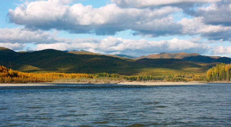
The natural conditions of the Baikal-Amur Railway are complex and varied. They are characterized by mountainous terrain in the western section and haze areas in the eastern.
Almost Arctic severity of the climate is characteristic of all areas of the passage of the highway, which determines the presence of permafrost, the widespread development of active physical and geological phenomena and processes, high seismicity, snow avalanches (especially on the western section of the highway), mudflows, etc., which are the reason for the large volume of work and the complexity of construction.
The route of the highway passes through a complexly dissected mountain-taiga region.
Over 3,500 watercourses are crossed by the route along its length. Among them are the largest rivers of Siberia and the Far East: Lena, Kirenga, Upper Angara, Vitim, Olekma, Nyukzha, Zeya, Selemdzha, Bureya, Amgun.
The rivers are mountainous and fast flowing.
Floods are characterized by a short duration with sharp 6-10-meter rises and drops in levels, high speeds currents.
The climate of the entire BAM zone is sharply continental with long cold winters (8 months) and short warm and rainy summers.
Average annual air temperatures throughout the BAM zone are negative and vary from minus 3.2 (Nizhniangarsk) to minus 7.8 °C (Chara). The absolute minimum temperatures reach minus 60 °C, the absolute maximum air temperature is plus 40 °C.
The route passes in the southern zone of the area of permafrost development. This determines the combination of permafrost and thawed rocks, high-temperature (0 - minus 1.5 °С) and low-temperature (minus 1.5–6.6 °С) permafrost soils in a number of sections of the route, large differences in the thickness of frozen strata (from 0.5 up to 100–200 m and more).
The annual amount of precipitation throughout the BAM zone ranges from 350 to 700 mm or more.
The estimated score during design was taken no higher than 9 points, with catastrophic earthquakes with a force of 10–12 points noted.
The route of the highway for 410 km passes in the zone of 8-magnitude and 740 km - in the zone of 9-magnitude earthquakes.
Slide 6. Brief information about natural conditions in the BAM zone
The main mineral deposits of the BAM gravity zone.
Deposits that are currently being developed on an industrial scale and play a cargo-generating role for loading the Baikal-Amur Mainline:
Neryungri and Urgal coal mines;
Korshunovskoye and Rudnogorskoye iron ore mines.
Apsatskoye, Ogodzhinsky and Elga coal mines;
Chineyskoe, Taiga and Garinskoe iron ore;
Udokan copper;
Kuranakhskoye and Katuginskoye polymetallic;
Evgenevskoe apatite;
Kovykta gas;
Talakanskoye, Verkhnechonskoye, Chayandinskoye, Srednebotuobinskoye, Yarakta, Dulisminskoye, Ayanskoye and Adnikanskoye oil and gas fields.
Promising fields that require additional exploration and evaluation of the economic efficiency of development:
Neryundinskoe, Kapaevskoe, Polivskoe iron ore;
Khlodnenskoye and Shamanskoye polymetallic;
Golevskoe synnyrites;
Ukdusk and Seligdar apatites;
Nepa potash basin.
Within this territory, geologists have explored many objects attractive to investors, including: the Udokan copper deposit, the Chiney complex deposit with iron ores and polymetals of unique composition, the Apsat coal deposit, the Elga coking coal deposit, and the Kuranakh gold deposit. The payback period for the development of these deposits does not exceed ten years.
With the beginning of the development of these pantries, the inhabitants of the BAM zone automatically receive a job, local budgets - taxes, regions - stability. It is known that the growth of the well-being of railways and railway workers is directly proportional to the volume of freight traffic.
Slide 7. Brief information about natural conditions in the BAM zone
On the site from p. Lena to the Baikal Ridge, permafrost has an island character of the valley type. The thickness of the permafrost is about 30 m, the temperature is mainly from minus 0.2 to minus 0.8 ° C
Along the route, within the Baikal and Trans-Baikal high-mountain regions, there is also insular permafrost with a thickness of 5–20 to 60 m. The temperature of frozen soils varies from minus 0.2 to minus 1.0 °С. There are ice lenses of various origins.
Here, in the low-mountain regions, numerous permafrost phenomena are traced: thermokarst funnels, mari, cracks and heaving mounds.
The thickness of permafrost soils at the site of st. Nizhneangarsk - st. Chara varies from 40–50 to 100 m or more. The temperature of permafrost soils ranges from minus 0.7 to minus 6.6 °C. Permafrost soils are characterized by subsidence III-IV (sandy loam, sands) and I-II categories (pebbles).
The strip of the route from Chara to Tynda is practically covered by continuous permafrost. The permafrost is confluent, mostly low-temperature.
The geocryological structure of the area of the Tynda-Urgal route is more complex. Here, zones of insular (more than 50% of taliks), massive-island (40–50% of taliks), discontinuous (10–25% of taliks) and continuous distribution of permafrost are distinguished. Average annual temperatures here vary from 0 to minus 5 °C, and the thickness of permafrost varies in this area of the route from 100–200 m in the village. Tynda up to 30-60 m in the area of the village. Urgal.
In the area of the Urgal-Komsomolsk-on-Amur highway, permafrost is developed, characterized by a continuous distribution of 32%, discontinuous - by 36% and insular - by 32% of the extent of frozen soils.
Slides 8 - 9. Brief information about natural conditions in the BAM zone
Ice phenomena are observed along the entire route of the highway. By type, they are river, ground and mixed.
The thickness of icing ice varies from 1–1.5 to 3–4 m, reaching 6 m in some watercourses in some winters.
Underground ice is observed mainly on the floodplain and above-floodplain terraces of almost all major rivers in the highway zone. The depth of the ice varies from 0.5 to 5 m, and the thickness of the ice varies from 2–3 to 10 m, and in some places reaches even greater values. Underground ice develops along river terraces.
Thermokarst lakes and heaving mounds have smaller distribution areas than ground ice. The areas of individual thermokarst lakes reach 2–5 ha, and the size of individual heaving mounds is up to 20–30 m in diameter and 4–6 m in height.
A characteristic feature of the landscape of permafrost regions is mari (bogs on permafrost), covering almost the entire area of floodplain terraces, low floodplain terraces and, in part, low areas of high terraces.
Large-block scree, rockfalls, kurums are widespread in the area from Kirenga to Tynda and cover almost all slopes of mountain river and stream valleys.
In the mountainous regions of the route, mainly from Kirenga to Tynda and from Urgal to Berezovka, mudflows are often formed, which, as a rule, belong to water-stone flows and act mainly along small watercourses with a length of 3 to 20 km.
Snow avalanches threaten the route to the greatest extent on the Baikal and Severo-Muisky ridges.
At the survey stage, 294 avalanche complexes were surveyed, crossed by the route or located near it. This made it possible to take into account the avalanche danger and lay the track almost along its entire length outside the avalanche zones.
Other engineering-geological processes, such as solifluction, landslides, bank erosion, and others, are also developed in the area of the route, but they did not have a significant impact on the laying of the route.
Slide 10. The history of the construction of BAM
The territories that today are included in the BAM zone began to be developed by the Russians after the campaigns of Yermak (1581-85) and the defeat of the Siberian Khanate. In an exceptionally short time - a little more than half a century - almost all of Siberia was annexed to the Russian state, the Russians reached the shores of the Sea of \u200b\u200bOkhotsk and the Pacific Ocean, and somewhat later reached North America.
The development of vast areas beyond the Urals, of course, cannot be explained only by an attempt by the most active part of the Russian peasantry and Cossacks to get away from serfdom and church-state control. Such a spontaneous, intuitive impulse to the East turned out to be not only the historical and religious response of the Russian Orthodox world to the colonial expansion of Catholic and Protestant Europe - it also created a global alternative to the "Eurocentric" policy of the Russian state.
This alternative began to be realized only in late XIX century, when the rapid development of Japan, and especially the United States, became a harbinger of the inevitable collapse of the old European metropolises. Entry of Russian goods to the markets of China and Central Asia, as well as ensuring the security of the eastern borders Russian Empire brought to life the grandiose project of the Trans-Siberian Railway, brilliantly implemented in an incredibly short time. And, if the loss of Alaska did not cause any political reaction, then the defeat in the war with Japan in 1904-1905, the loss of the Kuriles, South Sakhalin and influence in Manchuria - put on the agenda a more balanced policy, made it necessary to seriously develop the economic development of Siberian regions and the Far East. To solve these problems, there was a catastrophic lack of population and transport routes. It is no coincidence that the plans for railway construction along the “northern route” in the current BAM zone with access to the regions of Yakutsk and Magadan and further to the Bering Strait date back to this time.
In the first half of the 19th century the first proposals and projects for the transport development of Transbaikalia and the Amur region appear. The Decembrists exiled to Siberia were the first to talk about railway construction in this area - among them M. Bestuzhev, G. Batenkov, D. Zavalishin and others.
The first BAM projects arose in the 1880s, when the construction of the Trans-Siberian railway from Chelyabinsk to the Pacific Ocean began. The idea of building the BAM escalated when they began to discuss the possible directions of the eastern part of the Trans-Siberian Railway, as it was then called. According to one proposal, the railway should have been built in the direction of Irkutsk, the southern tip of Baikal and along the southern shore of the lake to the Selenga and Khilok (southern version), according to another, from Taishet to the north of Baikal, from there to the Muya, then to the tributary of the Shilka River and beyond on the Amur (northern version).
It was decided to carry out surveys of the route of the future road according to both options. In 1889, a group of surveyors led by Colonel Voloshnikov made a "railway reconnaissance" of the territory between the Angara and Muya rivers. Another group, led by engineer Prokhasko, in the same year, explored the area between the Muya and the Black Uryum (the left tributary of the Shilka).
The work carried out showed the great complexity of the relief and soils of the northern Baikal and Transbaikal regions. In addition, this area was almost completely deserted. Therefore, during the construction of the Trans-Siberian Railway, preference was given to the southern option. The question of building a railway between the northern tip of Lake Baikal and the Amur disappeared, but not for long.
Slide 11. The history of the construction of BAM
The possibility of laying a shorter railway line through the northern tip of Lake Baikal constantly attracted the attention of specialists in subsequent years. Instead of designing a large highway through the north of the Baikal region, projects began to be put forward to connect the Lena gold mines with the Trans-Siberian by a railway line. In order to solve this problem in the pre-war period, that is, before 1914, a number of reconnaissance (purely preliminary) surveys were carried out in the following directions: Irkutsk - Bodaibo, Irkutsk - Zhigalovo, Irkutsk - Verkholensk, Irkutsk - Kachug, Taishet - Bratsk - Ust- Kut and others.
However, there was still no systemic picture of the mineral resource base, which was still not in demand by the Russian economy. The process of development by railways of the Euro-Asian spaces at that time was just beginning. The need to ensure the security of the eastern borders of the Russian Empire brought to life a grandiose project for the construction of the Trans-Siberian Railway.
The railway to the Lena mines was not built, but the work on its exploration did not remain fruitless. As a result of the research, extensive material on the relief, soils, soils, etc. was collected and processed. And the direction Taishet - Bratsk - Ust-Kut was the western part of the BAM.
The first World War interrupted the search for a steel track from the central part of Eastern Siberia to the Amur through the north of Lake Baikal. Thus ended the first period of the "biography" of BAM. The second was destined to begin under Soviet rule.
Slide 12. The history of the construction of BAM
Russian defeat in Russo-Japanese War(1904-1905) showed the vulnerability of the Trans-Siberian. Since the 1880s The main motive for the construction of BAM was the military-strategic goal of the government. This motif retained its significance in Soviet times.
In 1924, the Council of Labor and Defense of the USSR approved a long-term plan for the construction of the country's railways. For the first time, the contours of the future "Second Trans-Siberian" were outlined in the papers.
In 1930, the Dalkraikom of the All-Union Communist Party of Bolsheviks sent a proposal to the Central Committee of the All-Union Communist Party of Bolsheviks and the Council of People's Commissars of the USSR on the design and construction of the second Trans-Siberian Railway with access to Pacific Ocean. In this document, the future railway was first called the "Baikal-Amur Mainline". In April 1932, the first government decree "On the construction of the Baikal-Amur Mainline" appeared. Design organizations have begun surveying the BAM route.
After the restoration of the economy, destroyed by the civil war and during the years of intervention, our country began the systematic involvement in the economic circulation of the natural resources of the eastern regions. unfolded big railway construction in the sparsely populated parts of the country. Research began on the railway track on the BAM route as well.
The first survey work on the eastern section of the BAM began in 1926–1928. They were led by a special corps of the Railway Troops of the Red Army (created on January 14, 1932). The beginning of mass survey work at BAM dates back to May 1931.
In 1931, Dalzheldorstroy NKPS conducted reconnaissance surveys at the Klyuchi - Kirensk section and surveys at the Bochkarevo - Nikolaevsk-on-Amur and Khabarovsk - Sovetskaya Gavan sections. Initially, BAM was considered within the eastern section - from the Urusha station of the Trans-Baikal Railway to the village of Permskoye on the Amur.
To conduct research, a special East Siberian expedition of technical surveys was created - in short, Vosttiszheldor.
The survey used aerial photography. For the first time, Art. Bam (Takhtamygda, at the junction of the Trans-Siberian Railway with BAM).
Slide 13. The history of the construction of BAM
In 1933, the very first government decree "On the construction of the Baikal-Amur Mainline" was issued. The general direction of the BAM route with strongholds Taishet - Severobaikalsk - Tyndinsky - Urgal - Komsomolsk-on-Amur - Sovetskaya Gavan was determined.
As planned, in 1933 the final surveys on the site Takhtamygda - Tynda were completed, and in the same year from the station. Bam Trans-Baikal Railway construction began.
In the next year, 1934, the BAM Construction Department carried out final surveys on the Tynda - Ust-Niman section and preliminary surveys on the Ust-Niman - Komsomolsk-on-Amur section.
For 1932–1934 surveys of the railway line Volochaevka - Komsomolsk-on-Amur were completed and its construction began. The railway was needed by a large Komsomol construction site, which was unfolding at that time on the Amur. At the same time, according to the plan, it was the approach line to the BAM, that is, it was supposed to serve as a kind of its rocade.
The search for another access railway line to BAM Urgal - Izvestkovaya began in 1934.
Since 1932, exploration work has also been carried out on the extreme eastern section of the BAM - from Komsomolsk-on-Amur to Sovetskaya Gavan.
In the central and western sections of the Baikal-Amur Mainline, surveys were carried out on a much smaller scale.
In 1932–1936 The NKPS also carried out a number of surveys at the Taishet-Ust-Kut section.
Soviet-Japanese conflict on the lake. Hasan and R. Khalkingol forced to speed up the process of increasing military traffic along the Trans-Siberian. Work at BAM was curtailed. In 1937, the second resolution on the construction of the BAM was issued. The current route from Taishet through Ust-Kut, Nizhneangarsk, Tynda, Urgal, Komsomolsk-on-Amur to Sovetskaya Gavan was approved. In 1937–1938 a significant part of the workforce was involved in the construction of the second tracks of the Trans-Siberian. For the development of survey and design work, Bamtransproekt was created (since 1939 - Bamproekt).
Slide 14-15. History of BAM construction
At the end of 1937, the Bamlag prisoners completed the construction of the 178-kilometer section Bamovskaya - Tynda, which was dismantled in 1942.
On the Izvestkovaya-Urgal section (339 km), work began in 1937. In 1942, the line was put into operation with large imperfections, and in 1943 it was dismantled.
By 1941, 123 km of track from Urgal to Komsomolsk had been built, and then mothballed.
On the Taishet-Padun section, construction began in 1938. By 1941, 68 km of track had been laid, which was mothballed at the end of 1941. At the same time, construction was suspended on the Komsomolsk-on-Amur-Sovgavan section.
During the years of the Great Patriotic War rails, metal spans and railway equipment of BAM were used for the construction of the "Zavolzhskaya rokada" Saratov - Stalingrad.
As a result, in 1942, the railway communication on the already built sections of the BAM was terminated.
Slide 16. The history of the construction of BAM
In 1943, the State Defense Committee of the USSR began the accelerated construction of the section Komsomolsk-on-Amur - Sovetskaya Gavan (468 km).
The tight deadlines for construction did not allow crossing the Sikhote-Alin ridge with a tunnel. The railway in this section was laid as an open track along the Kuznetsovsky Pass using curves with a radius of 200 m and triple traction slopes. Pass bypasses were operated during 1945–2012. Ferry (in summer) and ice (in winter) crossings at the crossing of the Amur near Komsomolsk functioned for more than 30 years (from July 19, 1945 to September 26, 1975).
In July 1945, the railway line to Sovetskaya Gavan went into operation. In 1945, the construction of the railway was resumed. line Taishet - Ust-Kut. In 1947, the Taishet-Bratsk line was opened. In July 1951, she was brought to st. Lena (Ust-Kut). This accelerated the construction of the Bratsk hydroelectric power station and large industrial facilities in Bratsk and Ust-Ilim.
In 1951, the Izvestkovaya-Urgal section (340 km) was put into operation. As a result, the connection between BAM and Sakhalin, Kamchatka, Kolyma and Chukotka has been strengthened.
In 1958, the Taishet-Lena section (692 km) was put into operation.
From the late 1950s to the late 1960s. minor work was carried out to fill the embankment, to develop the rock to the west of Komsomolsk-on-Amur. The constructed sections of the BAM and the connecting line Izvestkovaya - Urgal were used as logging roads.
In the 1930s–1950s at the expense of public funds, 2,075 km of railways were built (mainly according to lighter standards) on the approaches to the BAM and on the end sections.
In 1953, after the death of I.V. Stalin, until the mid-1970s. there was a break in construction. However, the military confrontation between the USSR and China on Domanskoye forced the government to resume large-scale work on the BAM.
Slide 17. The history of the construction of BAM
In 1967, the Central Committee of the CPSU and the Council of Ministers of the USSR issued a resolution on the resumption of design and survey work at the BAM. They were assigned to carry out by seven institutes of MTS Glavtransproekt, including Mosgiprotrans, Lengiprotrans, Sibgiprotrans.
Mosgiprotrans carried out the general management, the development of the main technical solutions for the projected highway, and the analysis of the general direction in the new design standards. The design of some of the most complex objects, the solution of scientific problems was carried out by specialized institutes of the MTS and the Ministry of Railways, as well as research and design organizations of other departments.
The All-Union Order of the October Revolution Research Institute of Transport Construction (TsNIIS) developed and implemented two all-Union scientific and technical programs on new progressive designs, technical solutions, and improvement technological processes and coordinated the activities of about 100 co-executing organizations.
In 1964–1974 design and survey work was carried out taking into account new technical conditions, seismic hazard, and the replacement of locomotive traction with diesel and electric ones.
The large BAM, the construction of which began in July 1974, was impossible without the preliminary implementation of approaches to it and connecting branches, invaluable experience in surveys, design and construction, accumulated since the beginning of the 30s. The main direction of the route Ust-Kut - Nizhneangarsk - Chara - Tynda - Urgal - Komsomolsk-on-Amur - Sovetskaya Gavan, finally chosen in 1942 as a result of many years of study, turned out to be optimal.
In 1974, construction work began on the BAM: a total of 4,200 km were to be built. During 1979 - 1989. the main line was gradually put into permanent operation at the start-up complex, and a number of lines - in full design. The construction of the western section of the BAM, the second track Taishet - Lena and the lines Bamovskaya - Tynda - Berkakit was carried out by organizations of the Ministry of Transport Construction (since 1992 - Corporation "Transstroy"), and the eastern one - by the railway troops. The Ministry of Railways of the Russian Federation acted as the customer of the entire BAM complex.
Since 1974, work on the construction of the BAM unfolded on a broad front.
On July 8, 1974, the Decree of the Central Committee of the CPSU and the Council of Ministers of the USSR "On the construction of the Baikal-Amur Railway" was issued. A commission of the Council of Ministers of the USSR for the construction and development of the BAM was established (July 1974). As well as the construction organization "Glavbamstroy" (head K.V. Mokhortov - Deputy Minister of Transport Construction, graduate of NIVIT). The necessary funds were allocated for the construction of the first category railway with a length of 3,100 km, the second line Taishet - Lena (721 km), the line Bamovskaya - Tynda - Berkakit (Small BAM).
On the Small BAM with a length of more than 399 km, 300 km of highway roads were laid, an earthen bed in the amount of 35 million m 3 was erected. Volunteer Komsomol members, military builders, student construction teams from the USSR, Bulgaria, Hungary, Mongolia and other countries became the main building forces.
A powerful flow of financial resources and equipment was sent to BAM.
Slide 18. The history of the construction of BAM
The construction of the BAM main route was carried out in eight directions: from the station. Lena to the east, from st. Tynda to the east and west, from st. Komsomolsk-on-Amur to the west, from the station. New Urgal to the west and east, from the station. Berezovka (Postyshevo) to the east and west. Along with the laying of the railway line, residential settlements, cultural centers, consumer service institutions were built, industrial and technical buildings, communications were built, and settlements were improved.
The importance of the construction of the BAM for the economic development of Siberia and the Far East was never denied, its economic feasibility was implied, and the military-strategic necessity was emphasized.
Slide 19. The history of the construction of BAM
At the XVII Congress of the Komsomol, the highway was declared an All-Union Komsomol construction site. 39 sponsored construction organizations from the republics, territories, regions and cities were sent to build settlements at the stations. Urgal was built by Ukraine, Uoyan - Lithuania, Kichera - Estonia, Tayura - Armenia, Ulkan - Azerbaijan, Soloni - Tajikistan, Alonka - Moldova, Zeysk - Bashkiria, Fevralsk - Krasnoyarsk, etc.
39 patronage organizations participated in the construction of 39 settlements and 2 cities at BAM stations, including: Leningrad (Severobaikalsk station), Latvian and Belorussian SSR (Taksimo station), Moscow (Tynda station), Moscow region ( st. Dipkun and st. Tutaul), Novosibirsk region (st. Tungala and st. Postyshevo), Ukrainian SSR (st. Urgal).
At the height of construction, the BAM team numbered approximately 130,000 people of more than 75 nationalities. In total, more than 50,000 students worked at BAM during the 15 years of construction.
For 15 years, 84,236 workers received vocational training at Glavbamstroy alone, and 338,883 builders completed off-the-job training. About 8,000 builders received secondary and higher education in absentia.
Slide 20. The history of the construction of BAM
The BAM used the latest designs, methods of construction and operation of facilities in the most difficult hydrological conditions, powerful equipment and rational labor methods. So, for example, track ballasting was carried out immediately after the laying of the rail-sleeper grid. This made it possible to preserve the subgrade, increase the speed of trains, and ensure the safe passage of heavy cranes and heavy rolling stock.
During the construction of artificial structures, progressive structures and technologies were used: corrugated metal culverts, columnar and gantry bridge supports, unified concrete blocks, suspended installation of superstructures. A way was found to preserve permafrost soils using liquid cooling systems. For the first time here, methods were developed and implemented to control the thermal regime of embankments on subsidence, during thawing, bases using structures made of sorted stone, foam plastic and geotextiles.
During the electrification of sections of the BAM, unconventional solutions were found for the construction of longitudinal power lines. The operation of the constructed sections of the railway was carried out in the conditions of the ongoing construction of the railway track. New methods of organizing the transportation process in difficult technological and climatic conditions were introduced.
Slide 21. The history of the construction of BAM
17 (28) April 1984 at times. Miroshnichenko (491 km east of Tynda, 2,835 km from Taishet), the eastern section of the BAM was docked.
On September 20 (29), 1984, the path of the western section of the BAM was docked at times. Balbukhta (1,608 km from Taishet, 876 km east of Lena station).
October 1, 1984 at st. Kuanda was laid the "golden link" of BAM. The 10-year stage of construction of the highway was completed. On October 27, 1984, the first two passenger trains with honorary passengers from Ust-Kut and Komsomolsk arrived in Tynda. Through traffic of trains along the BAM has opened!
During 1980–1989 sections of the highway were gradually put into permanent operation at start-up complexes. At the end of 1989, an act was signed State Commission on the acceptance into permanent operation of the last hauls of the BAM:
- in September 1989, the section Verkhnezeysk (Zeysk) - Tungala (156 km) was put into permanent operation;
- in October 1989 - Taksimo - Chara (250 km);
- at the end of 1989 - Angarakan - Taksimo (101.5 km) bypassing the Severo-Muisky tunnel with a slope of 18 ‰.
However, the longest 15-kilometer tunnel in Russia under the Severo-Muisky ridge remained unfinished.
Slide 22. The history of the construction of BAM
The tunnel route crosses four fault zones filled with water. Tunneling was associated with chemical fixation and freezing of soils. The constant movement of trains through it began on December 5, 2003. The reasons for the long construction were the erroneous assessment of all the difficulties of the future construction of the tunnel and delays in financing (especially in the last years of construction).
Before the tunnel was put into operation, the movement of trains was carried out from March 8, 1983 to November 1989 along a bypass 26.4 km long with a longitudinal guiding slope of 40 ‰, and from November 1989 to December 2003 - along a bypass with a length of 54, 3 km (open track of the second track) with a slope of 18 ‰.
The length of the tunnel is 15,343 m in a single-track double-slope design at a depth of up to 1,000 m. The length of all passed workings of various sections during the construction period was 43.1 km. The volume of rock, issued from the faces during the construction of the tunnel, is 2.9 million m 3. At the peak of the construction work of the almost 30-year period of construction of the BAM (1974–2003), up to 6 thousand people were simultaneously involved. The builders did a colossal job: they removed more than 2 million m 3 of soil, laid 700 thousand m 3 of monolithic reinforced concrete, and assembled 70 thousand tons of metal structures. The mileage of double-traction trains along the detour was 39 km, the costs were 15 million rubles. per year, the travel time is 2.5 hours, and the mileage through the tunnel was 15 minutes with a single traction. As a result, the level of train traffic safety has increased.
Slide 23. The history of the construction of BAM
In 1996, the BAMZhD was disbanded: its western section was taken over by the East Siberian Railway, and the eastern section - by the Far Eastern Railway. BAM made it possible to solve complex issues of economic development of the region rich in raw materials, a new outlet to the Pacific Ocean, connected our state with the countries of the Asia-Pacific region. BAM reduces the range of cargo transportation compared to the Trans-Siberian to Tynda by 590 km, to Komsomolsk - by 488 km, to Khabarovsk - by 230 km.
So, the final point in the construction of the BAM can be considered December 5, 2003 - the date of putting the Severo-Muisky tunnel into permanent operation.
Slide 24. BAM today
The Baikal-Amur Mainline (BAM) runs through the territory of the Irkutsk Region, the Trans-Baikal Territory, the Amur Region, the Republics of Buryatia and Sakha (Yakutia), and the Khabarovsk Territory.
Key stations of BAM:
Taishet;
Lena;
Taximo;
Tynda.
Slide 25. BAM today
Neryungi;
New Urgal;
Komsomolsk-on-Amur;
Soviet harbor.
The total length of the BAM from Taishet to Sovetskaya Gavan is 4,300 km.
BAM is connected to the Trans-Siberian Railway by three connecting lines: Bamovskaya - Tynda, Izvestkovaya - Novy Urgal and Volochaevka - Komsomolsk-on-Amur.
At present, a double-track railway has been built from Taishet to Lena (704 km) and a single-track railway from Lena to Taksimo (725 km). On the rest of the BAM section, a single-track railway with diesel traction was built.
BAM passes through the territory with severe natural and climatic conditions - through areas of permafrost (the depth of which is from 1-3 to hundreds of meters) and high seismicity (up to 9 points). The highway crosses 11 full-flowing rivers (among them Lena, Amur, Zeya, Vitim, Olekma, Selemdzha, Bureya) and 7 mountain ranges (Baikal, Severo-Muisky, Udokansky, Kodarsky, Olekminsky Stanovik, Turansky and Dusse-Alinsky). Due to the difficult terrain, more than 30 km of the railway passes in tunnels (among them are Baikal (6.7 km) and Severo-Muisky (15.3 km)).
During the construction of BAM, the latest designs were applied, new methods of construction and operation of facilities in difficult hydrogeological conditions were developed and patented.
Slide 26-27. bam today
The construction of BAM solved the tasks of the national level:
open access to the natural resources of a vast region;
transit traffic is provided;
the shortest East-West intercontinental railway route was created, running for 10,000 km along Russian railways;
in the military-strategic sense, the highway fends off possible failures and interruptions in the movement of trains on the Trans-Siberian.
Currently, the socio-economic potential of the BAM is not fully disclosed. The operation of this highway does not bring profit to Russian Railways. main reason current situation - the slow development of adjacent territories. Of the planned nine territorial production complexes, which were supposed to ensure the loading of the BAM, only one has been implemented - in the Neryungri coal basin.
In the direction of Taishet - Tynda - Komsomolsk-on-Amur, the volume of transportation in the cargo direction is about 12 million tons per year. The limitation of the throughput capacity of BAM sections was caused by the closure of separate points during the period of a decline in traffic in the 90s, the presence of sections where the turnaround time was violated, there were defects in the subgrade, the superstructure of the track and artificial structures.
BAM carries about 12 million passengers a year. The intensity of passenger train traffic along the highway is insignificant - 1-2 pairs of trains per day on the Komsomolsk-Severobaikalsk section and 9-16 pairs on the western section.
Slide 28
Investments in the amount of 2.6 billion rubles will be spent on the laying of second tracks and the start of construction of tunnels on the Baikal-Amur Mainline in 2013.
The strategic position of the BAM, the technical and economic potential of the area of its passage is so huge that, of course, it will be in demand by Russia in the foreseeable future.
JSC "Russian Railways" has developed a "Strategic Program for the Development of the Baikal-Amur Mainline until 2020". It is planned to spend 317.2 billion rubles on the development of the highway until 2020. in 2006 prices. (70% of investments will be provided by Russian Railways, 30% - by the investment fund). Due to these investments, a significant amount of work is envisaged:
construction and restoration of 91 sidings;
construction of 800 km of the second main tracks;
equipment of about 700 km of railway lines with automatic blocking;
extension and construction of 171 receiving and departure tracks;
acquisition of about 750 freight locomotives and about 11,000 freight wagons;
reconstruction of 85 bridges, 3 tunnels, 650 km of subgrade, etc.
The program "Railway transport" of the federal target program "Development of the transport system of Russia (2010-2015)" provides for:
construction of a new railway line Tommot - Kerdem - Yakutsk (Nizhny Bestyakh) with a total length of 450 km;
designing a new railway line Selekhin - Nysh with a total length of 582 km.
Tourism can become one of the most important areas for boosting the economy of the BAM zone. Of great interest for international and Russian tourism are the Baikal Ring, which includes the Angara hydroelectric power stations, the Upper Lena, the Tsarskaya Hollow, Sikhote-Alin and other places with excellent recreational conditions.
Transport development of the BAM zone should not be limited only by the railway. BAM will work efficiently and fully only when it is helped by sea and river ports (Vanino, Osetrovo, Komsomolsk-on-Amur), when a highway runs parallel to the route and access roads to Udokan and other mineral deposits, forests are built, when Dozens of airports of local airlines and large international airports will start operating. We should talk about the development of the entire transport complex, including all types of modern transport.
The integrated development of the BAM zone also implies a second exit of the railway route to the Pacific Ocean, since the growing trade of the APEC countries with Europe opens up serious opportunities for using the BAM as the shortest and most reliable transport route between these world centers. It is also important to expand our own trade with APEC.
Slide 29
What is the future fate of BAM? Today it can be unequivocally stated that BAM is waiting for grandiose development. What will happen is what was said at the time of its construction, "BAM-the future of the country." Today, life itself will push both the Government of the Russian Federation and the Russian Railways company and other interested departments to complete the reconstruction of BAM. The implementation of the largest projects in the Far East and the north of the country will depend on the increase in the capacity of the BAM.
The start of the project for the modernization of the Baikal-Amur Mainline (BAM) has been laid. This was told by the President of JSC "Russian Railways" Vladimir Yakunin at a press conference on the results of the board of the company. He stressed that the company has begun to implement the decisions of the President of Russia Vladimir Putin . According to him, work has already begun on the expansion of a number of bottlenecks. “In fact, the project as a whole is still under development, but there are also projects in specific areas. Taking into account the work on their development, we can consider that we are at the initial stage of implementation”- said Yakunin. " With the participation of federal budget funds, the implementation of such projects asreconstruction and modernization of the Baikal-Amur and the Trans-Siberian Railway…”- supported the President of JSC " Russian Railways» Minister of Transport of Russia Maxim Sokolov.
In July 2013, at a meeting with members of the government in Novo-Ogaryovo, Russian President Vladimir Putin proposed updating the scheme for the development of the Trans-Siberian Railway and BAM. Both lines must be expanded, modernized, extended. " Over the past five years, only in the direction of the Far Eastern ports of Russia, the volume of freight rail trafficgrew by 55%, amounting to about 110 million tons per year - these are record figures for this area", Putin stressed.
It is planned to finance this project at the expense of Russian Railways, the National Wealth Fund of Russia (NWF) and the budget.
Prepared materials: FEDERAL STATE BUDGETARY EDUCATIONAL INSTITUTION OF HIGHER PROFESSIONAL EDUCATION "SIBERIAN STATE UNIVERSITY OF COMMUNICATIONS", FEDERAL STATE BUDGETARY EDUCATIONAL INSTITUTION OF HIGHER PROFESSIONAL EDUCATION "MOSCOW STATE UNIVERSITY".
The Baikal-Amur Mainline Expansion Project is one of the latest infrastructure initiatives of the Russian government and Russian Railways aimed at increasing Russia's transport connectivity with the countries of the Asia-Pacific region and improving conditions for industrial development in the Russian Far East.
40 years
July 8, 2014 marked forty years since the adoption of the resolution "On the construction of the Baikal-Amur Railway". During the celebration of the fortieth anniversary of BAM, during a teleconference with the President of Russia, a “silver link” was laid, which marked the beginning of the BAM-2 project.
The legendary construction of communism over these forty years has passed both the stage of Komsomol enthusiasm and constant attention of the press, and the decline of the 1990s. In the post-Soviet period, the construction of the BAM was often mentioned as a sign of the inferiority of the Soviet economy and an example of the inefficiency of large infrastructure projects in general.
According to the original project, the BAM was supposed to carry up to 35 million tons of cargo per year, but by the time of the collapse of the USSR, the throughput of the road was only 10 million tons. actively used, but moreover - extremely overloaded.
The Baikal-Amur Mainline passes through the territory of the Irkutsk Region, the Trans-Baikal Territory, the Amur Region, Buryatia and Yakutia, and the Khabarovsk Territory.
Key stations of BAM:
- Taishet
- Taksimo
- Tynda
- Neryungi
- New Urgal
- Komsomolsk-on-Amur
- Vanino
- Sovetskaya Gavan
The total length of the BAM from the city of Taishet to the port of Sovetskaya Gavan is 4300 km.
BAM is connected to the Trans-Siberian Railway by three lines: Bamovskaya–Tynda, Izvestkovaya– Novy Urgal, and Volochaevka–Komsomolsk-on-Amur.
At present, an electrified double-track railway has been built from Taishet to Lena station (704 km). Single-track electrified road - from Lena station to Taksimo station (725 km). The remaining eastern section of the BAM is a single-track railway with diesel traction.
In 2013, 33% more cargo was transported along the BAM than in the best Soviet year of the highway - 1988. According to the management of the Russian Railways, if the company had not worked to gradually expand the “bottlenecks” and had not opened the Kuznetsovsky Tunnel in 2012, the line would have long faced large-scale congestion. According to expert estimates, by 2015 the length of sections of the Baikal-Amur Mainline with a capacity deficit will increase by more than 3,000 kilometers. The busiest areas will be the Novaya Chara-Taksimo and Kirenga-Lena Vostochnaya sections.
A separate incentive for the development of the Siberian railways is the “Asian turn” in Russian policy that emerged in 2014, increasing the importance of trade relations with the countries of the Asia-Pacific region, and especially with China.
The main mineral deposits located near the BAM
Industrially developed deposits:
- Neryungri and Urgal coal fields
- Korshunovskoye and Rudnogorskoye iron ore<
Well-studied fields where an economic evaluation of the development efficiency was carried out:
- Apsatskoye, Ogodzhinsky and Elga coal mines
- Chineyskoe, Taiga and Garinskoe iron ore
- Udokan copper
- Kuranakhskoye and Katuginskoye polymetallic
- Evgenevskoe apatite
- Kovykta gas
- Talakanskoye, Verkhnechonskoye, Chayandinskoye, Srednebotuobinskoye
Deposits requiring the development of transport infrastructure:
- Yarakta, Dulisminskoe, Ayanskoe and Adnikanskoe oil and gas
Promising deposits:
- Neryundinskoe, Kapaevskoe, Polivskoe iron ore
- Khlodnenskoye and Shamanskoye polymetallic
- Golevskoe-synnyrites
- Ukdusk and Seligdar apatites
- Nepa potash basin
natural conditions
The Baikal-Amur Mainline runs through territories whose natural conditions are extremely diverse and complex. The western section of the BAM route is characterized by mountainous terrain. The eastern section of the route is characterized by the presence of mares - swamps on permafrost.
Almost all areas of the passage of the Baikal-Amur Mainline are characterized by the extreme severity of the climate, which determines the presence of permafrost, the depth of which reaches from one to hundreds of meters.
Average annual air temperatures along the entire route of the BAM are negative and vary from minus 3.2 °С (indicator of Nizhneangarsk) to minus 7.8 °С (indicator of Chara). The absolute minimum air temperature on the track was minus 60 °C, the absolute maximum was plus 40 °C.
The route of the highway runs through zones of high seismicity (up to 9 points on the Richter scale).
BAM crosses eleven full-flowing rivers, including Lena, Amur, Zeya, Vitim, Olekma, Selemdzha and Bureya. In total, the BAM crosses more than 3,500 watercourses. The highway passes through 7 large mountain ranges, including Baikal, Severo-Muysky, Udokansky, Kodarsky, Olekminsky Stanovik, Turansky and Dusse-Alinsky.
Numerous active physical and geological processes are noted along the entire length of the highway. In the mountainous regions of the passage of the highway, mainly from Kirenga to Tynda and from Urgal to Berezovka, mudflows are a frequent natural disaster. The sections of the highway passing through the Baikalsky and Severo-Muysky ridges are most exposed to the risk of snow avalanches. In total, 294 avalanche complexes were identified in the BAM area.
Despite taking into account the avalanche risk when laying the BAM route, avalanches periodically converge on the way
So, in 2011, an avalanche derailed a train en route from Severobaikalsk to Kirenga. To protect against the risks of landslides and rockfalls, which are quite high on all mountainous sections of the route, the construction of galleries was often used during the construction of the BAM. The geological risks of the highway significantly complicate both new construction and current operation.
BAM-2 project
According to expert estimates, the volume of export of minerals from the deposits of the east of Russia will double by 2020 and reach 113.2 million tons per year.
Increasing the production of raw materials, building new industrial enterprises along the BAM route, as well as increasing the capacity of the ports of Vanino and Sovetskaya Gavan Gavan - the main gateway for Russian exports to the Asia-Pacific countries - will lead to the emergence of "bottlenecks" almost along the entire length of the BAM. The largest capacity deficit is expected in the Vysokogornaya–Vanino section.
The project for the expansion of the Baikal-Amur Mainline provides for the construction of a second branch of the main line along most of the route, the electrification of individual sections and the replacement of rolling stock. The need for transportation along the BAM by 2025 will be about 100 million tons of cargo.
According to Evgeny Solntsev, head of the Irkutsk group of the directorate for the reconstruction and construction of railway transport facilities of JSC Russian Railways: “... the volume of upcoming design and construction work is huge and comparable to the volume of construction of the BAM in Soviet times, and the construction time is much shorter. Already by 2017, it is necessary to double the capacity of BAM - from 16 to 32 pairs of trains per day, for which it is necessary to reconstruct more than 500 kilometers of second tracks, 90 stations, 85 bridges and build a new Baikal tunnel.
According to the statement made by the head of Russian Railways Vladimir Yakunin in his blog, after the reconstruction of the BAM is completed, most of the cargo will be redirected to the highway - the transit of coal and minerals will increase at least twice, which will allow Russia to further increase international trade, in particular with China.
Project financing
Expert estimates of the total amount of funding required vary, but the approximate amount of investment required for the development of the BAM along its entire length for the period up to 2020 is about 400 billion rubles.
According to the passport of the investment project "Modernization of the railway infrastructure of the Baikal-Amur and Trans-Siberian Railways with the development of throughput and carrying capacity", which is currently awaiting approval by the Government of the Russian Federation, the total investment in the project is envisaged in the amount of 562.4 billion rubles, of which 300 billion rubles it will be necessary to provide Russian Railways, 150 billion rubles. - funds from the National Wealth Fund (NWF), 110 billion rubles - subsidies from the budget. In 2014, it is planned to perform work for 61.4 billion rubles, the total volume of contracts concluded in 2014 is estimated by Russian Railways at 90 billion rubles. 50 billion rubles will be attracted from the National Welfare Fund, the rest will be the money of the monopoly.
Mining of the second Baikal tunnel is expected to start this year.
Currently, near the western portal of the operating tunnel, located on the border of the Irkutsk region and the Republic of Buryatia, a shift camp for 300 workers is being built from scratch.
“The new tunnel, which is planned to be commissioned in 2017, will significantly increase the capacity of this bottleneck of the Baikal-Amur Mainline, and the speed will also increase,” said Viktor Khlyupin, head of the North Baikal Tunnel Distance of the East Siberian Infrastructure Directorate, in an interview with the Gudok newspaper. .
Now preparations are underway to start construction of the second corridor inside the Baikal Range. The new corridor of the Baikal tunnel will be laid parallel to the existing one. In 2014, more than 2.1 billion rubles will be allocated for the construction of the tunnel.
Perspectives and engineering protection
The scale of the Baikal-Amur Mainline expansion project is comparable to the volume of construction of the mainline during the Soviet era. At the same time, builders will be forced to work under much tighter deadlines. To ensure the growth of exports from new fields and industrial enterprises, by 2017 it is necessary to double the throughput capacity of the highway.
The complexity of the terrain on the BAM route, high seismicity and avalanche risks make it necessary to introduce new and unique solutions in the field of engineering protection of transport routes
In this direction, as well as in general issues of the development of the project, the builders will be greatly assisted by the experience gained during the implementation of the Sochi project. Russian construction organizations have gained experience in construction in a short time, in difficult mountainous conditions and with high landslide, mudflow and avalanche risks. At one time, the Sochi Olympiad for the red word was called the "Second BAM". Now Russia has the opportunity to implement a real BAM-2 and balance its transport structures between West and East.

Baikal-Amur Mainline (BAM)
The Baikal-Amur Mainline (BAM) runs through the territory of the Irkutsk Region, the Trans-Baikal Territory, the Amur Region, the Republics of Buryatia and Sakha (Yakutia), and the Khabarovsk Territory.
Key stations of BAM: Taishet; Lena; Taximo; Tynda; Neryungi; New Urgal; Komsomolsk-on-Amur; Vanino; Soviet harbor.
The total length of the BAM from Taishet to Sovetskaya Gavan is 4,300 km. BAM is connected to the Trans-Siberian Railway by three connecting lines: Bamovskaya - Tynda, Izvestkovaya - Novy Urgal and Volochaevka - Komsomolsk-on-Amur.
At present, a double-track railway has been built from Taishet to Lena (704 km) and a single-track railway from Lena to Taksimo (725 km). On the rest of the BAM section, a single-track railway with diesel traction was built.
BAM passes through the territory with severe natural and climatic conditions - through areas of permafrost (the depth of which is from 1-3 to hundreds of meters) and high seismicity (up to 9 points). The highway crosses 11 full-flowing rivers (among them Lena, Amur, Zeya, Vitim, Olekma, Selemdzha, Bureya) and 7 mountain ranges (Baikal, Severo-Muysky, Udokan, Kodarsky, Olekminsky Stanovik, Turan and Dusse-Alinsky). Due to the difficult terrain, more than 30 km of the railway passes in tunnels (among them are Baikal (6.7 km) and Severo-Muisky (15.3 km)).
During the construction of BAM, the latest designs were applied, new methods of construction and operation of facilities in difficult hydrogeological conditions were developed and patented.
"History of construction of BAM"
The prerequisites for the start of the construction of the Baikal-Amur Mainline were the disappointing results of the Russo-Japanese War of 1904-1905, which showed the urgent need to build a second rokadnaya railway in the east of the country, duplicating the Trans-Siberian Railway.
According to the original plan, the highway was supposed to run from Ufa along the shortest distance to the eastern sea coast through the northern tip of Lake Baikal.
In Soviet times, research on the development of the railway network in the east of the country resumed in the late 1920s. - early 30s. It was then that the road from Taishet to the east first received its modern name - the Baikal-Amur Mainline. It was proposed to start the road from the Urusha station (approximately the middle of the current BAM near Skovorodina), and the final point was planned to be Komsomolsk-on-Amur, which was then the village of Perm.
In 1932, the Council of People's Commissars adopted a resolution "On the construction of the Baikal-Amur Mainline", which approved the plan for the construction of the BAM. The construction was planned to be completed in 3 years: through traffic along the entire highway in the operating mode was to be opened by the end of 1935.
However, the construction of the highway was repeatedly stopped for various reasons (lack of labor, the Great Patriotic War, earthquakes in the construction area in the late 1950s).
The active construction of the BAM was resumed in 1974. Komsomol volunteers and military builders became the main engines of construction. Republican Komsomol detachments competed with each other and had "their own" facilities: the largest station Urgal was built by the Ukrainian SSR, Muyakan station - Belarus, Uoyan - Lithuania, Kicheru - Estonia, Tayuru - Armenia, Ulkan - Azerbaijan, Soloni - Tajikistan, Alonka - Moldavia. Tynda, the capital of BAM, was built by Muscovites.
By 1980, the Baikal-Amur Railway was organized with the location of the railway administration in the city of Tynda.
On September 29, 1984, a "golden" docking took place at the Balbukhta junction (Kalarsky district of the Chita region). The eastern and western directions of the BAM builders met, advancing towards each other for 10 years. On October 1, the laying of the "golden" links of the BAM took place at the Kuanda station (Kalarsky district of the Chita region).
The final completion of the construction of the Baikal-Amur Mainline can be considered December 5, 2003, when traffic was opened through the Severo-Muisky tunnel. In terms of its length (15,343 m), it is the longest tunnel in Russia and the fifth in the world. According to the construction conditions, the tunnel has no analogues: permafrost, an abundance of groundwater, scree, landslides, tectonic faults.
BAM currently. The construction of the BAM solved the tasks of the national level: access to the natural resources of the vast region was opened; transit traffic is provided; the shortest East-West intercontinental railway route was created, running for 10,000 km along Russian railways; in the military-strategic sense, the highway fends off possible failures and interruptions in the movement of trains on the Trans-Siberian. Currently, the socio-economic potential of the BAM is not fully disclosed. The operation of this highway does not bring profit to Russian Railways. The main reason for this situation is the slow development of adjacent territories. Of the planned nine territorial production complexes, which were supposed to ensure the loading of the BAM, only one has been implemented - in the Neryungri coal basin.
In the direction of Taishet - Tynda - Komsomolsk-on-Amur, the volume of transportation in the cargo direction is about 12 million tons per year. The limitation of the throughput capacity of BAM sections was caused by the closure of separate points during the period of a decline in traffic in the 90s, the presence of sections where the turnaround time was violated, there were defects in the subgrade, the superstructure of the track and artificial structures.
BAM carries about 12 million passengers a year. The intensity of passenger train traffic along the highway is insignificant - 1-2 pairs of trains per day on the Komsomolsk-Severobaikalsk section and 9-16 pairs on the western section.
Answer left the guest
1) 9298.2 km - this is the longest railway in the world
2) Northern - Moscow - Yaroslavl - Kirov - Perm - Yekaterinburg - Tyumen - Omsk - Novosibirsk - Krasnoyarsk - Vladivostok.
New - Moscow - Nizhny Novgorod - Kirov - Perm - Yekaterinburg - Tyumen - Omsk - Novosibirsk - Krasnoyarsk - Vladivostok.
Southern - Moscow - Murom - Arzamas - Kanash - Kazan - Yekaterinburg - Tyumen (or Petropavlovsk) - Omsk - Barnaul - Novokuznetsk - Abakan - Taishet - Irkutsk - Ulan-Ude - Chita - Khabarovsk - Vladivostok.
Historical - Moscow - Ryazan - Ruzaevka - Samara - Ufa - Miass - Chelyabinsk - Kurgan - Petropavlovsk - Omsk - Novosibirsk - Krasnoyarsk - Vladivostok.
4) Moscow, Nizhny Novgorod, Kazan, Samara, Ekaterinburg, Novosibirsk, St. Petersburg, Ufa, Tyumen, Perm, Omsk, Bratsk, Ust-Kut, Kirov, Lipetsk, etc.
5) The composition and direction of cargo flows along any line, and not just along the Trans-Siberian Railway, is determined by what and where is mined, produced and consumed in the gravity zone of the main line, and where this mined is sent, and from where the consumed is imported.
Here pollock, for example, is always transported along the Trans-Siberian Railway in a western direction, and the forest is from Siberia in the direction where it is scarce.
6) The Government of the Russian Federation and Russian Railways have developed and are implementing a set of measures to further increase the transit potential of the entire transport corridor between Europe and the countries of the Asia-Pacific region, formed on the basis of the Trans-Siberian Railway, namely:
large-scale investment projects are being implemented in the eastern part of the Trans-Siberian to ensure the growth of rail traffic and transit between Russia and China;
the necessary development of railway stations on the border with Mongolia, China and the DPRK is being carried out;
approaches to seaports are being strengthened;
container terminals are being modernized in accordance with international standards.
a comprehensive reconstruction of the Karymskaya-Zabaikalsk section is underway to ensure the growing volumes of cargo transportation to China (primarily oil).
Until 2015, Russian Railways plans to allocate about 50 billion rubles for the reconstruction of the Trans-Siberian Railway.
In accordance with the "Strategy for the development of railway transport in the Russian Federation until 2030", it is planned to specialize the Trans-Siberian Railway for the passage of specialized container trains and for passenger traffic.
Natural conditions for the functioning of the Trans-Siberian Railway, the impact of these conditions on the functioning of transport
Natural conditions for the functioning of the Trans-Siberian Railway, the impact of these conditions on the functioning of transport
- The Trans-Siberian Railway is a powerful double-track electrified railway line with a length of about 10,000 km.
km, equipped with modern means of informatization and communication. It is the longest railway in the world, a natural continuation of the pan-European transport corridor No. 2. The technical capabilities of the Trans-Siberian Railway now allow transporting up to 100 million passengers.
tons of cargo per year, including 200,000 twenty-foot equivalent containers (TEU) from the countries of the Asia-Pacific region to Europe and Central Asia. In the future (with the use of BAM capacities), the volume of these transportations can be up to 1 million units per year.
The highway passes through the territory of 20 constituent entities of the Russian Federation and 5 federal districts. There are 87 cities on the Trans-Siberian with a population of 300,000 to 15 million people. 14 cities through which the Trans-Siberian Railway passes are the centers of the constituent entities of the Russian Federation. These resource-rich regions have significant export and import potential.
In the regions served by the highway, more than 65% of the coal produced in Russia is mined, almost 20% of oil refining and 25% of commercial timber production is carried out. More than 80% of the country's industrial potential and main natural resources are concentrated here, including oil, gas, coal, timber, ferrous and non-ferrous metal ores, etc.
In the east, through the border stations of Khasan, Grodekovo, Zabaikalsk, Naushki, the Trans-Siberian Railway provides access to the railway network of North Korea, China and Mongolia, and in the west, through Russian ports and border crossings with the former republics of the Soviet Union - to European countries.At present, Russian Railways is ready to increase the volume of container traffic along the Trans-Siberian Railway by 2-2.5 times, and, subject to an increase in the fleet of specialized cars and the capacity of port terminals, by 3-4 times.
Since 1999, the volume of container traffic on the Trans-Siberian Railway has been constantly increasing by an average of 30-35% per year. In 2004, the total volume of container traffic along the Trans-Siberian Railway amounted to 386.95 thousand in twenty-foot equivalent (TEU), incl.including transit 155.4 thousand TEU, export - 118.6 thousand TEU, import - 113 thousand TEU. In the international communication for 2004.
3247 container trains followed. The total volume of cargo transportation in containers along the Trans-Siberian Railway from the Asia-Pacific countries to Western Europe amounted to 155.7 thousand containers in TEU against 117.2 thousand in 2003 and 70.6 thousand in 2002.
In 2005, the total volume of traffic amounted to 388.3 thousand TEU containers (including 139.2 thousand - import, 124.8 thousand - transit and 124.3 thousandexport). In the communication between Russia and China, 134.9 thousand containers were transported (2004
Characteristics of the Trans-Siberian Railway according to the plan:
- 121.1 thousand containers). More than 65% of them were transported through the port of Vostochny, 25% - through the border crossing Zabaikalsk
Attention, only TODAY!
One of the biggest achievements of the 19th and early 20th century was the construction of the Trans-Siberian Railway
Learn the history of the Trans-Siberian Railway
History of the Trans-Siberian Railway
INTRODUCTION
The main route of the Trans-Siberian Railway starts from Moscow and goes to Vladivostok, however, the Trans-Siberian Railway has several branches:
Trans-Mongolian Highway was built in 1940-1956. between the city of Ulan-Ude, located just to the east of Lake Baikal, and the capital of China.
From Ulan-Ude the road goes south through the whole of Mongolia, crossing the Gobi Desert, and ends in Beijing. The length of the route from Moscow to Beijing is 7867 kilometers.
Transmanchurian Highway branches off from the main route of the Trans-Siberian at the Karymskaya station, located east of Lake Baikal. After Karymskaya, the railway line turns to the southeast and goes through Zabaikalsk and Manchuria through Chinese territory to Beijing. The length of the route from Moscow to Beijing is 9001 kilometers.
3. Baikal-Amur Mainline (BAM) was officially opened in 1984. This road starts in Taishet and stretches to Sovetskaya Gavan, a city on the Pacific coast.
BAM is located several hundred kilometers north of the Trans-Siberian Railway and runs parallel to it. For tourist trips, this section is practically not used, because.
there are no trains that would run along the entire highway from beginning to end. If you decide to take this railroad, you will have to make several transfers and possibly take a bus to get to your destination.
HISTORY
The impetus for the creation of the Trans-Siberian Railway was mainly economic considerations related to the size of our country. But in the end, the developed project became a matter of national pride.
Despite these worthy motivations, the railway project was in development for a long time, and the road construction progressed even more slowly.
The idea of creating a railway to the outskirts of Siberia arose in the middle of the nineteenth century. But that was only the beginning of the story. Among those who proposed various projects for the creation of the road, there were also foreign companies. But the Russian leadership did not want to increase foreign influence in Siberia and the Far East. Thus, it was decided to build the road using funds from the Russian treasury.
In 1886, 25 years after the idea of creating the Trans-Siberian Railway was first voiced, Emperor Alexander III finally decided that he had already heard enough considerations on this project.
It's time to act. Thus, in 1887, three research expeditions were formed and sent to study the lands through which the road was to pass. Continuing the policy of refusing foreign participation in the creation of the road, the authorities announced that "The Siberian railway, this great people's work, must be carried out by Russian people and from Russian materials." Construction began in February 1891 simultaneously from Chelyabinsk and Vladivostok.
![]() Starting point - Vladivostok
Starting point - Vladivostok
Alexander III, inspired by the idea of the Trans-Siberian Railway, instructed his son to start building a large railway through Siberia in order to "connect the abundant natural gifts of the Siberian regions with the network of internal rail communications."
Young Nikolai Alexandrovich, following the order of his father, on May 31, 1891, took part in a solemn prayer service on the occasion of the start of the construction of the road, as well as in the ceremony of laying the first stone of the railway station and a silver plate in honor of the start of construction. Construction has begun.
Difficult task
The implementation of the project was hampered by severe climatic conditions.
The railway ran through sparsely populated areas through the impenetrable taiga. Additional problems were created by large rivers that crossed the route of the new road, wetlands and permafrost areas that lay in the way of the builders. The most difficult was the construction near Lake Baikal, because. here the builders had to blow up the rocks to build tunnels and build railway bridges across the canyons washed by many mountain rivers flowing into Lake Baikal.
![]() But the difficulties in laying the road were connected not only with nature.
But the difficulties in laying the road were connected not only with nature.
In addition to the huge cost of construction, there was a big problem with personnel and labor. Specialists necessary for the project implementation were recruited in all major cities. Prisoners and soldiers, Siberian peasants and townspeople worked as ordinary workers at the construction site.
Despite these problems, up to 600 km of the railway were commissioned annually. The incredibly fast pace of construction of such a complex road - it was completed in just 12 years - amazed the world. The Trans-Siberian finally connected Europe with the Pacific coast.
Incentive to improve
Immediately after construction, the Trans-Siberian Railway began to have a significant impact on the economic development of the region and contributed to the growth in the turnover of goods.
However, the Russo-Japanese War (1905-1906) began, and then the insufficient capacity of the highway became obvious. At that time, only 13 trains a day passed on the railway. After the war, steps were taken to modernize the road. Then it became obvious that the speed of trains was insufficient for the implementation of this plan.
The rails were made more durable, some parts of the railway track were replaced from wood to metal, and the number and size of wagons and trains were increased. The Russo-Japanese War prompted the government to make the line continuous (until the section of the Circum-Baikal Railway was completed, the crossing of Lake Baikal was carried out by ferry).
![]() The final stage
The final stage
Continuous railway communication from Chelyabinsk to the Pacific Ocean through the territory of the Russian Empire was officially opened in October 1916, after the construction of the Amur Mainline and the Amur Bridge was completed.
During the First World War, the state of the Trans-Siberian road deteriorated, but the greatest damage was done to the road during the Civil War. A huge number of trains and structures were destroyed, many bridges were burned and blown up. However, immediately after the end of the Civil War, the restoration of the road was started. The main repair work was completed in 1924 - 1925, and in March 1925 the movement of trains along the entire length of the highway was resumed.
TRANSSIB TODAY
Road to the future
The Trans-Siberian not only connected Siberia and the Far East with the rest of Russia, it created a whole chain of new cities and towns in the most remote parts of the country.
The significance of the Trans-Siberian Railway today is evidenced by the fact that its 100th anniversary in 2001 was celebrated very widely.
And this gave a new impetus to the development of the road.
By the centenary of the road, measures were taken to modernize the Trans-Siberian Railway, designed to increase the throughput of the highway. Experience has shown that the delivery of goods from Japan to Germany via Vladivostok takes less time than the sea route. And this is the best way to use it.
Trans-Siberian Railway
Also, the importance of the Trans-Siberian Railway is undoubted when it comes to trade with South Korea.
The thousandth trip by train to Finland along the Trans-Siberian Railway was timed to coincide with the centenary.
The train departed from Nakhodka (a city in the Far East) and arrived at the Finnish border nine days later. That's an impressive amount of time for such a distance.
Currently, the Trans-Siberian Railway is the longest railway in the world, and this is registered in the Guinness Book of Records.
Regardless of Kipling's popular expression, "East is East and West is West, and they will never meet," the Trans-Siberian Road facilitates just such a meeting.
Sitemap TransSiberianExpress.net 2018
Abstract on the disciplines "History of bridge and tunnel construction" and OKPS
Completed by: Yakimenko M.K. (MT-111)
Siberian State Transport University
Novosibirsk 2010
Introduction.
The Trans-Siberian Railway or the Great Siberian Way is a well-equipped railroad across the entire continent, connecting European Russia, its largest industrial regions and the capital of the country, Moscow, with its median (Siberia) and eastern (Far East) regions.
This is the road that binds Russia, a country that stretches across 10 time zones, into a single economic organism, and most importantly, into a single military-strategic space.
Background.
At the beginning of the 20th century, the gigantic regions of Western and Eastern Siberia, the Far East remained socio-economically, politically and culturally backward outskirts of the Russian Empire, cut off from its European part.
Russia turned into a more or less unified economic organism with the development of transport, and primarily railway transport. In the second half of the 19th century, rail lines cut through the European part of Russia in different directions. At the end of the 19th and the beginning of the 20th century, when the needs for the development of Russian capitalism in breadth exacerbated the problem of developing new territories, the need to build a railroad through Siberia became ripe.
The Trans-Siberian Railway was designed to open Siberia to Russian capitalism. Its construction was also dictated by the foreign policy goals of the tsarist autocracy - the desire to gain a foothold both economically and politically in the Far East.
In 1857, the Governor-General of Eastern Siberia N. N. Muravyov-Amursky raised the question of building a railway on the Siberian outskirts of Russia. He instructed military engineer D. Romanov to conduct surveys and draw up a project for the construction of a railway from the Amur to the De-Kastri Bay.
In the fifties and seventies of the XIX century, Russian specialists developed a number of new projects for the construction of railways in Siberia, but all of them did not find support from the tsarist government, which only in the mid-eighties of the XIX century began to resolve the issue of the Siberian railway. Many options for the construction and financing of the road were put forward by representatives of foreign capital. But the Russian government, fearing the strengthening of foreign influence in Siberia and the Far East, rejected the proposals of foreign capitalists and decided to build the road at the expense of the treasury.
In 1887, under the guidance of engineers N.
P. Mezheninov, O. P. Vyazemsky and A. I. Ursati organized three expeditions to find the route of the Central Siberian, Trans-Baikal and South Ussuri railways, which by the nineties of the XIX century had almost completed their work. In February 1891, the Committee of Ministers recognized the possibility of starting work on the construction of the Great Siberian Route simultaneously from two sides - from Chelyabinsk and from Vladivostok. May nineteenth, 1891
In Vladivostok, a solemn ceremony of laying the foundation stone for the Ussuri railroad, the first link of the Trans-Siberian Railway, took place.
Construction.
In 1894, the construction of the North Ussuri road began. The line passed through very rugged terrain, crossed many rivers and watersheds. Three and a half years later, after the start of work in December 1894 on the South Ussuri road, temporary traffic was opened from Vladivostok to Grafskaya, and two years later the first train came from Vladivostok to Khabarovsk. The entire Ussuri railway with a total length of 769 kilometers with thirty-nine separate points entered into permanent operation in November 1897. It became the first railway line in the Far East.
The construction of the West Siberian road began in June 1892.
The railway to the Ob entered into permanent operation in 1896, a year ahead of schedule. At the same time, less money was spent than was envisaged by the estimate.
In 1893, under the guidance of engineer N.P. Mezheninov, the construction of a road from the Ob to Irkutsk began.
In January 1898, a section of the road from the Ob to Krasnoyarsk with a branch line to Tomsk was put into operation, and a year later the trains went to Lake Baikal.
Traffic along the Trans-Baikal Mainline was opened in 1900.
Under an agreement between Russia and China in 1897, the construction of the Chinese Eastern Railway (CER) began, connecting the Siberian road with Vladivostok. In 1903, it went into operation. The new road with a length of 6503 kilometers made it possible to open through railway traffic from Chelyabinsk to Vladivostok. In eleven years, 7717 kilometers of track were laid, more than one hundred million cubic meters of earthworks were completed, bridges and tunnels were erected in sections with a total length of up to 100 kilometers.
In 1900, it was decided to build the Circum-Baikal Railway along the southern coast of Lake Baikal.
The construction was headed by engineer B. U. Savrimovich. The length of this section is an eighteenth of the total length of the road, but its construction required a fourth of the total cost of the road.
On this site, for the first time in the practice of railway construction in Russia, electricity was used to light the builders' barracks, as well as for drilling and other work.
A.V.Liverovsky conducted research on the selection of optimal explosives, determining the size and placement of wells in the production of blasting in rocks of various strengths. The total length of the drilled wells exceeded 700 kilometers, and the consumption of explosives was 2,400 tons. The builders put the road into permanent operation in 1905 - a year ahead of schedule.
In 1906, surveys of the Amur road began. Surveys on the Western section of Sretensk were conducted under the leadership of O.D. Drozdov. A group of E.Yu. worked on the Eastern section from Amozar to Khabarovsk.
Podrutsky. The work was carried out in winter, frosts reached -50 degrees. People lived in tents, often got sick.
At the beginning of 1907, the State Duma, ignoring public opinion, rejected the bill on the construction of the Amur road, but a year later it was decided to build a railway along its entire length with branches to Nerchinsk and Blagoveshchensk. Work on the first section, 193 kilometers long from Kuenga station to Uryum station, was completed in 1910.
Trans-Siberian, Trans-Siberian Railway
This 636 km section was named the West Amur Railway.
In 1911, the laying of a section of the Middle Amur Railway from the Kerak station to the Bureya River with a length of 675 kilometers with a branch to Blagoveshchensk began. In 1912, the construction of the last section of the Great Siberian Route from Bureya to Khabarovsk was headed by A.V. Liverovsky.
Here on the way the builders met many difficult mountain ranges, water barriers.
The bridge across the Amur River, 2600 meters long with spans up to 130 meters, was built according to the project of L.D. Proskuryakov.
In 1915, when the laying of the track was completed along the road, the bridge over the Amur was not yet ready. Wagons across the river were transported on ferries in summer, and in winter they were dragged by horses along the ice crossing.
In October 1916, the bridge across the Amur was put into operation.
Now, throughout the entire Great Siberian Way, trains went through the territory of Russia.
Present and future.
Currently.
Currently, a significant part of the cargo flows in the East-West direction goes by sea. The dominant or almost monopoly position of maritime carriers in this direction does not allow shippers to count on a reduction in the transport component in their costs.
In this regard, rail transport is a reasonable economic alternative to sea transport.
In addition, transportation along the Trans-Siberian Railway has a number of objective advantages compared to sea transportation:
— the possibility of a two-fold reduction in the transit time of goods: as the experience of container transportation shows, the transit time for a container train from China to Finland via the Trans-Siberian Railway can be less than 10 days, while the usual travel time by sea is 28 days;
— low level of political risks, because
up to 90% of the route passes through the territory of the Russian Federation - a state with a stable democratic system of state power, a stable political climate and a steadily growing economy;
— minimizing the number of cargo transshipments, which reduces the costs of cargo owners and prevents the risk of accidental damage to cargo during transshipment.
The Trans-Siberian Railway is included as a priority route in communication between Europe and Asia in the projects of international organizations UNECE, UNESCAP, OSJD.
More than 50% of foreign trade and transit cargo is transported via the Trans-Siberian Railway.
The technical capabilities of the Trans-Siberian now allow transporting up to 100 million tons of cargo per year, including 200 thousand containers (TEU) of international transit. In the future, the volume of transportation of the latter can be up to 1 million units per year.
The quality of transport service on the Trans-Siberian Railway meets the highest international requirements:
The Transsib successfully uses modern information technologies that provide full control over the passage of trains and inform customers in real time about the location, following the entire route, the arrival of a container or cargo at any point in Russia.
Our program is a great opportunity to travel through vast Russia along the Trans-Siberian Railway - from Moscow to Vladivostok. We have selected the best regular trains, good hotels and have compiled a varied excursion program to the most interesting cities along the way. On the itinerary: Yekaterinburg - Novosibirsk with Akademgorodok - Krasnoyarsk with a trip to the famous Stolby National Park - two days of rest on Lake Baikal - Ulan-Ude and Ivolginsky Datsan - a picnic on the Chita hills - taiga outside the window - Blagoveshchensk with Amur - and, finally, Vladivostok.
The program is designed in such a way that we spend about half of the nights on trains, and half in good hotels.
Excursions alternate with active rest, a short break in movement is planned for Baikal - a day of rest surrounded by magnificent nature.
Departure is possible at any time for a group of 2 people.
Tour program:
| Day 1 | Departure from Moscow to Yekaterinburg from Kazansky railway station at 13.18 by train 118 or 56. |
|
Day 2 |
We're moving hilly Ural mountains and arrive at Ekaterinburg at 18.03. Meeting, transfer to the hotel. Founded in 1723 as city-factory, Yekaterinburg in its history, it has been the center of the Ural mining district, the capital of the Ural region, which united gigantic lands from the Arctic Ocean to Kazakhstan, a closed military city and even the capital of the virtual Ural Republic. |
|
Day 3 |
In the morning, the city tour begins: the 18th century dam on the city ponds, the quaint mansion of the merchant Sevastyanov, a walk through the pedestrian city center is a good opportunity to buy a souvenir and dine in some beautiful place. Visiting the famous Church-on-the-Blood on the site of the execution of the royal family. Optionally - a mineralogical museum, where a representative collection is collected Ural gems. conditional visit Europe-Asia borders. Transfer to the station, departure at 17.39 to Novosibirsk. Outside the window, woodlands and swamps begin Western Siberia. Night on the train. |
|
Day 4 |
Arrival at Novosibirsk at 15.00. Meeting, accommodation at the hotel. Excursion program (on this day or in the morning of the next day): Akademgorodok, central streets and Krasny Prospekt, sightseeing of the iconic buildings of the city: the opera house, the "hundred-apartment building" of the Stalin era - an architectural monument of federal significance, built at the turn of the 90th and 20th centuries mansions of Siberian merchants: stone and wooden - a wonderful architectural heritage of Novonikolaevsk. On request - a visit in the evening to a performance in the most famous opera house in Siberia. Overnight at the hotel. |
|
Day 5 |
Departure by train number 100 at 13.29 to Krasnoyarsk. A good opportunity to see how swampy birch woodlands Western Siberia are replaced by the present taiga.
Arrival at Krasnoyarsk at 01:20 the next morning. Meeting, transfer to the hotel. |
| Day 6 | Day in Krasnoyarsk. City tour, trip to Stolby National Park and a walk along the pedestrian tourist route, visiting the Krasnoyarsk hydroelectric power station (viewing from the outside) and the observation deck Tsar-Ryba over the Yenisei. Overnight in Krasnoyarsk. |
| Day 7 | Transfer to the station, at 12.47 - departure to Irkutsk by train number 78. Day and night on the train. |
|
Day 8 |
Arrival at Irkutsk at 08.32 am. A short sightseeing tour of the city with a walk along the embankment of the Angara River and a visit to "one-story Irkutsk" - wooden houses richly decorated with traditional wooden carvings. moving to Baikal, to Listvyanka, one of the oldest Russian settlements on the shores of the great lake. Day recreation on Baikal. Optional excursion program: visit to the art gallery and to the shaman-stone on the Angara, visit to the Taltsy architectural and ethnographic museum; transfer by boat to Port Baikal, short walk along the Circum-Baikal Railway along the shore of Lake Baikal: we will go through several tunnels made in the rocks. Stunning views of Lake Baikal, its far shore and the Khamar-Daban ridges open from the steep shore. Return to Listvyanka in the afternoon (the entire excursion program on this day is additional, for an additional fee). |
|
Day 9 |
Free day on Baikal (the hotel room must be vacated by 12.00). In the evening transfer to Irkutsk, departure by train number 362 to Ulan-Ude at 21.32. |
| Day 10 | Arrival at Ulan-Ude at 06.00 am. We are in Buryatia. Departure to Ivolginsky datsan- the center of Russian Buddhism. Presentation on the topic "Characteristics of the transport highway"Walk around the territory of the monastery, communication with the monks. Lunch at the cafe Buryat cuisine: we will definitely try "poses" - a type of large dumplings or manti, a national dish (payment on the spot). Return to the city, excursion "Introduction to Verkhneudinsk": the old center, the famous monument "Lenin's head". Boarding the train, crossing Ulan-Ude - Chita. Train number 70, departure at 18.10. |
| Day 11 | Arrival at Chita at 06.20 am. Meeting, time for breakfast. A small sightseeing tour of the city and a trip out of town. We will climb one of the hills surrounding Chita, picnic lunch in nature overlooking the birch and larch taiga. Return to the city, transfer to the railway. station, departure at 18.00 by train number 392 "Chita-Blagoveshchensk" to Blagoveshchensk. |
| Day 12 | A day on the train and only in the morning of the next day we arrive in a city on the Chinese border. On this day we pass famous villages of the Trans-Siberian like Shilka, Erofei Pavlovich, Skovorodino. Outside the window is the taiga. |
| Day 13 | Arrival in Blagoveshchensk at 08.01 am, meeting and transfer to the hotel (accommodation is guaranteed after 12.00). Blagoveshchensk is a cozy, well-groomed city. Late in the morning - a city tour: the Arc de Triomphe, which was originally built in Blagoveshchensk in honor of the arrival of the heir to the throne, Tsarevich Nikolai Romanov, the future Emperor Nicholas II, in 1891 (later the arch collapsed during a flood in 1928, and in 2005 it was restored on the old foundation). Square im. Lenin and Victory Square, Embankment of the Amur River- a favorite place for recreation of urban residents. Departure to the observation deck, from where panorama of the city. From here you can also see the Chinese Heihe - a large trading zone on the Amur. If possible: a boat trip along the Amur (tickets about 500 rubles, payment on the spot). |
| Day 14 | Transfer to Belogorsk station, departure to Vladivostok at 07.30 in the morning by branded train number 2 "Russia" or by train number 8. Another day on the train. |
| Day 15 |
Distance from Moscow - 9288 km. The second half of the day is free: you can buy the last souvenirs and prepare for your departure home. |
| Day 16 | Transfer to the airport, flight to Moscow by one of Aeroflot's daily flights (at 14.00 or another). Arrival in Moscow on the same day an hour later (local time). |
The cost of the program per person (excluding train tickets): 118,000 rubles
(the price is valid for a trip of at least 2 people)
The total cost of tickets for all trains (approximate):
Coupe, top shelf: 38,000 rubles
Coupe, lower shelf: 44,000 rubles
The tour price includes: accommodation in hotels of 3-4 * level along the route (double occupancy, the list of hotels is below); meals - breakfasts at hotels, all excursions according to the program (except for additional ones), tickets for boats and ferries along the route, all transfers to trains and to the airport, entrance tickets to the Stolby park, picnic lunch in nature in the Chita region.
Tour price not included: air flight Vladivostok-Moscow (from 12,000 rubles), meals (except breakfasts in hotels and 1 lunch), entrance tickets to museums and photography fees, train tickets (the program shows the approximate cost of tickets), a tour of Listvyanka, personal expenses.
Accommodation along the route:
Ekaterinburg: Park Inn by Radisson 4*
Novosibirsk: hotel Marins Park 4*
Krasnoyarsk: Novotel 4* hotel
Blagoveshchensk: hotel "Asia" 3*+
Vladivostok: Zhemchuzhina Hotel 3*
Listvyanka: "Cross Pad".
Draw your attention to: depending on the day of the start of the journey, the numbers of trains along the route may be different, because
some trains run "on even", some - "on odd", some - on certain days of the week. Therefore, the number of the train and the time of its departure may vary very slightly, your final program may differ slightly from the declared basic one.
We accept tour requests 65 days in advance before departure - it is in this case that we can most likely buy exactly the tickets you are counting on (for example, only the lower shelves, or seats in one compartment for a family).
Ticket sales start 60 days before the train's departure. In summer, the desired tickets must be bought on the day the sale opens, otherwise you will have to make changes to the route if there are no seats.
Optional:
Overnight in Chita (so that there are no three nights in a row on trains).
In this case, we can offer accommodation in a 3* Mont Blanc hotel (from 7,000 rubles per room per day) and an extended excursion program (fishing on Lake Arakhley, 100 km from Chita, including a lunch of freshly caught fish on a fire, from 25,000 rubles per person ),
Organization of recreation in 5* lodge-hotel "Baikal residence" near Severobaikalsk.
Located in the northern part of Lake Baikal on one of the cliffs between the Baikal and Barguzin ranges, the Baikal Residence Lodge Hotel is an ideal secluded place to explore Lake Baikal.
The cost of rooms is from 19,000 rubles per day (+ road: train Irkutsk-Severobaikalsk or flight Irkutsk-Nizhnyeangarsk or in summer - motor ship "Kometa" from Irkutsk or Port-Baikal to Severobaikalsk).
Excursion day and overnight in Khabarovsk, one of the largest cities in the Far East.
Presentation on the topic "Trans-Siberian Railway"
About company
The company Trans Highway Kit is located in Moscow and is located at Krasnobogatyrskaya street, 6s8. The fields of activity of the company include the following types: Logistics, Construction and repair of railway tracks.